More summer sunshine, but fires could produce hazy skies.
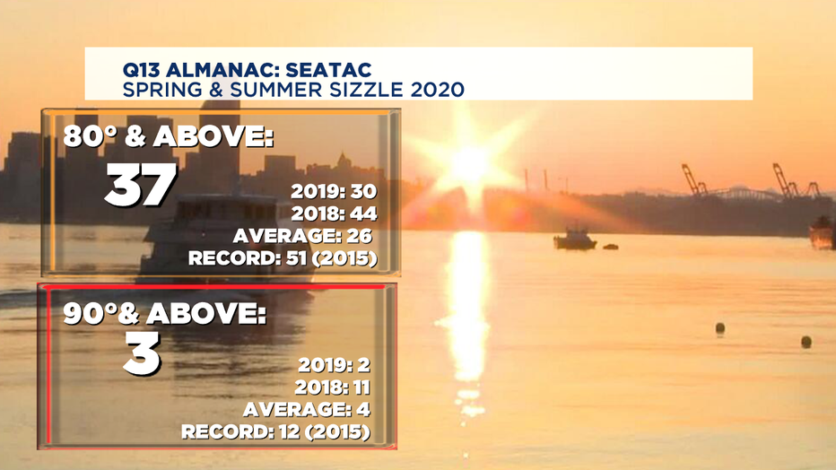
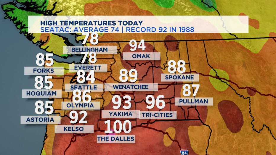
SEATTLE - Right out of the gate today most of us seeing beautiful summer skies. The coast dealt with a little cloud cover and some fog this morning, but temperatures soaring into the low to mid 80s for the majority of the region, expcept the North Sound landing in the low to mid 70s. SeaTac with another 80 plus day and that now puts us at 37 for the year with more warm days ahead. Normal is 26 days so we are well beyond that marker.
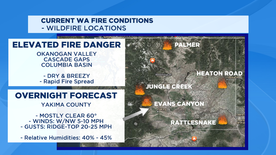
Now to the wildfire situation. The Evans Canyon fire has charred more than 50,000 plus acres in Yakima County and still going strong. Right now the fire is only 10% contained and it is getting very difficult to breath near that area. We are seeing "Unhealthy" values for areas surrounding this fire. Please listen to the warnings and protect yourself from the smoke elements especially for those who already struggle with allergies, asthma, and other respitory issues. The forecast overnight calls for temperatures in the low 60s with winds NW 5-15mph, gusting on the ridge-tops 20-25mph. This will be another tough night for firefighters battling this massive blaze.
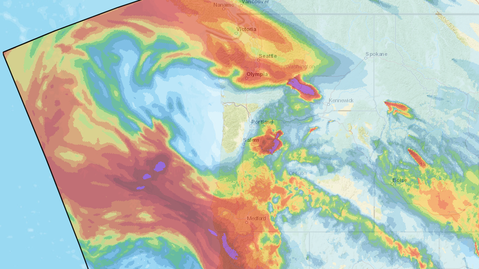
And looking at the bigger picture down the west coast..... smoke from the record-setting California wildfires may start to move north and then out over our Pacific Ocean waters and back into the northwest. This may produce hazy skies for our Friday forecast.
While it's only experimental, the NOAA HRRR (High Resolution Rapid Refresh) model is showing that smoke plume gets pushed back into Washington and Oregon and could stick with us for awhile. Depending on how much that experimental forecast verifies, we could have minor to moderate impacts around Western Washington. Minor impacts would be hazy skies and some beautiful sunrises and sunsets. More significant impacts if the wildfire smoke is thicker or ends up being closer to the ground-- then we could see more of an impact on air quality. As of this writing, the Puget Sound Clean Air Agency's website says, "minimal impacts on ground-level air quality, with MODERATE air pollution levels at most. If smoke lingers in the region over the weekend, air quality may reach pollution levels that are UNHEALTHY FOR SENSITIVE GROUPS." If the wildfire smoke is thick enough, it will block sunlight and actually cap our temperatures significantly like what we saw in August 2018 around Puget Sound when we lost 4 weeks of summer to choking wildfire smoke.
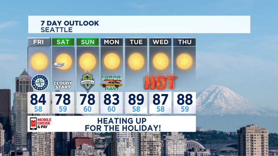
Back here at home, Western Washington's summer is thriving into September. Usually about this time of year we tend to think summer is over with the kids going back to school, but not this year. Summer time temperatures will continue to soar above normal well into next week with Labor Day kicking off the start of a very warm stretch. And by the way the official start to fall is September 22 at 9:31am.
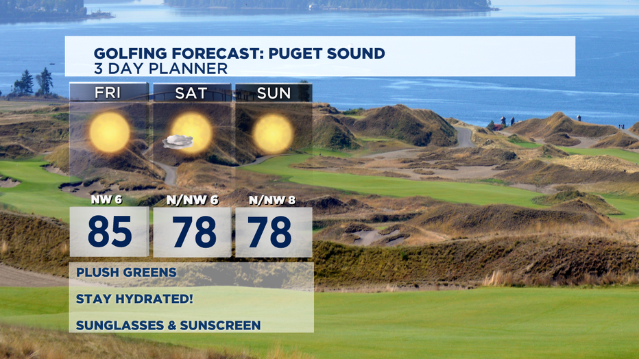
Friday looks a little hazy with some smoke pushing in otherwise we'll see more sunshine with highs about 10-degrees above normal in the mid 80s. As we move into the heart of the weekend we'll back off both Saturday and Sunday highs a bit, landing in the upper 70s to low 80s with some low level clouds courtesty Mother Natures marine push.
Labor Day kicks off our streak of heat! With strong ridging still in place and easterly winds off the Cascades our temperatures will jump up even more into the mid 80s Monday with Tuesday and Wednesday pushing toward 90. Seattle may be just shy of 90, but to the south and east foothills we'll certaintly get close to record territory. And with the heat also comes more concern for elevated fire danger. Humidities will become very low and any wind will help fuel fires already burning in Eastern Washington. Stay safe and be careful!
Have a great night! ~Erin
________________________________
- Erin Mayovsky, Q13 Forecaster
Twitter: @ErinMayovsky
FB: /ErinMayovsky
Instagram: @ErinMayovsky
________________________________
