

Seattle weather: Heavy rain, avalanche danger and flood threat

Heavy rain, avalanche danger and flood threat
After feet of snow accumulated over the Cascade mountains, much of it will melt thanks to the arrival of an atmospheric river event.
SEATTLE - After feet of snow accumulated over the Cascade mountains, a good amount of it will melt thanks to the arrival of an atmospheric river event.
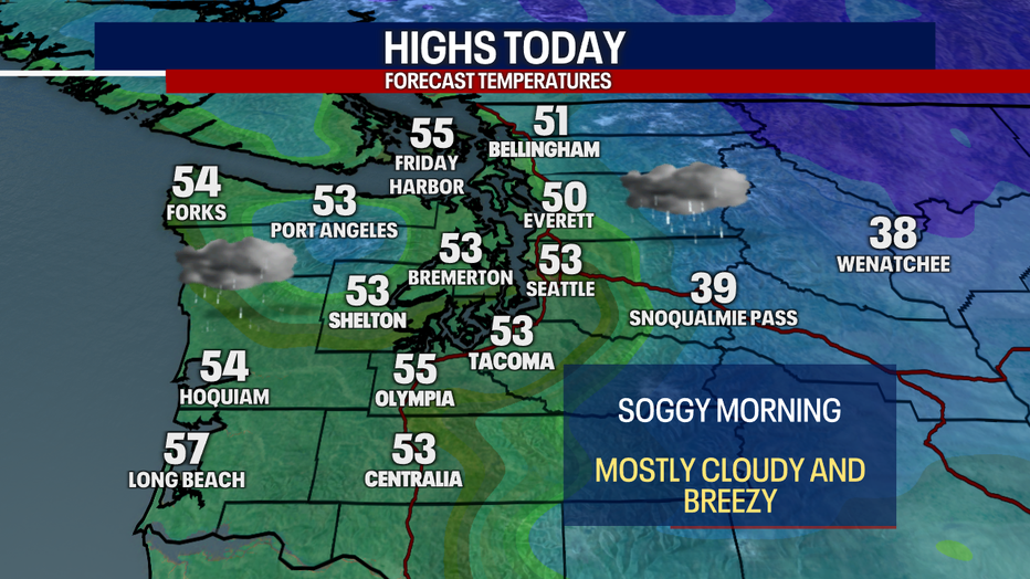
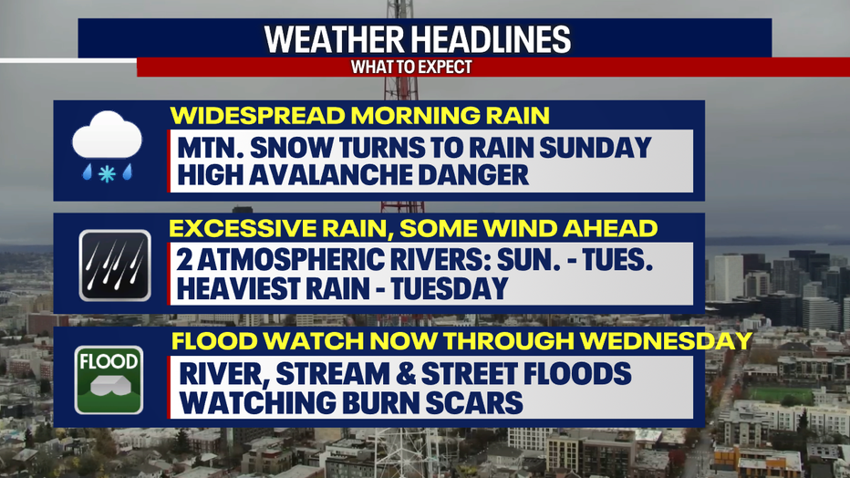
This morning, wet weather surged through Western Washington - triggering widespread lowland rain. Mountain snow was ongoing. Snow at the passes made for treacherous driving this morning. Snow over the Cascades will gradually turn to rain this afternoon.
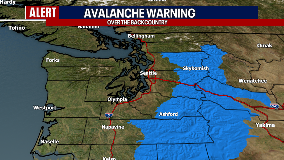
Avalanche danger remains elevated in the backcountry. An Avalanche Warning remains in effect for all areas in the blue below. For more details, visit the Northwest Avalanche Center website.
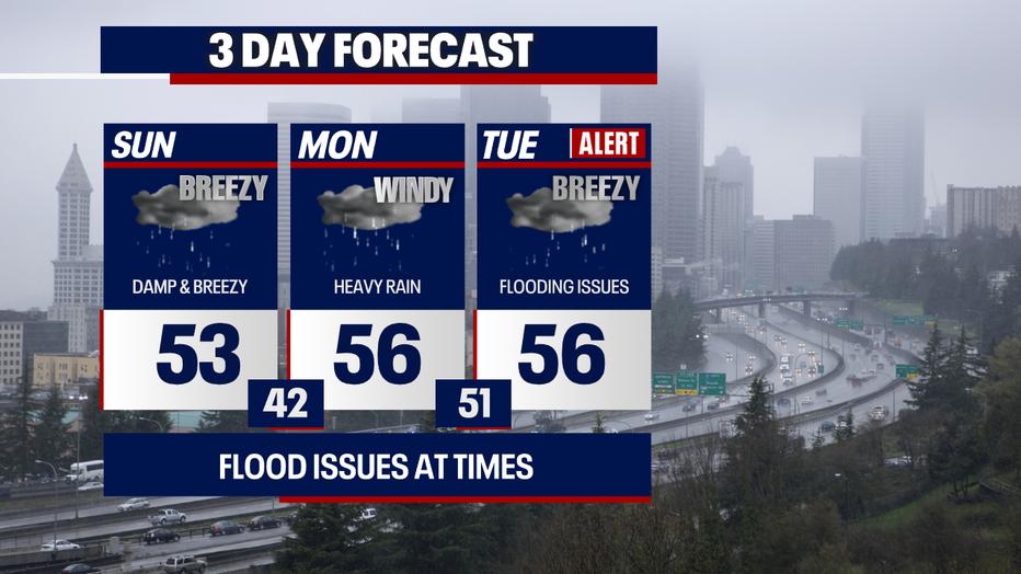
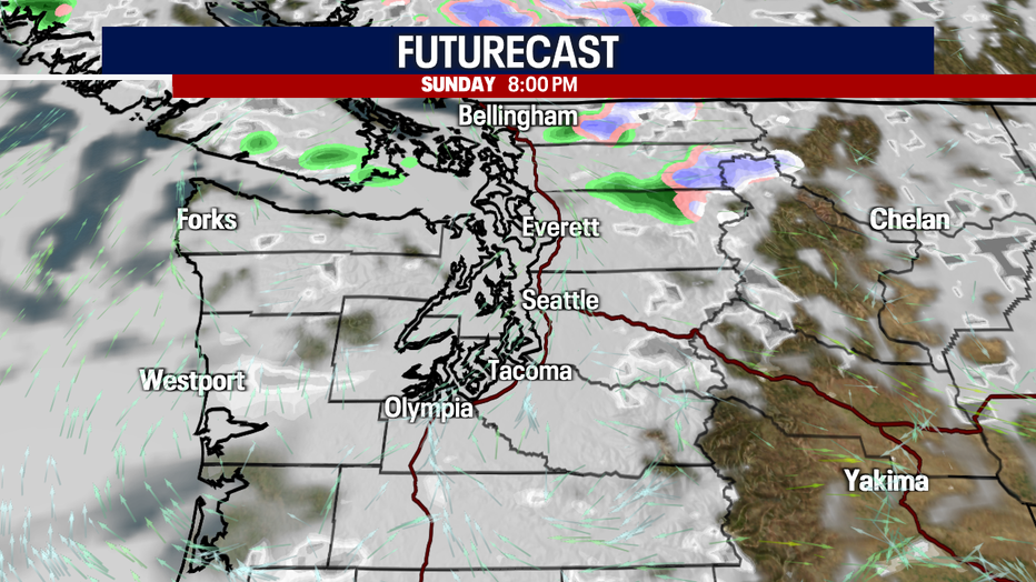
Later tonight, most backyards will get a break from the wet weather. However, a weak convergence zone could continue to spark showers for parts of Central Puget Sound (e.g. Snohomish and King Counties). Mostly cloudy skies and breezy weather are in the forecast.
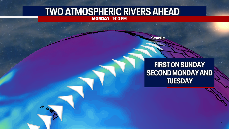
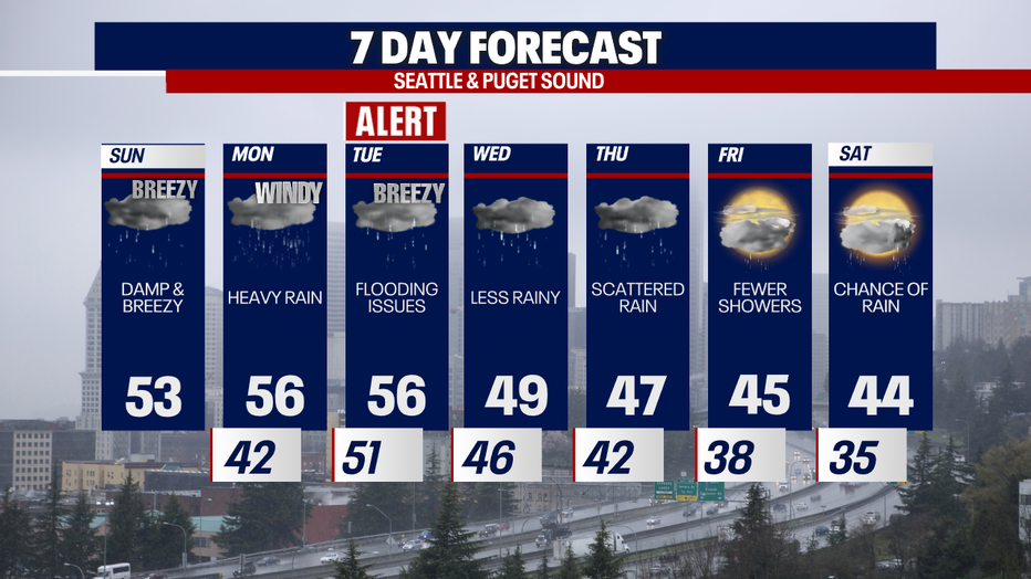
The next atmospheric river (definition: a long corridor of moisture in the mid levels of the atmosphere, typically composed of milder air) will take aim at Western Washington Monday, blasting heavy rain across the region through Tuesday. As the snow melts over the mountains and excessive rain continues to hammer the region, flooding will become an issue in the days ahead, particularly Tuesday.
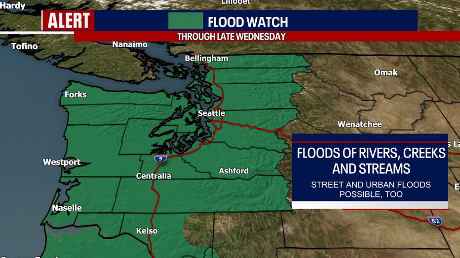
For this reason, the National Weather Service has posted a Flood Watch now through late Wednesday for everyone in green in the map below. River, creek and stream flooding is expected in many areas. Most of the river flooding will be minor to moderate – much of it happening Tuesday and Wednesday, but some of it could start today and Monday. The spots with the highest potential for major flood stage will be in King, Snohomish and Skagit Counties.
Keep in mind: as with most events like this, there's still uncertainty about the scope and extent of the river flooding. It'll depend on where the heaviest bands of precipitation set up and how river basins that originate in the higher elevations respond to the rain and snowmelt. We'll be watching and relaying the latest to you!
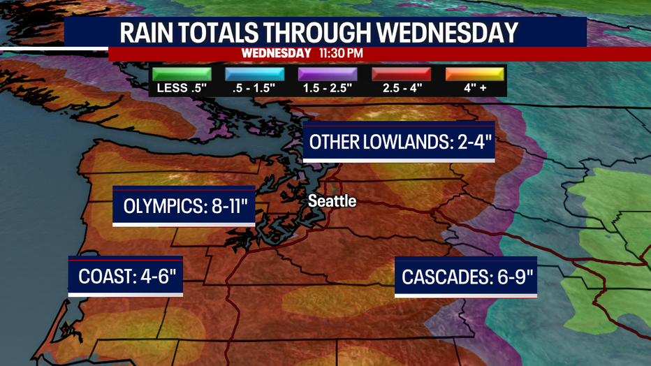
Rain totals through Wednesday will be impressive – reaching almost ten inches in the Cascades, eight to 11 inches over the Olympics and widespread two to four inches for the I-5 corridor.
Late Monday into early Tuesday, winds will be strong - potentially gusting in excess of 35-40 (max 45) mph. There could be some power outages and tree damage. There's still some fluidity about the timing and strength of the winds.
Rivers will still be flooded on Wednesday, but water levels will gradually recede.
Scattered rain is on the way for Thursday. Friday will offer some sunbreaks along with fewer showers. Rain is possible Saturday.
We're so thankful for your viewership! Please stay tuned for more details on the forecast. We're here for you.
Warmly,
Meteorologist Abby Acone
Follow me on X @abbyacone, Instagram @abbyaconewx, TikTok @abbyaconetv and Facebook (Meteorologist Abby Acone)