

Seattle weather: Early snow ends at the passes, dry and cool weather ahead
Wednesday morning rain, drier weather in the afternoon
In the lower elevations, we're forecasting soaking rain through Wednesday morning. Drier weather takes hold some time Wednesday afternoon.
SEATTLE - Rain in the lowlands and snow in the mountains will continue to wrap up as Wednesday rolls on, with sunny and dry weather around the corner.
It's already starting to melt, but Snoqualmie Pass measured five inches of season snow the past 24 hours. Stevens Pass measured at least six inches of snow. Snow in October at the pass level doesn't happen every year. Over the last 12 Octobers, Snoqualmie Pass has only seen snow half the time.

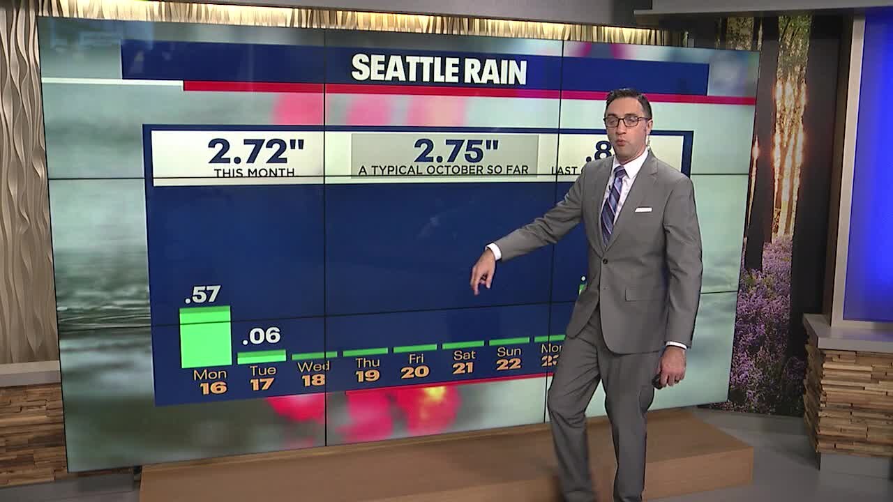
After a six day dry stretch, yesterday's soaking rain put the Seattle area right where we should be for late October. Additional rain this morning will add to that total, but it could be the last rain we see for the rest of the month as a long dry stretch approaches.

After early clouds and leftover showers, Western Washington will be getting back to some sunshine Wednesday afternoon. Light snow showers may linger in the mountains through the afternoon, but no more than a couple of inches is expected.

A cold, dry air mass will linger over the Pacific Northwest over the next week. High temperatures will remain cool, five to ten degrees below average.

Some of us could wake up to frost Thursday morning, with even colder morning temperatures by next weekend. Halloween is looking dry so far, but stay tuned!
