

Seattle weather: Lowland rain and mountain snow returns Friday
Lowland rain on Friday
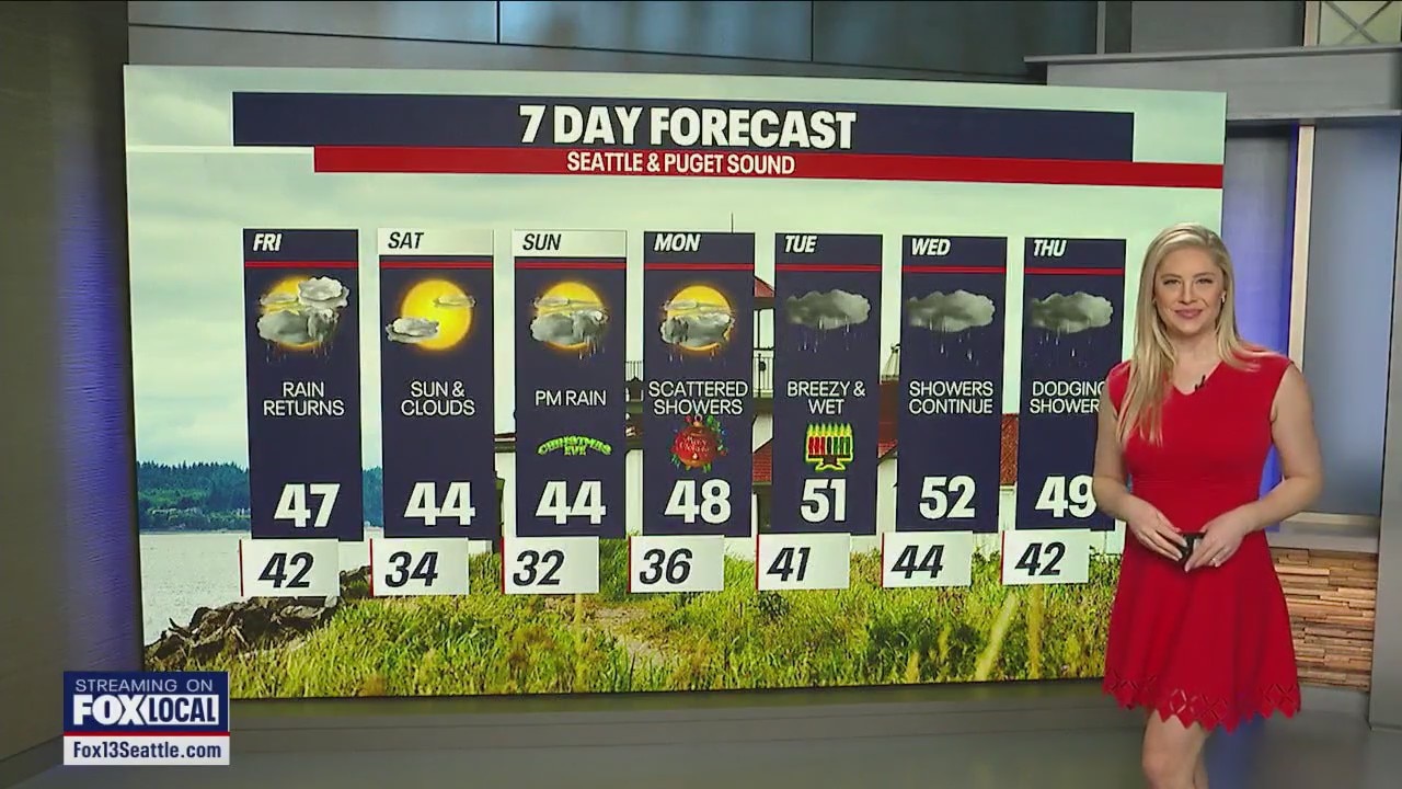
FOX 13 meteorologist Claire Anderson has the latest forecast for the holiday weekend.
Fog has continued to linger for areas of the south sound tonight and high clouds are streaming in ahead of our next system.

Clouds will continue to increase tonight, and showers will move in early Friday morning. Lows dropping into the low 40s to upper 30s.

Friday morning showers will be widespread and the snow levels will start around 4500'.

Showers will become more scattered by the afternoon and through the evening hours.

A Winter Weather Advisory goes into effect 10am to 10pm Friday for the Cascades above 4000'. Snow totals between 4-8"; passes affected include Stevens Pass.

Here is a look at the pass travel forecast if you are heading over the Cascades Friday.

Highs Friday will be cooler as the cold front moves through Western Washington. Highs in the upper to mid 40s.

Winds will also be breezy especially along the coast Friday. Winds around the Puget Sound will be strongest in the morning. 20-25 mph.

Dry time will return Saturday through most of Sunday. Rain returns to the lowlands later on Christmas Eve and some snow for the mountains. An atmospheric river set up is still on track for Monday through Wednesday.
