

Soggy start to last week of spring

Muggy, rainy weather across Western Washington
Q13 Meteorologist Grace Lim says to expect muggy and rainy weather Sunday in Western Washington before temperatures return to the 70s next week.
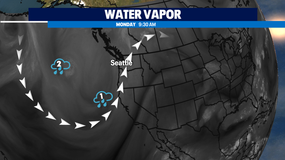
SEATTLE - After our wettest day in Seattle since our February snowstorm -- we're still tracking two areas of circulation in the trough that's affecting the Pacific NW for the beginning of this week.
They'll keep our weather active today and tomorrow with showers and a very slight chance of an isolated t-storm. We should be out of the showers and sun regimen by Wednesday afternoon and much warmer as we wrap up spring and say hello to summer.
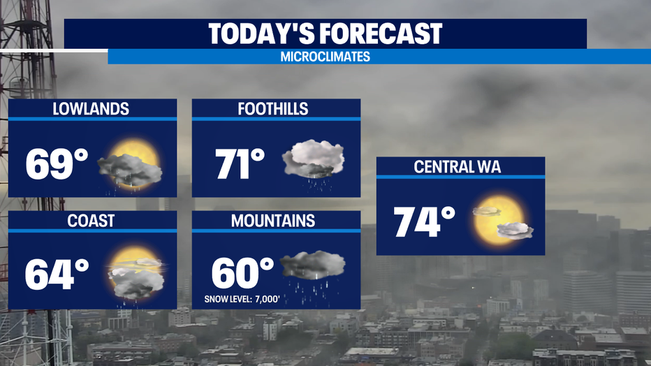
So, some on/off showers today for the coast, Puget Sound lowlands, and Central Washington this morning-- but some nice sun emerges between the showers this afternoon. The foothills and Cascades stay pretty rainy today with not nearly as much sunshine. High temps this afternoon will range from mid 60s on the coast to mid 70s in the Central Washington. Normal is 71 for the last week of spring.
We start drying out and warming up starting on Wednesday. With significantly warmer temperatures for the last few days of spring as we start to flirt with 80s by the weekend.
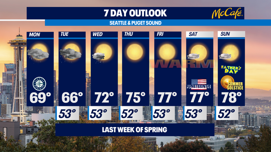
Sunday is the Summer Solstice. The new season officially begins at 8:32p in our time zone. Solstice is latin for "sun standing" and the sun will arc through the same spot in our northern skies for several days and from the 18th to the 25th, Seattle has our longest days of the year. Give or take a few seconds-- each day is about 15 hours and 59 minutes long! -Tim Joyce
Stay connected with Q13 News on all platforms:
DOWNLOAD: Q13 News and Weather Apps
WATCH: Q13 News Live
SUBSCRIBE: Q13 FOX on YouTube
FOLLOW: Facebook | Twitter | Instagram