

Seattle to see the return of 80-degree heat this week

Seattle weather: Showers wind down, sunshine on the way
Seattle weather: Showers wind down, sunshine on the way
Highs this afternoon will range below average in the mid to upper 50s. However, the 80s will likely make an appearance in Western Washington on Friday and Saturday.
There may be isolated showers today, but most backyards in Western Washington will wind up dry. A few downpours could be heavy locally. If any showers develop over the Cascades, not much in the way of additional accumulation of snow is expected.
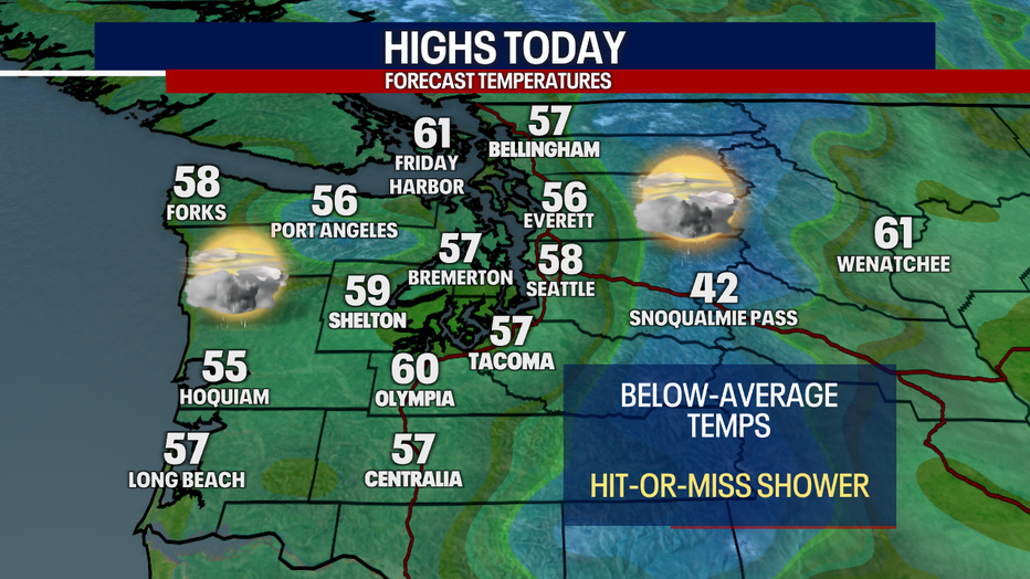
Temperatures only reach the mid to upper 50s across Western Washington Tuesday. (FOX 13)
Beginning Wednesday, a warmer and drier trend takes hold. Highs reach the low 60s in Seattle tomorrow. Temperatures boost to the low to mid-70s on Thursday before skyrocketing to the 80s on Friday and Saturday.
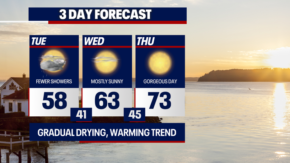
While showers are in the forecast today, sunnier skies are in store Wednesday and Thursday. (FOX 13 Seattle)
It's important to remember that we need to practice water safety this time of year. Water temperatures are still running dangerously cold.
If you're cooling off along a river, creek or lake, wear a life vest and be careful. Year-round, temperatures are cold in Puget Sound.
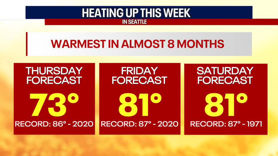
Highs will skyrocket above average this week across Puget Sound. Temperatures could lift into the 80s Friday and Saturday. (FOX 13 Seattle)
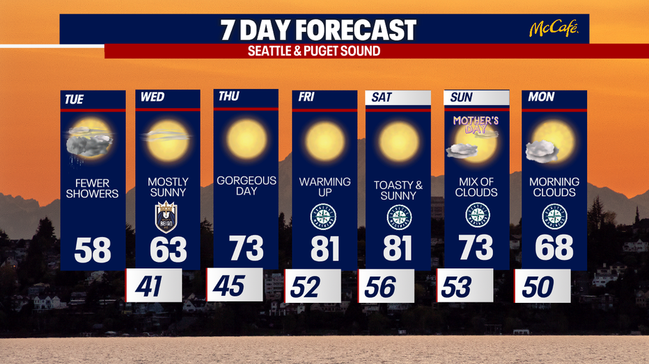
Temperatures gradually climb this week across Seattle and Puget Sound. (FOX 13 Seattle)
Enjoy the sunshine for Mother's Day!
Take good care,
Meteorologist Abby Acone and Chief Meteorologist Brian MacMillan