Cool and showery conditions roll on through next week
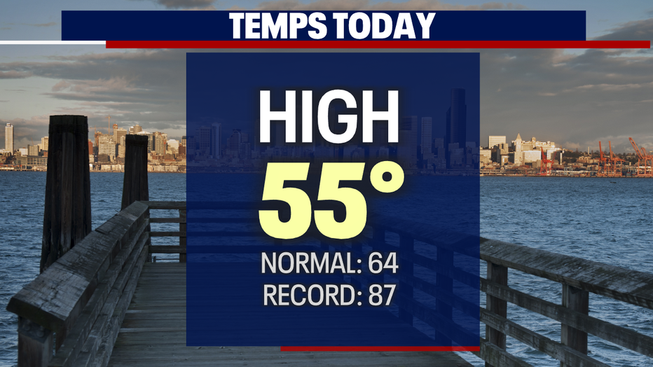
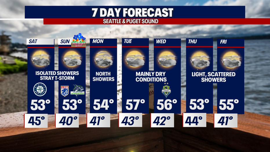
Seattle - Another day of below average temperatures across the Pacific Northwest. Highs Friday only climbing into the low to mid 50s. Seattle hit 55 today. Our average high temperature jumps to 65 Saturday.
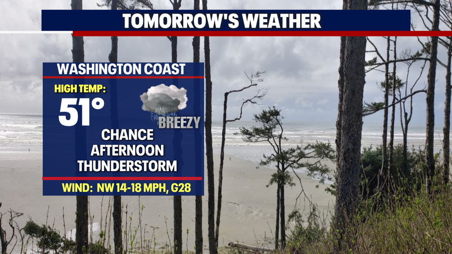
Weekend showers will continue and become spotty at times with a slight chance of an isolated thunderstorm possible.
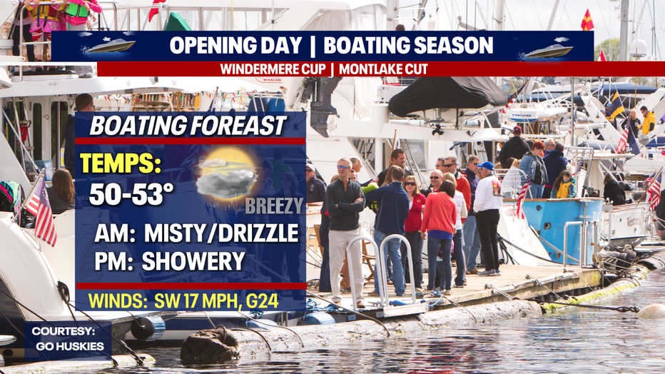
Saturday, Opening Day for boating season, starts out mostly dry, but showers pick up throughout the day. Winds will also become gusty tomorrow afternoon across the region. Sustained SW winds expected 14-18mph with gusts 20-30mph. Highs run cool, landing in the low to mid 50s.
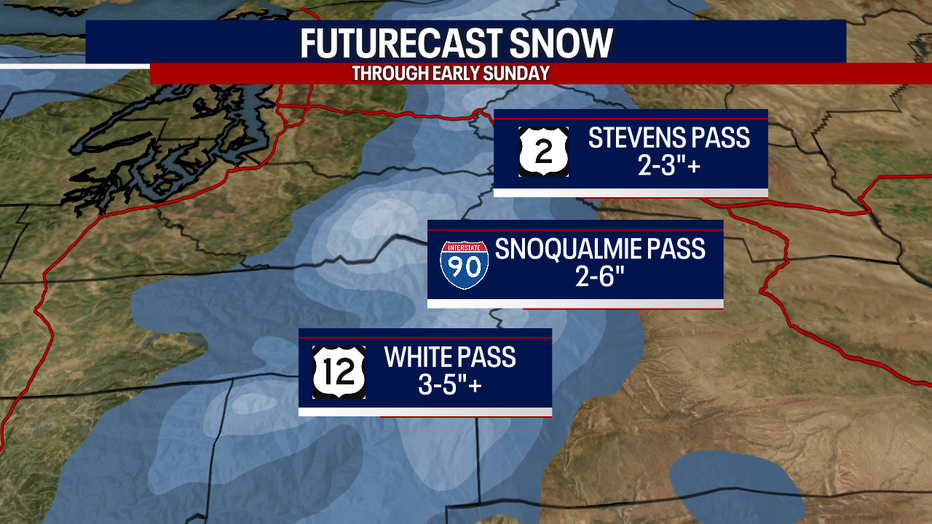
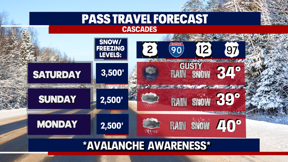
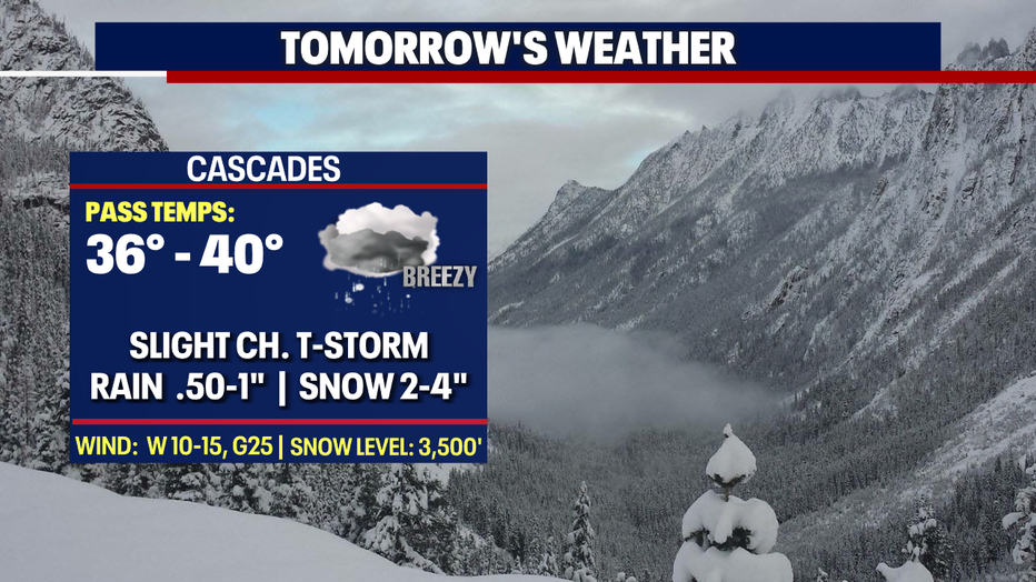
We're also keeping an eye on the mountains as snow levels drop and temps fall. By late Saturday snow will start to stick with the potential for a few inches at Stevens Pass and a little more the farther south you go over Snoqualmie and White Passes. Know the roads before you travel through the Cascades.
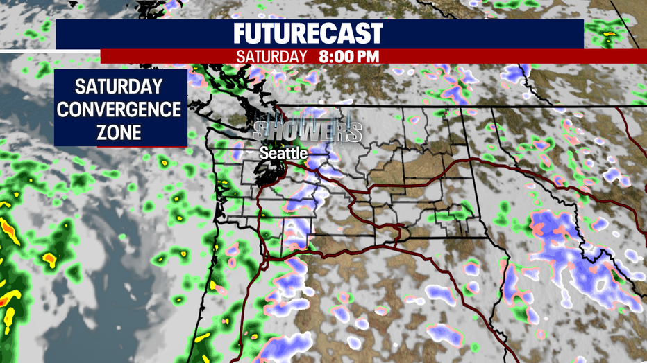
We're keeping an eye on a convergence zone situation setting up later in the evening Saturday. Showers may become heavy with a chance of small hail for north King and Snohomish Counties.
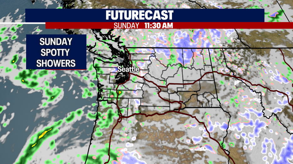
Showers become spotty as we roll into Mother's Day. Don't forget to celebrate Mom! Highs still only in the low to mid 50s.

As we jump into next week the forecast will remain under unsettled, cooler conditions. We'll see periods of showers followed by dry breaks.
Looking into the long-range forecast… models are hinting at warmer highs in the low to mid 60s with drier days. Stay tuned!
Have a great weekend everyone! ~Erin Mayovsky, FOX 13 Forecaster
*Beach Forecast
*Mountain Forecast
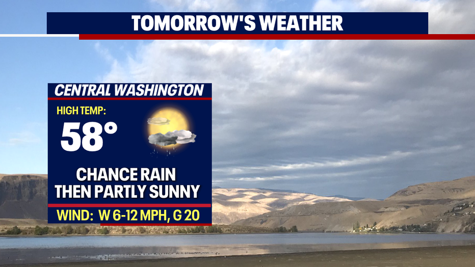
*Central WA Forecast