

Dry mornings, wet afternoons the next two days
Few light sprinkles to start Tuesday
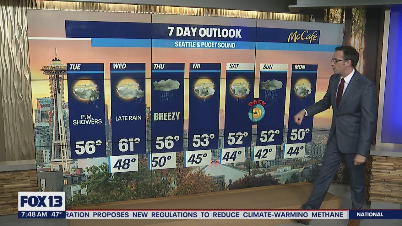
The first week of November looks wet every day, at least part of the day. The next three days, expect a similar pattern of a dry and cloudy morning, followed by a wet evening.
Seattle - Rain showers return to the Puget Sound area this afternoon and evening after a quiet start to the day.
This incoming system will mainly impact the Washington Coast, Olympic Peninsula, and Vancouver Island. Most of the Puget Sound area will be looking at light rain through the evening commute.

Wednesday will be the warmest day of the week as the day starts off dry, but a strong cold front will sweep through Wednesday evening bringing some breezy winds and widespread rain. The windiest spots will be along the coast and in the northern sound. Early Thursday morning, those winds could be breezy for everyone in Western Washington.
Rain showers will continue on and off through the weekend as temperatures continue to drop. Highs will only make it into the low 50s by Saturday.

Snow levels will be flirting with the passes at times over the next seven days. By early next week, we could see snow down to Snoqualmie Pass. Stay tuned!

Finally, it's time for the dark season. Seattle loses an hour and ten minutes of daylight during the month of November. On top of that, we will "fall back" this Sunday morning.

MORE FROM FOX 13 WEATHER:
DOWNLOAD: FOX 13 Weather and News Apps
WATCH: Forecast and Radar
READ: Closures and Delays
CHECK: Latest Weather Alerts and Live Traffic Map
INTERACT: Submit your Weather Photo
DAILY BRIEF: Sign Up For Our Newsletter
FOLLOW: Lisa Villegas, Erin Mayovsky, Brian MacMillan and Scott Sistek