Seattle weather: Fall-like weather has finally arrived in Western Washington

Rain to return Friday, help air quality
A strong moving system is on the way and will hit the coast first early Friday morning.
Seattle - It is finally going to feel like fall in Western Washington as cool temperatures and rain return to the Pacific Northwest.
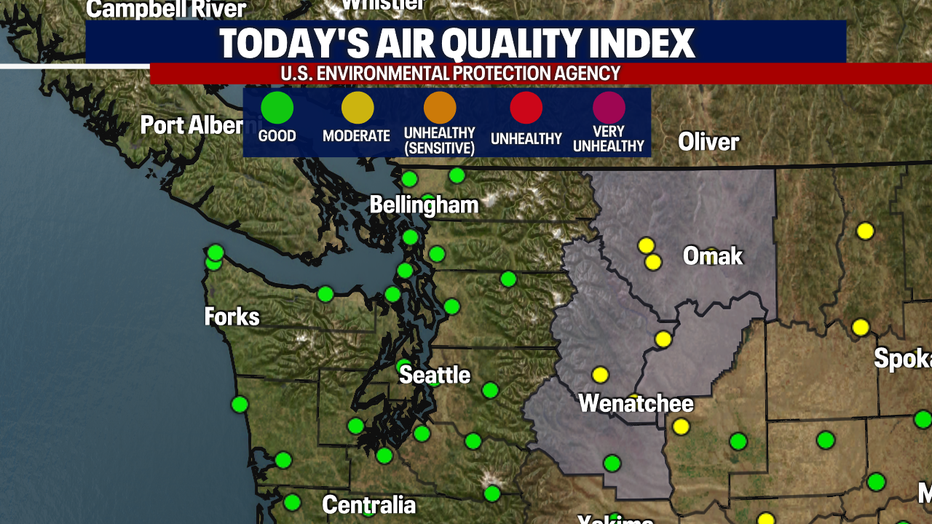
What a difference 24 hours makes! Air quality levels are all in the "good" category this Friday morning. Thursday around the same time, air quality was in the "unhealthy" and "very unhealthy" levels.
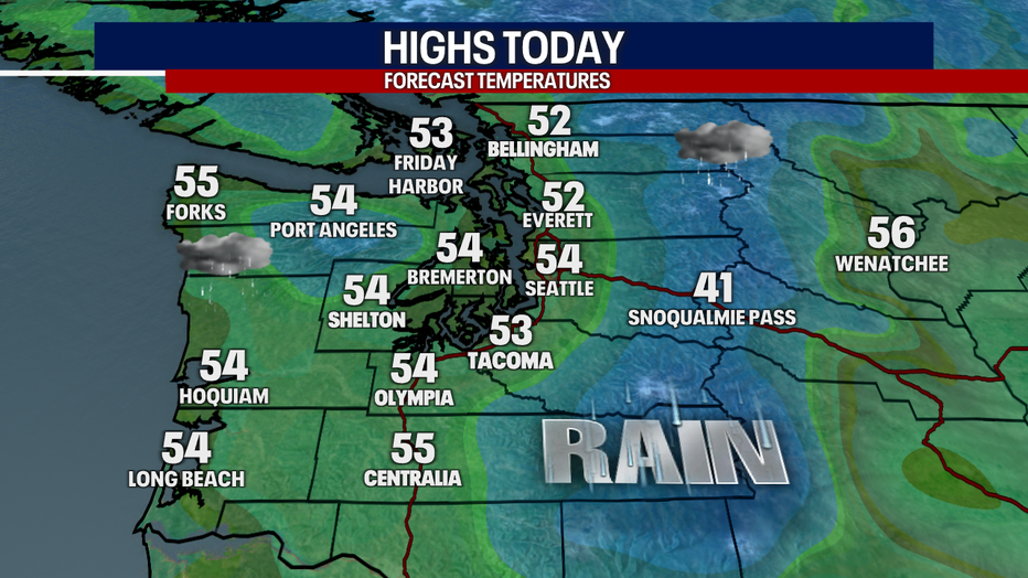
The strong cold front bringing in today's rain is also bringing in cooler temperatures. Afternoon highs will be about ten degrees cooler than Thursday's high temps.
Rain will stay widespread through midday and taper off into on and off showers the rest of the evening. As the front passes later tonight, Western Washington will see a break from the rain before the next wave hits early Saturday morning.
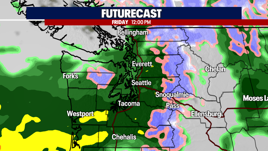
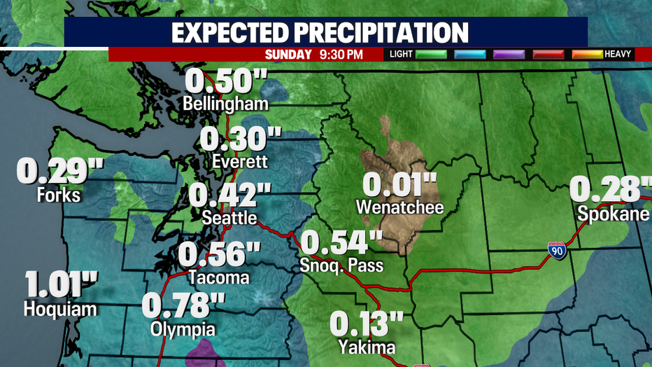
Over the next two days, north sound areas will see .25-.50" of rain, while the central and south sound could see closer to .50-1.00" of rain.
Snow is possible in the Cascades over the next 48 hours as snow levels drop to around 4,000 feet, however it likely won't have an impact on the roads. If we get heavy rain in any burn scar areas near Skykomish, that could contribute to some road issues due to debris flows near US-2. We will keep an eye on that.
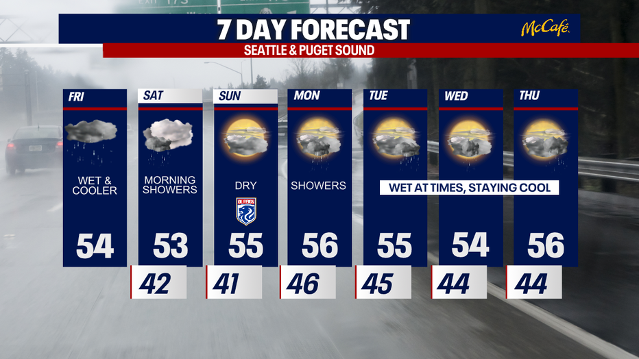
Overall, the next seven days look showery, cool, and free of smoke. If you're looking for some dry time, the second half of Saturday and all day Sunday look like your best bet.