First 60 degree day in months possible on Tuesday
Seattle - It is a soggy and cool start to the work week, but Western Washington will likely rebound Tuesday brining the warmest day of the year so far.
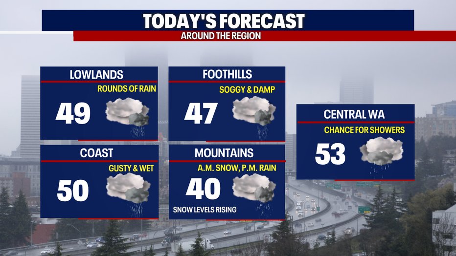
Widespread rain hit Western Washington during the morning commute Monday. As this system breaks up later this morning, we will get back to scattered showers. There should be some dry times as well. Snow will soon transition over to rain in the Cascades as snow levels rise this afternoon.
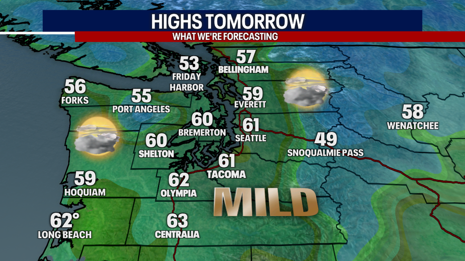
Tuesday will start of gray with some drizzle in spots, but the front will lift out of the area by late morning, ushering in much warmer temperatures and the potential for SeaTac's first 60 degree day since mid-November!
Here's a look at your forecast for the area tomorrow.
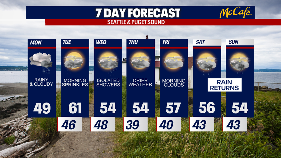
The warmer weather doesn't last long. A very weak cold front will push through on Wednesday, bringing a few showers to the area and temps back closer to average for this time of year.
If you are looking for some dry days this week, the best bets look to be Thursday and Friday. Rain returns for the weekend with average daytime highs.