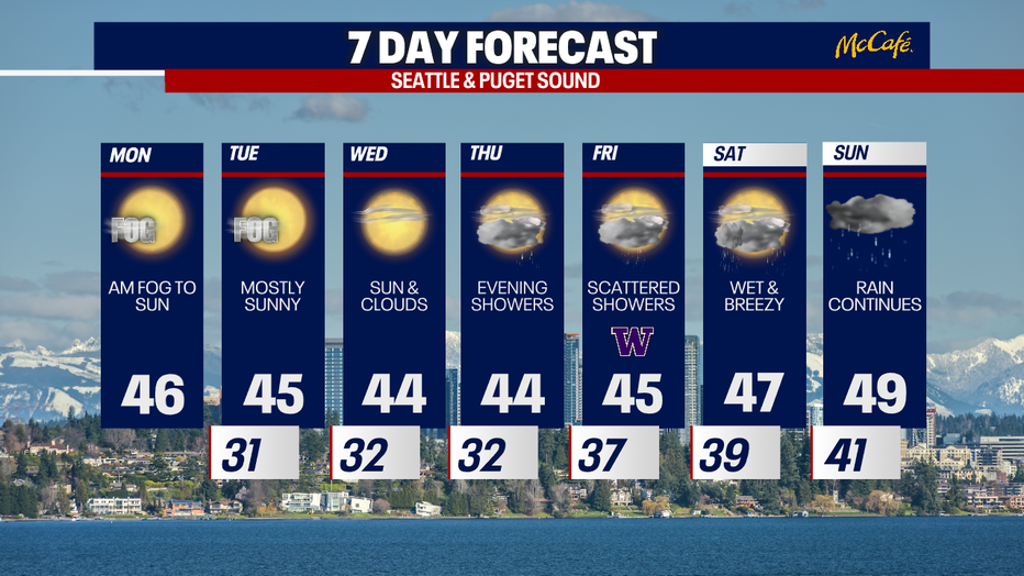
Seattle weather: Foggy mornings, sunny afternoons through Wednesday

Patchy fog Monday morning
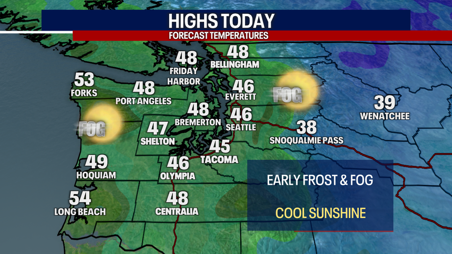
Temperatures will drop tonight in the upper 20s and low 30s. Watch for patchy frost and slick spots into the morning hours.
Seattle - A ridge of high pressure will continue to keep Western Washington dry the first half of the week, with patchy morning fog and frost.
High pressure overhead pushes smoke and pollutants from the higher levels of the atmosphere to the surface. This stagnant air at the surface can cause worsening air quality. Make sure to check local burn bans over the coming days before you use wood burning stoves or start a bonfire outside.
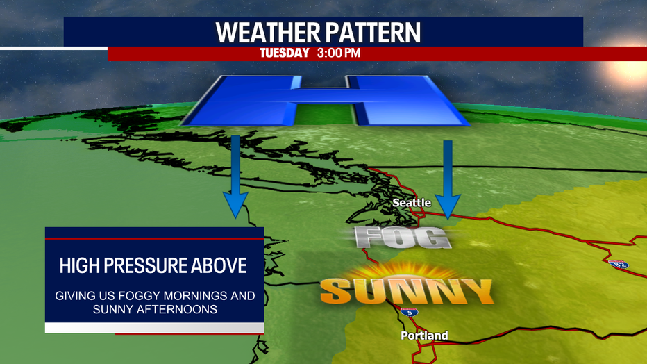
Monday, expect patchy morning fog, especially in the central and south Puget Sound areas. That will be followed by cool afternoon sunshine.
So far this month, we've measured almost five and two-thirds inches of rain at Sea-Tac. That's tracking nicely toward the average rainfall for November (6.31 inches), but we may fall short of the average, with no rain expected until the last day of the month.

The ridge of high pressure will move east midweek, opening the door to a series of wet weather systems later this week and through the weekend. Showers could start as early as Thursday afternoon and continue through Friday morning, but this first round of rain won't amount to much.
Heavier rain arrives this weekend, along with breezy conditions at times. Mountain snow is also possible this weekend.
Enjoy the next few days of dry, sunny weather!