

Ongoing mountain snow Sunday, spotty lowland snow Monday

Seattle weather: Rain/snow mix on the way
Fox 13 Seattle Meteorologist Abby Acone has your Seattle-area weather forecast for the work week ahead!
We're tracking a very dynamic and interesting forecast around Western Washington. We're expecting a powerful winter storm to wallop the Cascades, dumping one to three feet of snow! There's even a small chance for a rain/snow mix in the lower elevations Monday morning and evening.
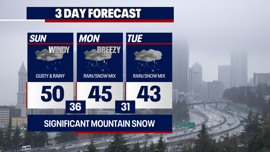
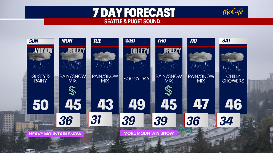
For today, you can plan on overcast skies and highs in the upper 40s to low 50s. It'll be a rainy day, so dress in waterproof layers!
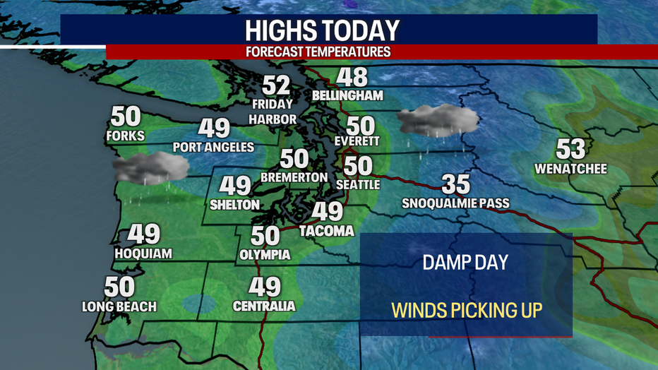
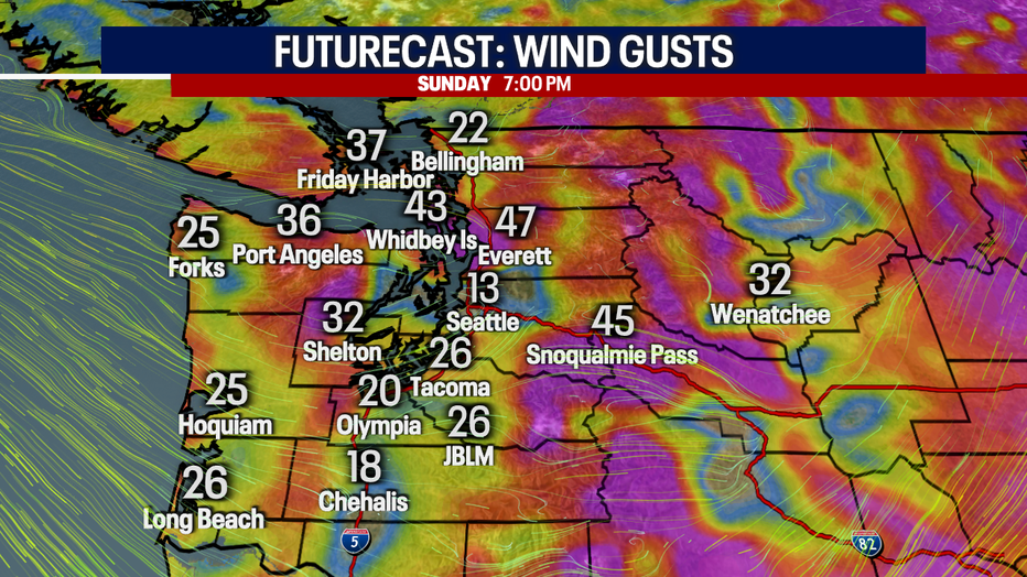
Winds will be somewhat forceful today. While I can't rule out spotty power outages or downed tree limbs in hyper-localized places, we don't anticipate impacts for most backyards. In general, gusts will peak between 4-7 p.m. today, reaching 20-35 mph (isolated 40 mph) for many in Western Washington including Seattle. For Whidbey Island, the Admiralty Inlet area, Everett and the Cascades, gusts may blow to upwards of 35-45 mph. It'll be breezy tomorrow, but winds won't be as strong as today.
Here's a look at potential wind gusts this afternoon. Important note: don't pay attention to the exact number as much as the overall trend. This is just one forecast model's projection.
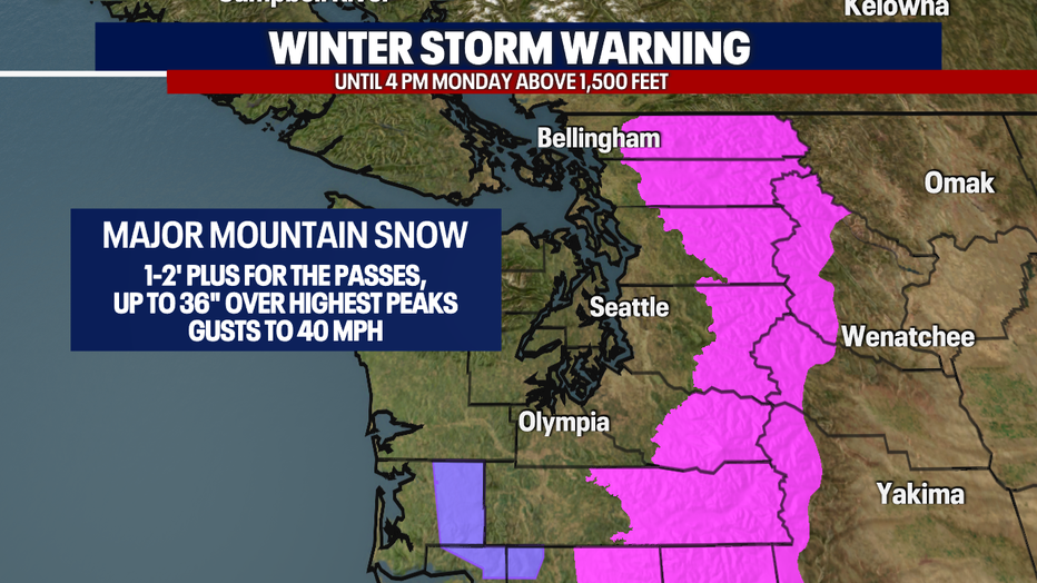
Over the mountain passes, travel will become increasingly difficult this afternoon. A Winter Storm Warning is in effect for the Cascade region above 1,500 feet in elevation until 4 p.m. Monday. Between one and three feet of snow is on the way; this is great for our lackluster snowpack we've had so far this season.
Drivers, beware: a combination of heavy snow and powerful winds will drop visibility and create treacherous conditions into Monday. Unfortunately, the threat for avalanches will be elevated over the backcountry, too.
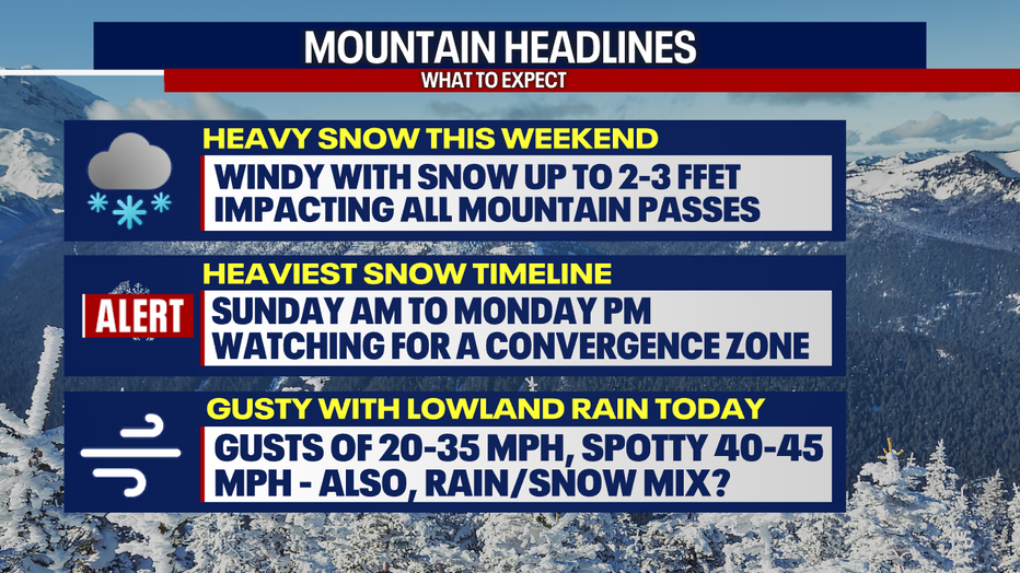
Check WSDOT conditions before you travel. Depending on conditions, I'd consider adjusting your travel plans. Ensure your car is prepared for winter driving, and don't forget to pack an emergency kit.
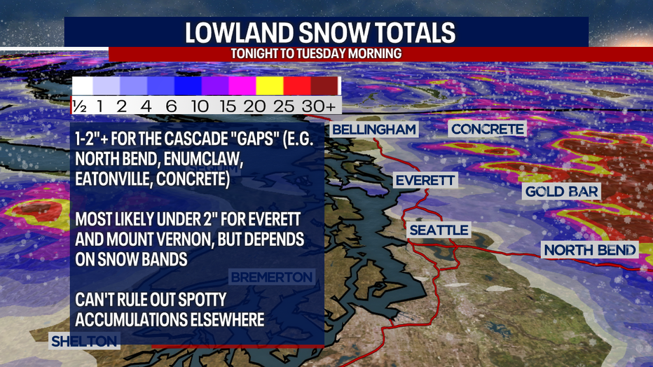
As if the forecast wasn't interesting enough, there's a small chance for an isolated rain/snow mix in the lowlands tonight, Monday morning and Monday evening. This is a challenging forecast, variable neighborhood-by-neighborhood and highly subject to change, so stick with us!
For the most part, we're not expecting snow accumulations below 1,000 feet in elevation through Tuesday. Also, any snow that accumulates Monday morning will likely melt during the daytime before there's another shot of spotty snow Monday evening. Tuesday morning could be icy. Snow in the lowlands tonight through Tuesday morning would mostly favor cooler surfaces like the grass and patio furniture, but it could stick to the roads in some cases.
Over the Cascade "gap" communities (e.g. North Bend, Gold Bar, Enumclaw and Eatonville), snow accumulations would likely only amount to an inch or less, but there could be exceptions where stronger bands of snow develop.
A minor coating of snow is also possible in communities like Everett and Mount Vernon. The coverage and amount of snow just depends on where the convergence zones develop. It seems most likely that totals would be under two inches in these neighborhoods, but higher totals are possible should the snow be heavy enough.
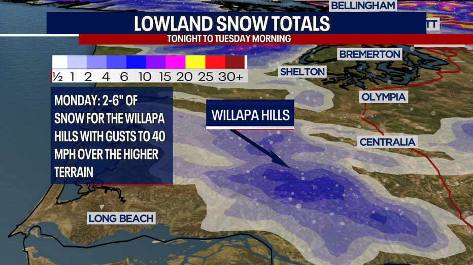
In addition, the Willapa Hills in Southwest Washington could see snow totals reaching two to six inches throughout the day on Monday. With the combo of wind and snow, lowered visibility could make for tricky driving.
Wednesday and Thursday mark the return of another round of significant mountain snow and moderate winds. Precipitation will probably be in the form of rain in the lowlands by Wednesday, but the chance for a light, minor rain/snow mix could pop up at times Thursday through Sunday.
Stay with us for updates! We appreciate you greatly and we love forecasting the weather for you :)
Take good care,
Meteorologist Abby Acone
Follow me on Facebook (Meteorologist Abby Acone), Instagram @abbyaconewx and TikTok @abbyaconetv