

Seattle weather: Rain returns Tuesday night

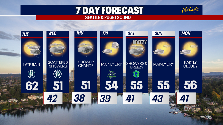
SEATTLE - Tuesday will start sunny and finish with clouds and showers as the Puget Sound area enjoys one more day with highs in the 60s.
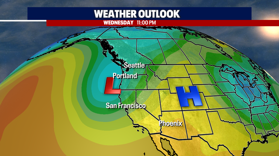
Enjoy these warmer early-April temperatures. Much cooler weather arrives Wednesday and Thursday.

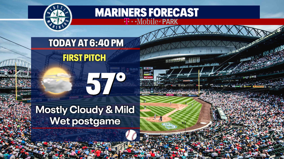
If you're heading to T-Mobile Park for the Mariners game against the Cleveland Guardians, the roof will likely be closed. The game should start dry tonight, but the walk back to the car after the game could be wet with showers.
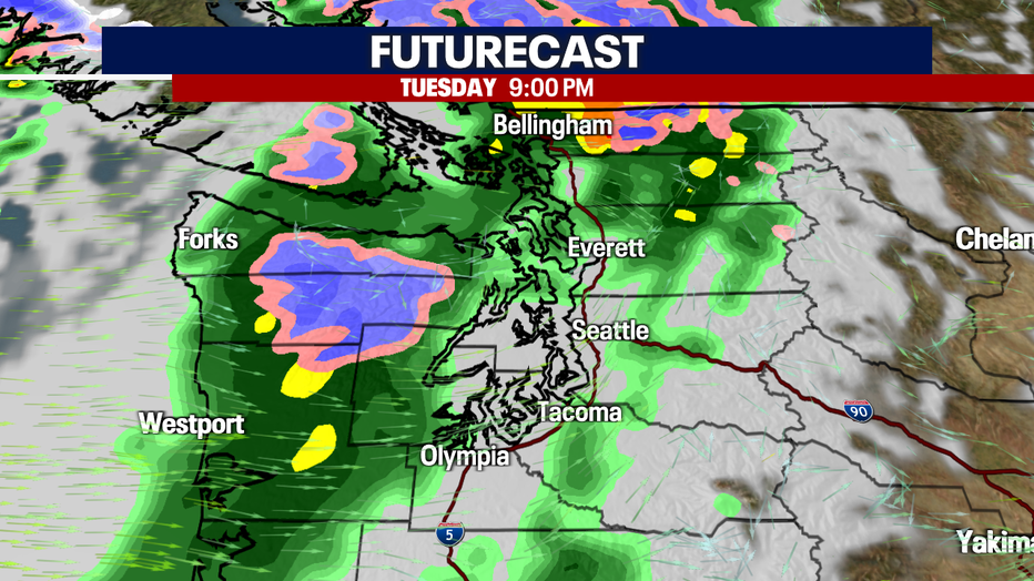
The Washington Coast will see some scattered showers by midday. Widespread rain will arrive on the coast by the evening commute and spread inland. Most areas around Puget Sound will see showers by 8:00 or 9:00 PM. The heaviest rain will hit north of Seattle between 10:00 PM and 2:00 AM.
Joining the rain will be an influx of colder air. Temperatures will drop about 10 degrees, into the low 50s for highs on Wednesday and Thursday.
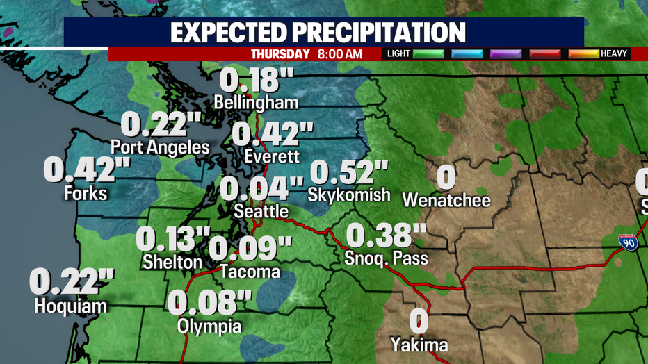
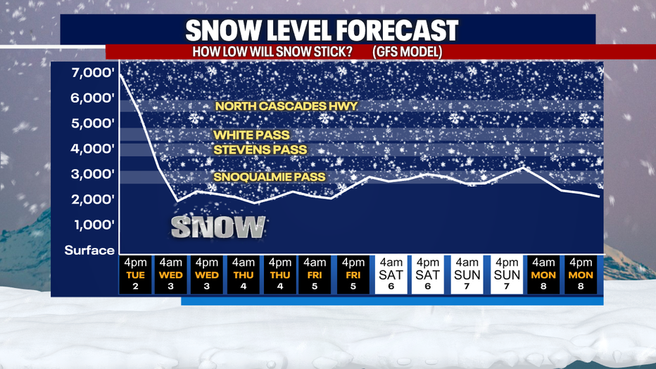
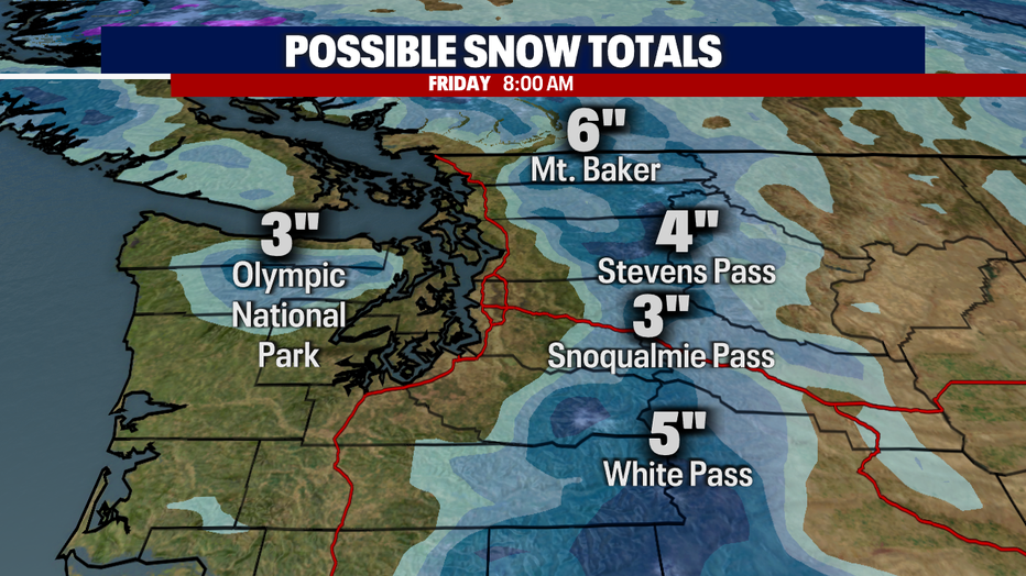
This will also cause snow levels to drop Wednesday through next weekend. There will not be much moisture left after snow levels drop, but we could see a few inches over the passes through Thursday.
The seven day forecast looks cooler than average with more dry times than wet. Early next week, we will get back to some sunshine with highs in the mid 50s.
To get the best local news, weather and sports in Seattle for free, sign up for the daily FOX 13 Seattle newsletter.