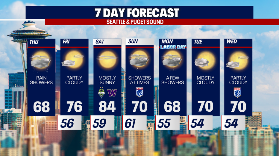
Seattle weather: Rain showers and cooler temps Thursday

Showers, cloudy start to Thursday
Thursday morning temperatures are near 60 with highs only warming a few more degrees into the mid-60s. By the afternoon, showers will let up for a drier evening.
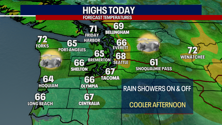
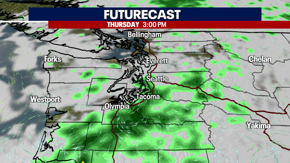
SEATTLE - A low pressure system dropping into the Pacific Northwest Thursday will bring showers and cooler afternoon high temperatures to Western Washington.
Showers will mainly be focused on the coast and south Puget Sound areas, but anyone west of the Cascades could catch a few light showers. Highs will be in the mid to upper 60s, about five to ten degrees below average for this time of year.
The system will dip south into Oregon later today, leading to a drier night after 10:00 PM.
Not much rain is expected in the north sound, but south sound areas could see .10" to .20" of precipitation before the day is done.
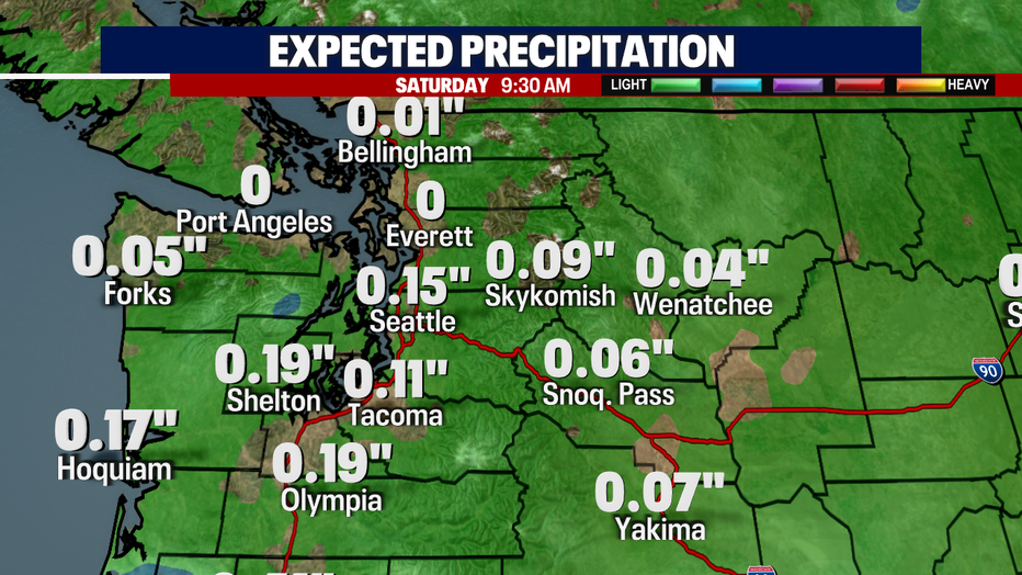
As we bring back nicer weather Friday and Saturday, we could also see some wildfire smoke mixed in with the sunshine. While it should only be a thin layer at the surface on Saturday, you may notice it more in the upper levels of the atmosphere.

Saturday looks like it will be the nicest day of the next week, with high temps in the mid 80s and lots of sunshine. Sunday and Monday, a chance of rain showers returns with much cooler temps.