

Seattle weather: Rain showers and mild temps through Thursday
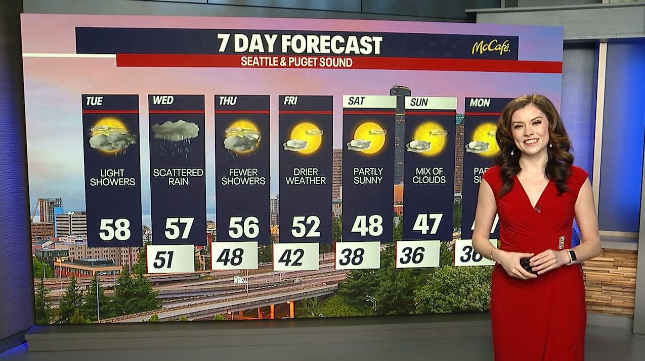
Seattle weather: Light showers with drier weather into the weekend
Seattle weather: Light showers with drier weather into the weekend
Seattle - Light rain showers will continue to push north as a warm front moves through Western Washington on Tuesday.
Temps will stay mild with highs in the upper 50s. There could be a few sunbreaks in the mix as well.

Widespread rain will return late Tuesday into early Wednesday. This will be an atmospheric river for most of the West Coast, with northern California and southern Oregon seeing the most precipitation. We will see heavier rain in the Olympics and over the North Cascades than the Puget Sound lowlands. This could bring another round of flooding issues to some of the more common areas, but that will remain to be seen. Landslides also remain a risk with the ongoing wet weather.

Expected precipitation through Thursday morning is between .25 and .50 inches for most of the Puget Sound area.

As the week goes on, snow levels will slowly drop. They will be back down to the pass level by Friday, but we will run out of moisture by then. There isn't much snow, if anything, expected for the mountain passes through early next week.

February still brings a risk of lowland snow, but we are quickly approaching the warmer spring season. The average last 32 degree morning is on March 9. While snow is possible after mid February in the Puget Sound lowlands, it becomes increasingly unlikely to see several days in a row of frozen weather when we get to March.

After several mild days, we will get back to normal by the weekend, with morning temps in the 30s and daytime highs in the mid to upper 40s. This weekend should stay mainly dry with partly cloudy skies.
