

Seattle weather: Big cooldown with mountain snow
We're forecasting a big cooldown around Western Washington this workweek. Mountain snow could create problems over the passes by Tuesday and Wednesday.

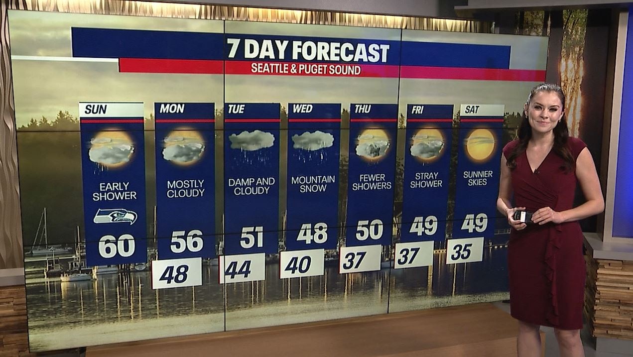
Today's forecast isn't too shabby: morning fog and clouds will ultimately clear for beautiful sunshine this afternoon. There's a small chance for a stray shower this morning, but most neighborhoods will be dry. Grab a sweatshirt or puffy jacket this morning! Also, keep the sunglasses with you for later today.
Here's the forecast for the Hawks game!


Tomorrow will also be mainly dry. Mostly cloudy skies with sunbreaks are in the forecast.
Tuesday and Wednesday will be the most active and wettest stretch all week. There could be accumulating snow over Snoqualmie, Stevens and White Passes Tuesday and Wednesday. There's still some uncertainty about the timing and impacts, so stick with us as we bring you updates. However, there will likely be enough to create challenging conditions for drivers. Stay tuned!
Fewer showers are on the way for Thursday and Friday. Temperatures continue to plunge through the end of the seven-day forecast. By Saturday morning, lows could plummet to the mid-30s in Seattle. Brr!

Warmly,
Meteorologist Abby Acone
Follow me on Instagram @abbyaconewx, TikTok @abbyaconetv and Facebook (Meteorologist Abby Acone)