

Seattle weather: Showers Friday, stronger storm this weekend
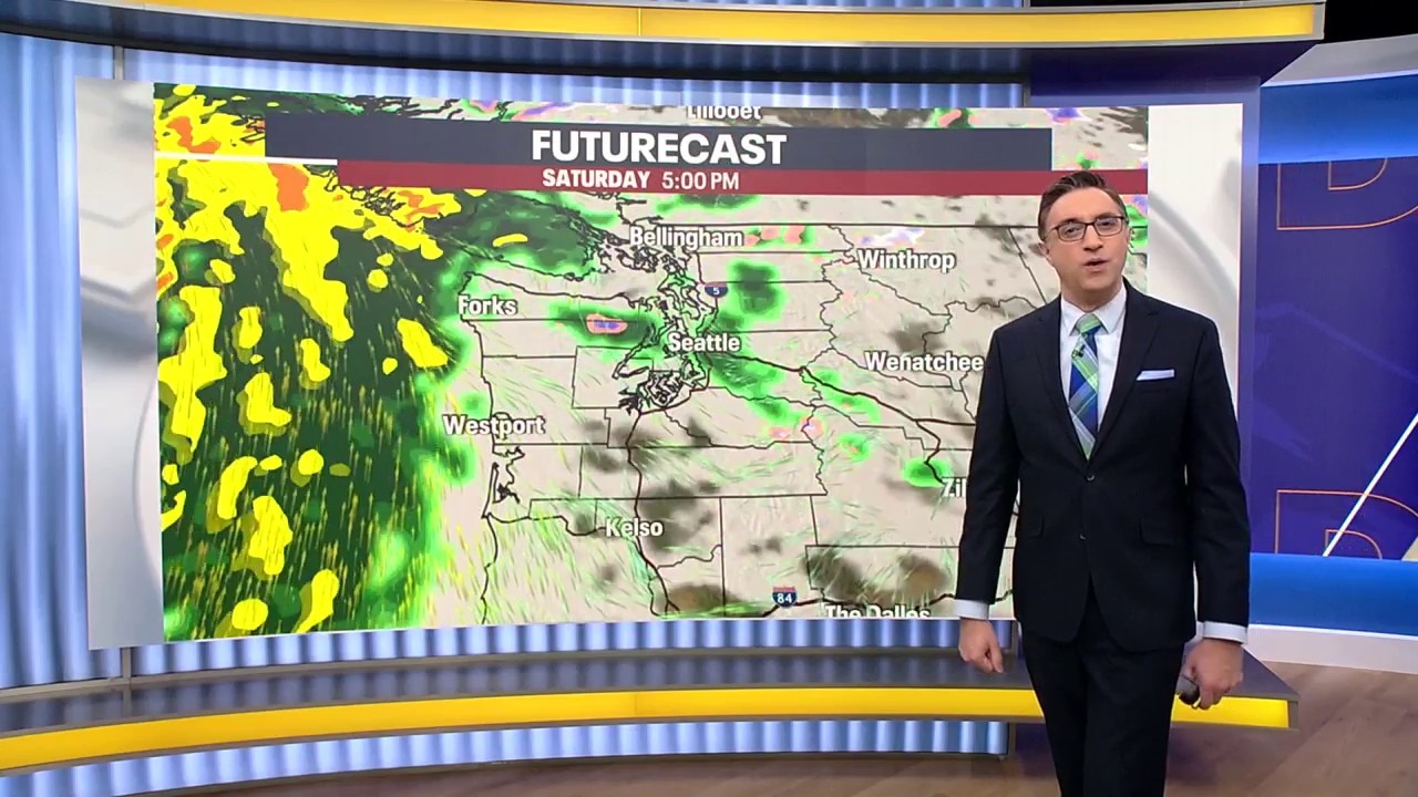
Seattle weather: Rain and gusty winds return Friday
The next frontal system to impact the Pacific Northwest moves onshore Friday, bringing the return of wind and rain.
SEATTLE - The wet and windy pattern is back across western Washington, with a stronger storm set to hit this weekend.
The coast is dealing with some coastal flooding today and large waves. Seas building to around 20 feet are reaching the coastline, and a High Surf Advisory remains in effect. Beachgoers should use caution and stay well back from the water.
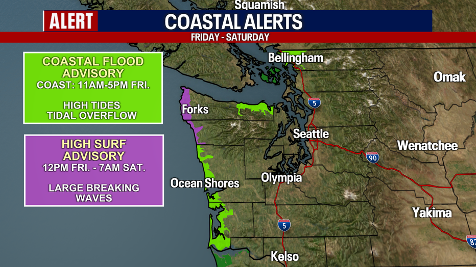
High surf and coastal flooding is expected through Saturday on the Washington Coast. (FOX 13 Seattle)
Tonight we will see scattered showers and decreasing winds.
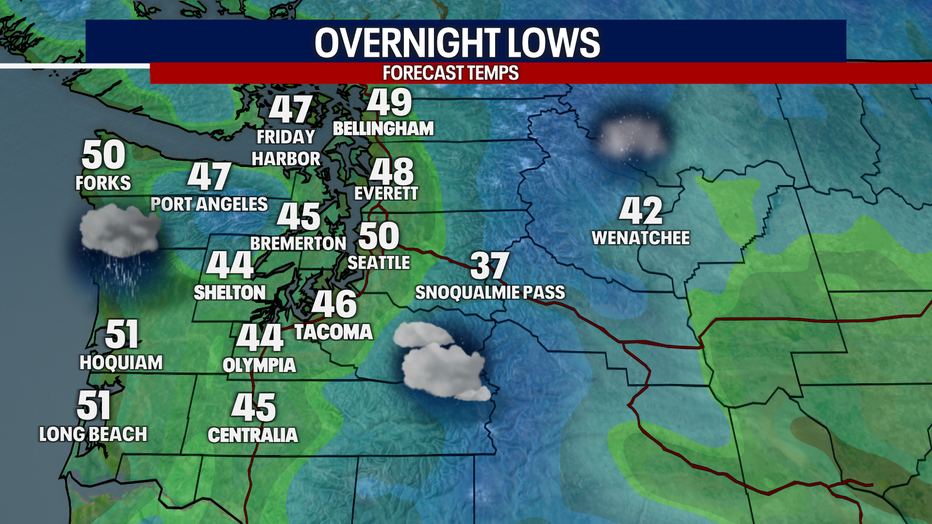
Expect showers to continue Friday night in Western Washington. (FOX 13 Seattle)
Stronger storm arrives Saturday
What's next:
The next system is expected to be stronger, arriving later Saturday and continuing into early Sunday morning. This storm will bring another round of widespread rain, with the heaviest amounts expected along the coast and Olympic Mountains.
Current rainfall estimates include:
- Washington coast: 1.5 to 2 inches
- South-facing slopes of the Olympics: More than 3 inches
- Puget Sound lowlands: Around 0.50 to 1 inch
Winds will also be a significant part of Saturday's storm. The strongest gusts are expected along the coast Saturday afternoon and evening, where gusts could reach over 50 mph. Another area of concern is along the Strait of Juan de Fuca, where we could see gusts in the 50 to 60 mph range.
For the rest of the Puget Sound area, gusts will be topping out in the 30 to 40 mph range. Winds should gradually ease Sunday as the front moves through, although scattered showers will continue.
The strongest gusts will blow through the Puget Sound area between 9 p.m. Saturday and 3 a.m. Sunday.
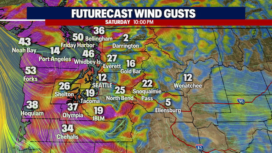
Gusts could reach up to 50+ mph on the coast and through the Strait of Juan de Fuca on Saturday night. (FOX 13 Seattle)
Cooler weather arrives Sunday night
Rainfall amounts should be lightening up by Sunday evening, but snow levels will drop to around 4,000 feet. That could bring some accumulating snow to higher elevations in the Cascades.
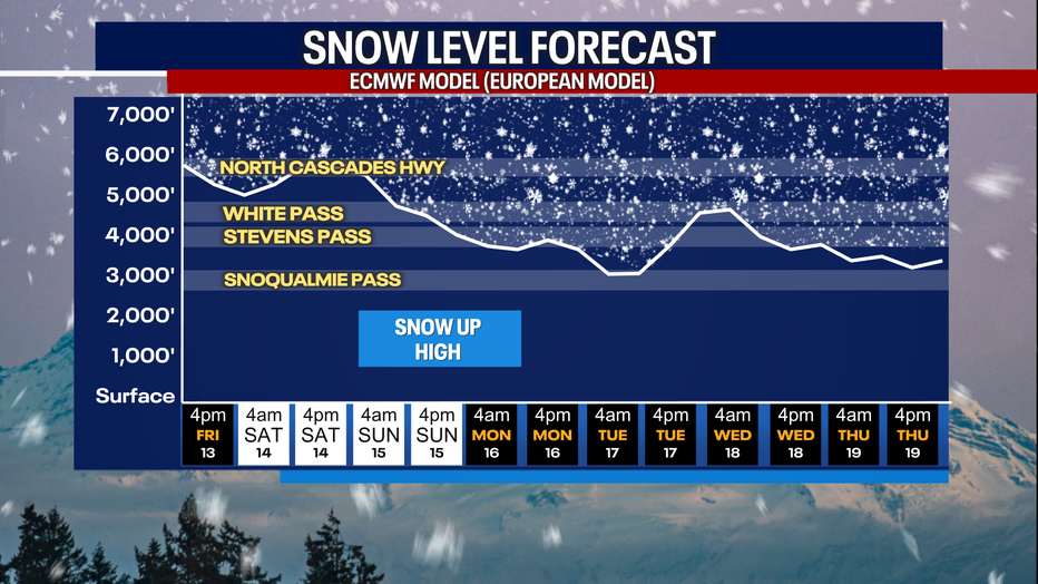
Snow levels will drop on Sunday to below the higher passes. (FOX 13 Seattle)
Drier next week
Looking Ahead:
Drier weather is expected next week with a few showers in the mix.
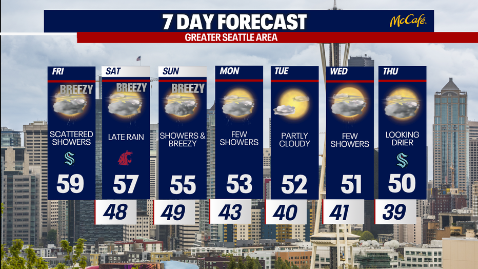
Rain returns to Seattle Friday, with a stronger storm hitting Saturday night. (FOX 13 Seattle)
MORE NEWS FROM FOX 13 SEATTLE
WA traffic: Closures to cause delays in King, Snohomish counties
Microsoft apologizes for nationwide outage, but what took so long?
Ocean Shores on boil water advisory. What residents should know
New hope emerges to save Seattle’s beloved Hawaii General Store
Seattle City Council rejects law imposing more restrictions on RVs
To get the best local news, weather and sports in Seattle for free, sign up for the daily FOX Seattle Newsletter.
Download the free FOX LOCAL app for mobile in the Apple App Store or Google Play Store for live Seattle news, top stories, weather updates and more local and national news.
The Source: Information in this story came from the FOX 13 Seattle Weather Team and the National Weather Service.