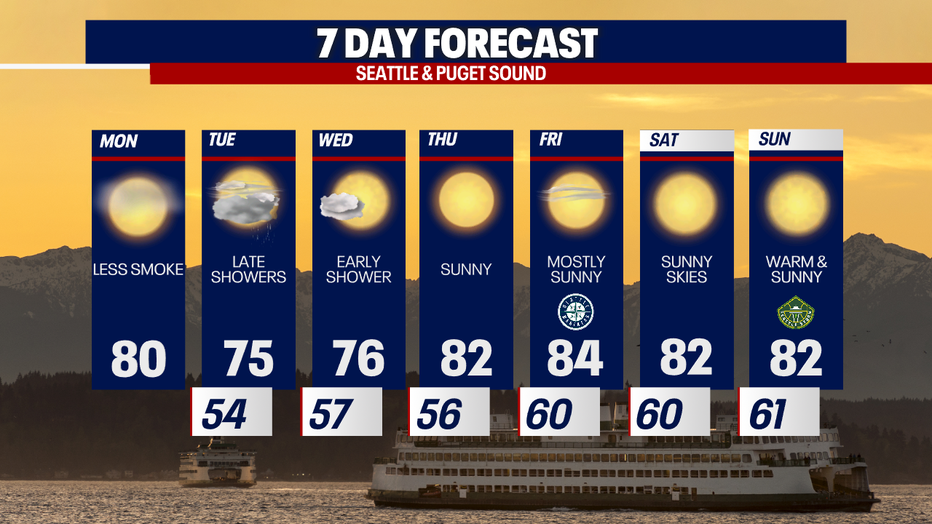
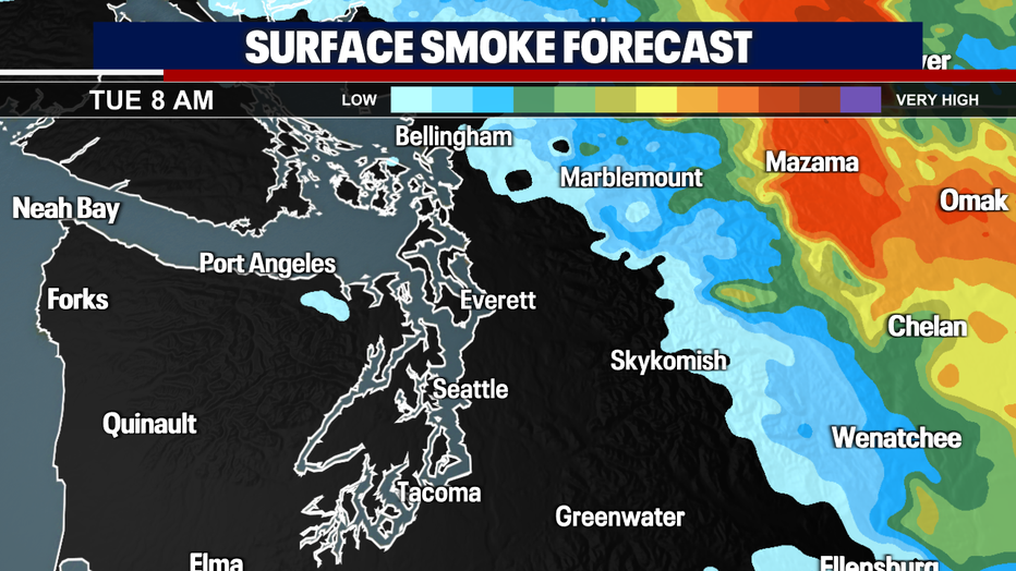
Seattle weather: Smoke starts moving out of Western Washington Monday

'Unhealthy' air quality to improve Monday
Air quality is already showing signs of improvement, but it’s still in the "unhealthy" or "unhealthy for sensitive groups" category this morning. Increased onshore flow will have us looking MUCH better by this evening.
Seattle - Wildfire smoke will move out of Western Washington thanks to onshore winds Monday.
A low pressure system and cold from is moving towards Washington bringing those nice onshore winds, as the remnants of Hurricane Hilary impact Eastern Oregon and parts of southeastern Washington.
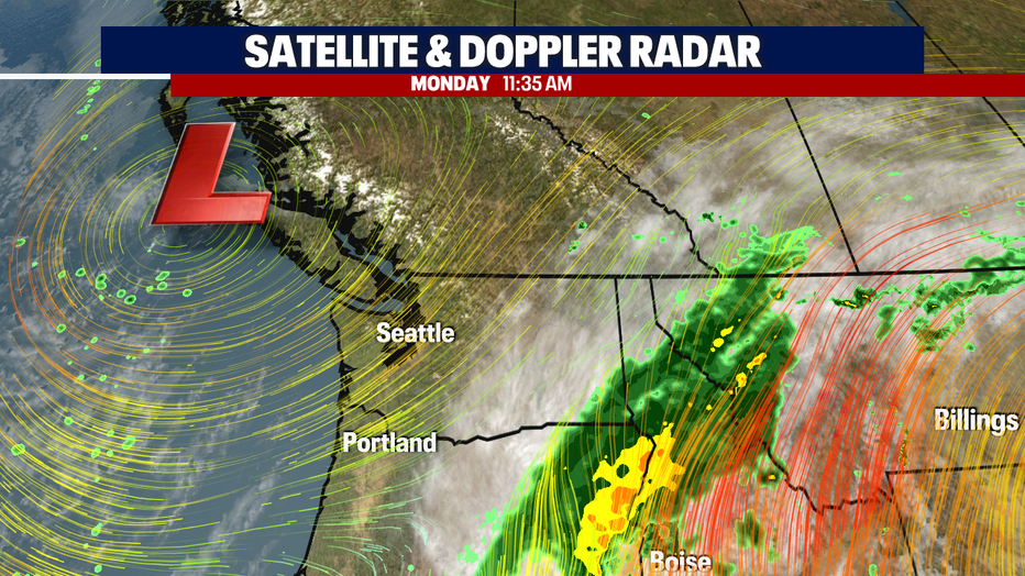
While it may take some time, the skies will look much clearer in Western Washington by Monday evening, and even better by Tuesday morning with this stronger onshore push.
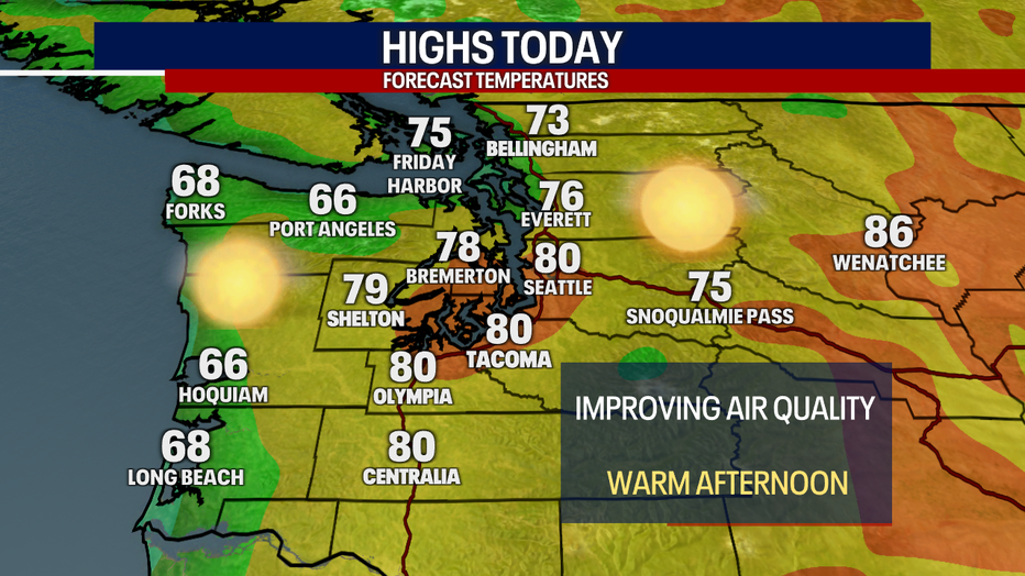
High temperatures Monday will stay warm, in the upper 70s and low 80s. Expect cooler temps for Tuesday and Wednesday.
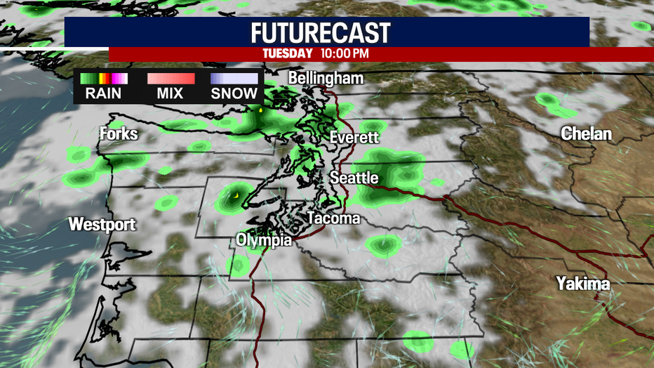
The only chance for rain in the 7 day forecast will hit Tuesday around sunset. This system will bring scattered showers to the area through Wednesday morning. We could still use a good soaker to help with wildfires, but we will have to wait for that.
After morning showers and clouds on Wednesday, Western Washington will get back to sunshine and warmer temperatures. Highs will be in the 80s through the weekend.