Strong ridging delivers warm and dry fall conditions.
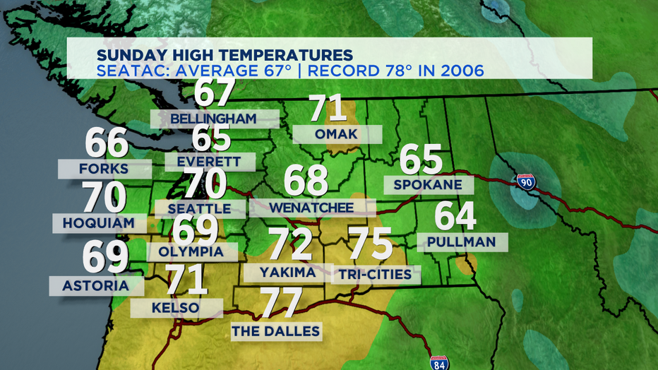
SEATTLE - What a gorgeous Sunday we are enjoying. Highs just a couple degrees shy of our seasonal average of 67. Here's how we did today.

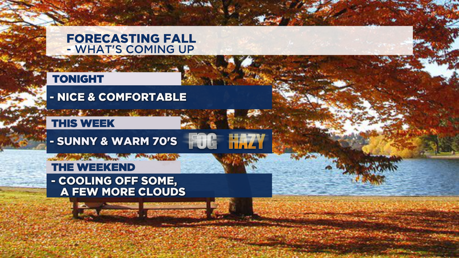
Our big weather story this week..... lots of sunshine with temps climbing into the upper 70s to near 80. We'll really feel more like summer this week than fall for the last week of September and first days of October. High pressure will settle in right over Western WA giving way to beautiful warm days ahead.
With the ridge in place we'll see winds shift northerly to northeasterly tonight, but by tomorrow look for more easterly offshore winds. So, instead of getting our usual cooler ocean air pushing in we'll be feeling the effects of a thermal trough over the coast and east winds will keep us some 5-10 degrees warmer this week than the norm.
Monday, a few morning clouds around, otherwise nice, and sunny with highs in the low 70s. Tuesday and Wednesday will essentially be a repeat of Monday with a little more heating added to the equation. Wednesday will be the hottest day of the week, possibly reaching the upper 70 for the metro area with some spots pushing 80!
Friday into the week will be pleasant too. Highs will cool slightly as our ridge starts to break down with Sunday being the coolest day over the next seven days. We may drop back down into the upper 60s, which is still above our average.

*One other situation we are keeping our eyes on this week will be the possibility of smoke from California drifting offshore and back into the Pacific Northwest by mid-week. We do not anticipate smoke being widespread now but depending on the shift in winds the coast and some areas inland could see some hazy skies. Stay tuned!
Have a great night all! ~Erin
____________________________________________
- Erin Mayovsky, Q13 Forecaster
Twitter: @ErinMayovsky
FB: /ErinMayovsky
Instagram: @ErinMayovsky
____________________________________________

