

Super soaker weather ahead!
SEATTLE - Our "Rain-uary" conditions are coming back. We're tracking the first of several fronts that will drench us here in the Pacific Northwest. And while we're looking at some pre-frontal showers this morning, the steady rain arrives later today and stays with us through the middle of the week.
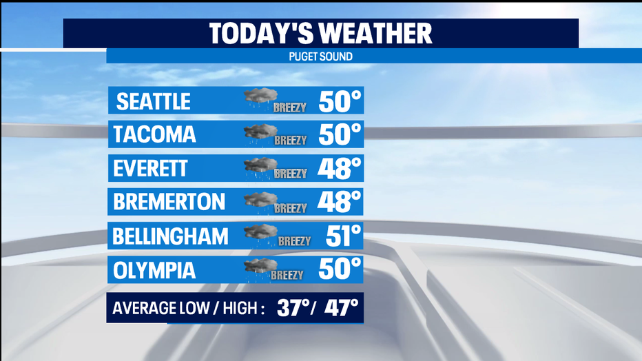
Temps this afternoon will again be above normal. But rain will intensify tonight and stay in a very active phase all through the overnight hours and into Tuesday. That will mean rising rivers and an elevated threat of landslides.
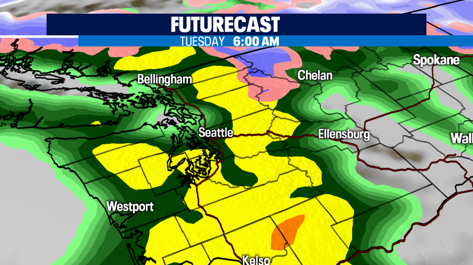
The rain train goes all day Tuesday and looks to taper off as we get into Wednesday. When you see these impressive rainfall forecasts that show rainfall totals today through Wednesday morning, you can see why we have a Flood Watch starting tonight and will last until Wednesday afternoon for ALL of Western Washington. Snow levels will be about 6-7k feet in the mountains, so we'll see a lot of snow melting as well as the incoming precipitation.

Rivers will be moving fast, high, and carrying debris. The river banks will be unstable due to the saturated soil, so stay make sure to stay back from rivers, creeks, and streams. We've already a much wetter than normal January, which is already our 2nd wettest month of the year on average.
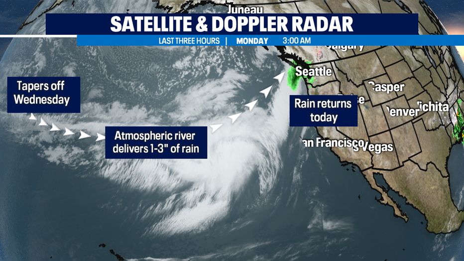
We do get a break as the atmospheric river, that we sometimes call a "Pineapple Express" eases up and moves east by Wednesday afternoon. Thursday just a chance of some showers.
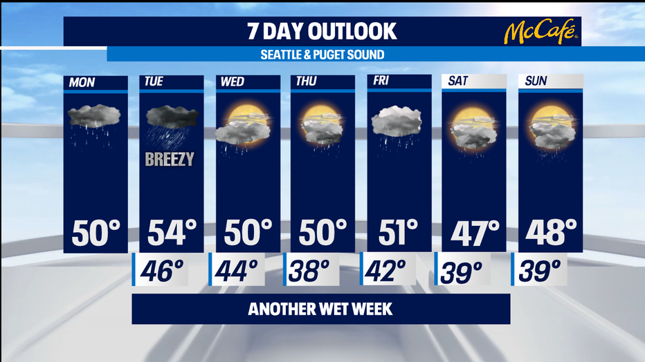
Another round of steady rain likely for Friday, but not nearly as wet as Tuesday. A chance of showers this coming holiday weekend that does look to include some wet weather for the MLK holiday next Monday. -Tim Joyce