

The calm after the storm
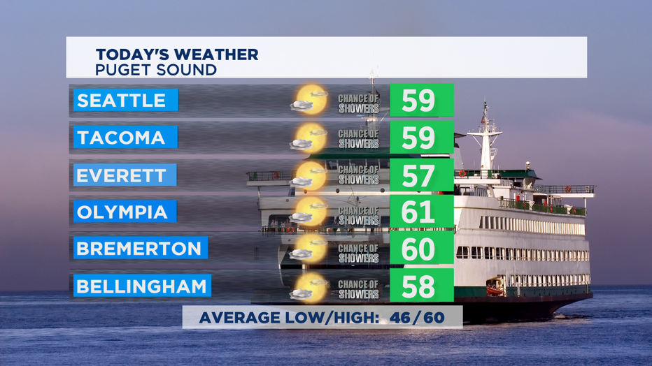
SEATTLE - Some morning showers around the region, but most will clear out by this afternoon.
The strong winds from yesterday, with peak winds near 50 mph, have died back considerably. It'll be a chilly afternoon with most places struggling to get to 60 degrees, but at least we'll have a nice mix of sun and clouds. The most likely places for afternoon showers today will be in the mountains.
Overnight tonight, we'll have fog forming late as temperatures drop into the mid 40s for most of us around Puget Sound and the coastal areas. It could even get frosty in spots in Central WA and higher foothills communities, so take care to cover or bring inside sensitive plants.
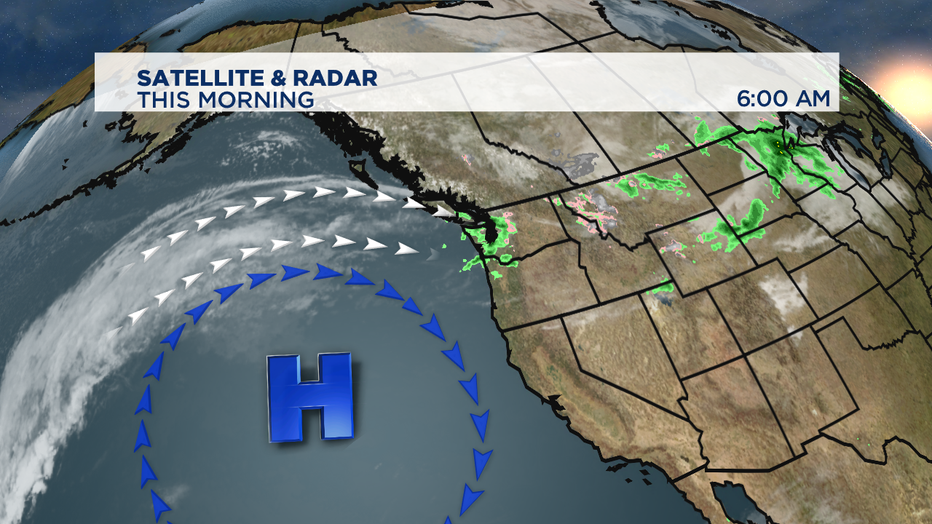
Our briefly drier weather comes to us thanks to a ridge of high pressure building offshore. Often when the ridge is pretty flat or not especially far north we call that a "dirty ridge". That just means that weather systems can move up and over the ridge and take a swipe at Western Washington as they track mostly into British Columbia. So, as we get into Friday through the weekend no huge storms on the horizon-- but we'll see some passing showers or the tail end of fronts delivering some precipitation at times.
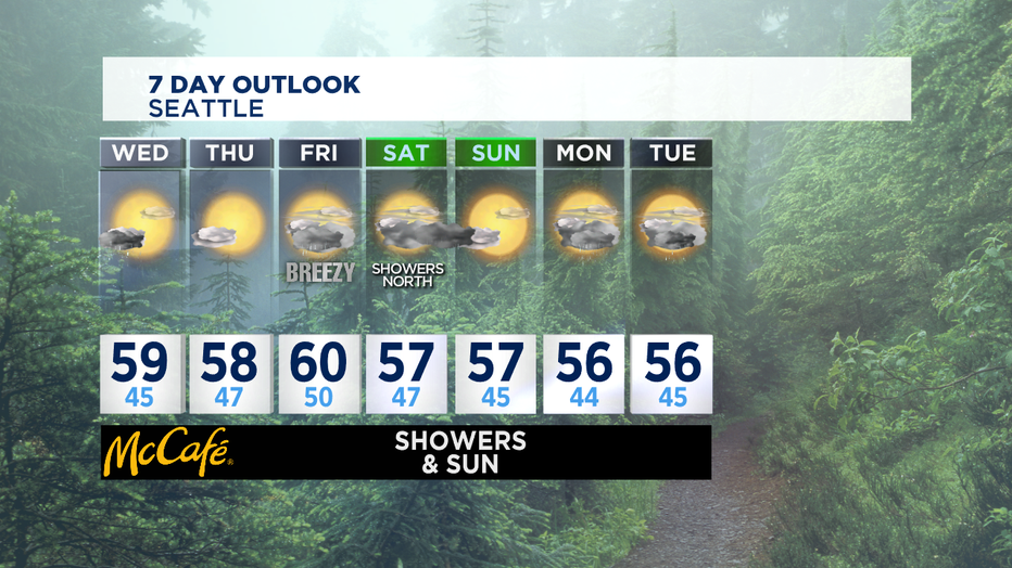
While Thursday looks really nice, Friday we'll see some passing showers likely mid-day. Most of Saturday looks dry from Seattle south down into Oregon. Sunday afternoon also looks quite pleasant. Next week looks like we'll see some seasonal showers and temps on the cool side. Normal afternoon temps for this part of fall is about 60. What you'll really notice in the next couple of weeks is the shorter days and much chillier mornings. -Tim Joyce