

Seattle weather: Turning drier to end the week
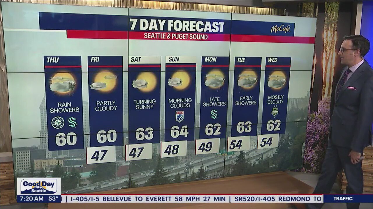
Showers will wrap up Thursday, with drier and sunnier weather ahead heading into the weekend.
The second half of September has been much cooler and wetter than the first half. Today marks the sixth day of consecutive rain, putting Sea-Tac at over double the average rainfall for the month. The soaking rain is much needed to dampen wildfires that continue to burn in the state.


Up in the mountains, we are starting to see the first dusting of snow. This is Crystal Mountain's Ridgeline camera this morning at about 6,800 feet in elevation. We could see a little bit more snow before the day is done up there.

Snow levels will rise again heading into the weekend and early next week.

Isolated showers will remain through the afternoon and there is a slight chance of a thunderstorm or two over the foothills and Cascades. Many spots will see some sunshine in the mix before the evening commute with high temperatures around 60 degrees.

Friday through the weekend will bring lots of sunshine and highs in the 60s. Showers return late Monday into early Tuesday.
