

A showery St. Patrick's Day for Western Washington

Showers return and increase throughout the day
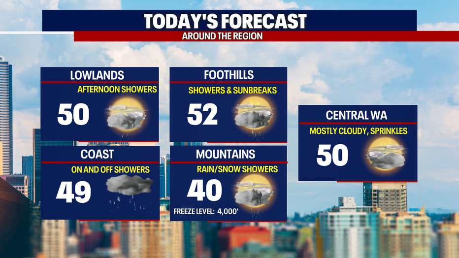
The cloud cover will be heavy throughout the day with highs reaching into the lower 50s.
Seattle - A weak cold front will sweep through Western Washington today, breaking the steady rain up as it pushes inland. Expect scattered showers and a mix of clouds and sunshine this St. Patrick's Day afternoon and evening with cooler high temps in the low 50s.
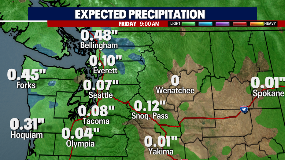
Today's round of rain will mainly impact the north sound, coast and Olympic Peninsula with ¼ to ½" in those locations. From Everett to Olympia, we may see up to 0.10".
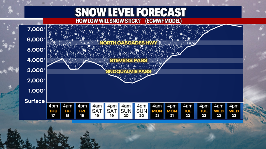
Snow levels over the next few days will bounce between 3,000 and 4,000 feet with Stevens Pass seeing the benefits of more snow the next few days. White and Snoqualmie passes will have a mix of rain and snow and travel won't be impacted as much.
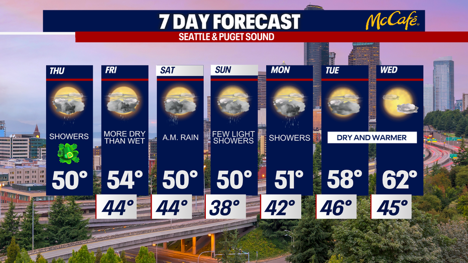
Looking ahead, the next round of heavier rain hits Friday night and into Saturday, but showers should taper off by late Saturday morning. After a few light showers on Sunday and Monday, a ridge of high pressure will settle in over the Pacific Northwest sending temps into the upper 50s and low 60s by midweek.
MORE FROM FOX 13 WEATHER:
DOWNLOAD: FOX 13 Weather and News Apps
WATCH: Forecast and Radar
READ: Closures and Delays
CHECK: Latest Weather Alerts and Live Traffic Map
INTERACT: Submit your Weather Photo
DAILY BRIEF: Sign Up For Our Newsletter
FOLLOW: Lisa Villegas, Erin Mayovsky, Brian MacMillan, Abby Acone and Scott Sistek