Air quality issues Thursday, smoke clears and rain returns Friday
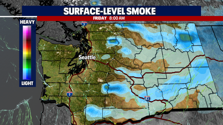
Seattle - Poor air quality will be a major factor around the Puget Sound area Thursday morning with some relief from the smoke expected starting Thursday evening.
Most spots up and down the I-5 corridor from Bellingham to Olympia are in the "unhealthy" to "very unhealthy" air quality index categories.
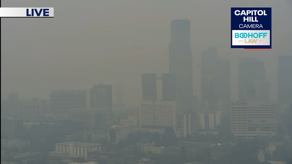
This is what downtown Seattle looked like around 10:00 AM Thursday from the Capitol Hill camera.
The good news is Western Washington will see a push of onshore southwesterly winds tonight and should start to see some relief this evening, with much better air quality by Friday morning.
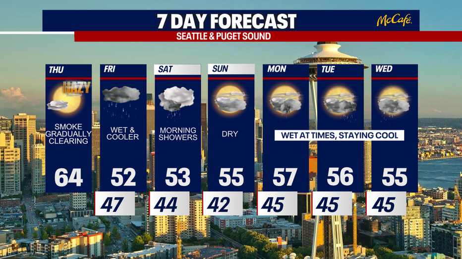
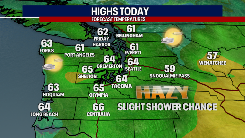
There is a chance for a few spotty light showers today, but not everyone will be getting wet until Friday. Highs today will be in the low to mid 60s.
Friday brings the first chance for soaking rain that Western Washington has seen in over three and a half months. Showers will arrive during the latter half of the morning commute.
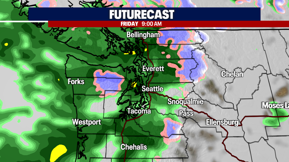
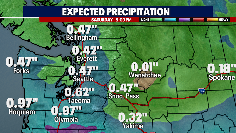
This system will bring the first significant rainfall since June, totaling a quarter to a half inch of accumulation through Saturday evening in the north and central sound, and potentially more in the south sound areas.
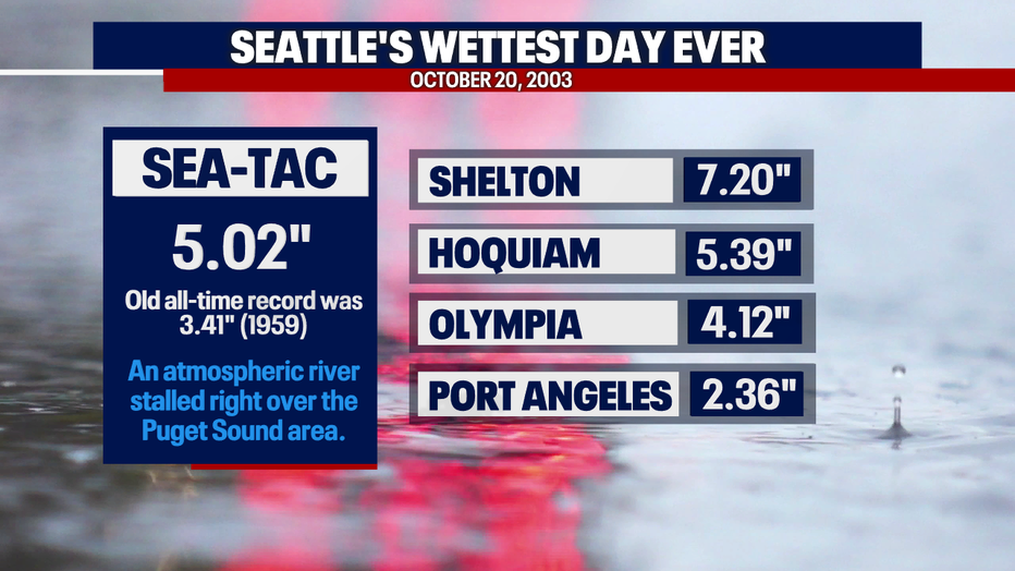
Today also marks the 19th anniversary of Seattle's wettest day ever. On October 20, 2003, Sea-Tac measured over five inches of rain in one day, shattering the old record of 3.41 inches set in 1959. An atmospheric river stalled over the Puget Sound area and dumped rain on the region all day long.
The second half of Saturday and Sunday should remain mainly dry, with more unsettled wet weather in store for early next work week. The next few days will also bring some mountain snow to the Cascades and could impact travel over the passes at times.