

Another foggy start to Wednesday and Thursday
Last day of fog could be on Thursday
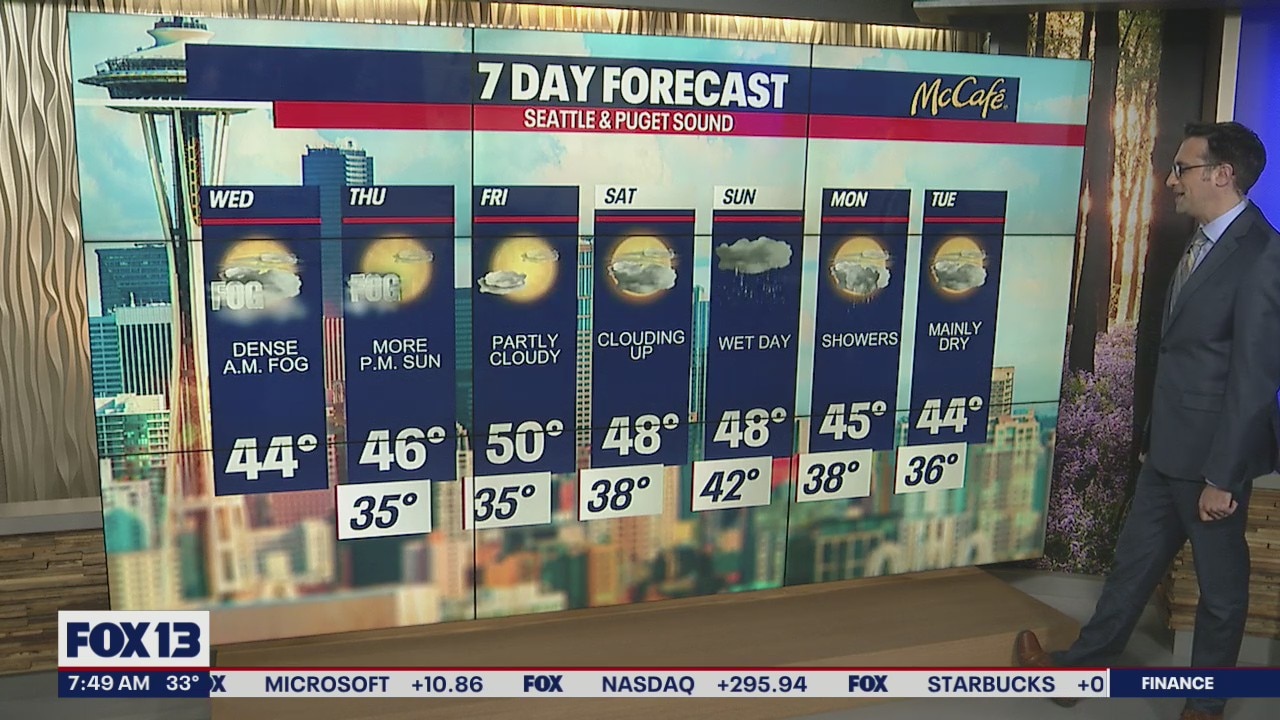
A dense fog advisory is still in effect until noon on Wednesday.
SEATTLE - A ridge of high pressure continues to keep the Pacific Northwest dry with foggy nights and mornings. Dense fog impacted the Puget Sound area for Wednesday morning's commute.
A Dense Fog Advisory was issued by the National Weather Service this morning, with some areas like Paine Field in Everett seeing less than ¼ mile of visibility. That advisory is in place until noon today.

It may be tough to break through the fog this afternoon, but some areas should see sunshine today with highs in the low to mid 40s.

The start to Thursday will bring fog back into the picture for the morning hours, but stronger offshore flow could help break up that fog earlier in the day. That would mean a nice sunny afternoon for a lot of us. Friday will be clear of the fog with partly cloudy skies and will likely be our nicest day of the next week.
The next rainmaker will hit sometime late Saturday night or early Sunday morning. This won't be a big soaker, but it will bring widespread rain showers and snow to the Cascades for the first time since January 20. Showers will linger through Monday.

Looking ahead, it will be more dry than wet for the first week and a half of February with no big storms or lowland snow in sight.

MORE FROM FOX 13 WEATHER:
DOWNLOAD: FOX 13 Weather and News Apps
WATCH: Forecast and Radar
READ: Closures and Delays
CHECK: Latest Weather Alerts and Live Traffic Map
INTERACT: Submit your Weather Photo
DAILY BRIEF: Sign Up For Our Newsletter
FOLLOW: Lisa Villegas, Erin Mayovsky, Brian MacMillan, Abby Acone and Scott Sistek