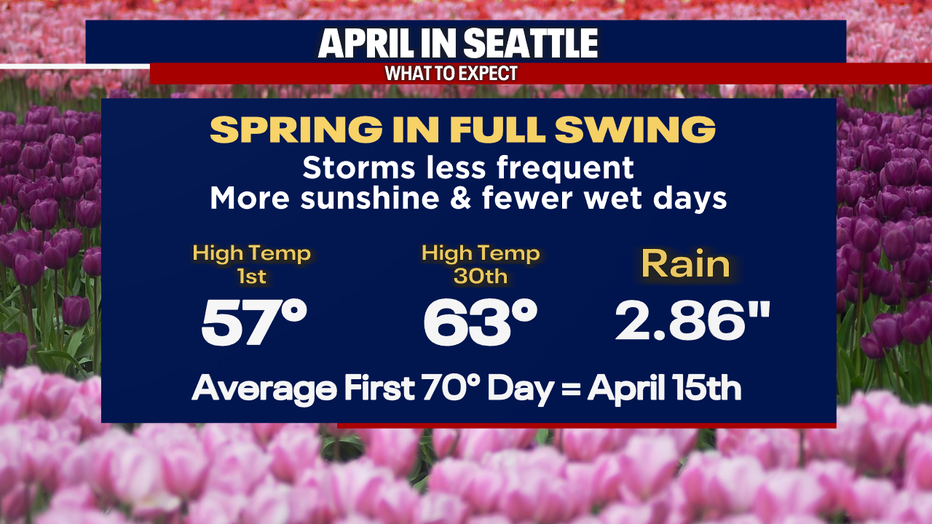
Seattle weather: April starts warm with sunshine and high clouds

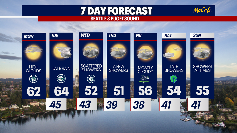
Sunny, temperatures in the 60s for monday
A few morning clouds around the Puget Sound on Monday, with more clouds along the coast. Highs will be slightly warmer, in the 60s with more sunshine in the forecast.
The first week of April in Seattle will bring a mix of warm sunshine and cool rain showers.
April is a transition month for the Puget Sound area. Major storms start becoming less frequent and temperatures climb into the 60s on average. The average first 70 degree day is April 15, but Sea-Tac achieved that twice already in mid-March.
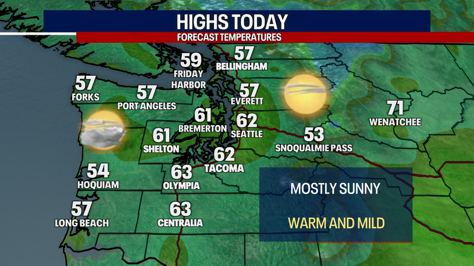
A ridge of high pressure is offshore and will continue to push east over the Pacific Northwest the next 24 to 36 hours. This will bring a mix of high clouds and sunshine this afternoon with highs in the 60s along the I-5 corridor.
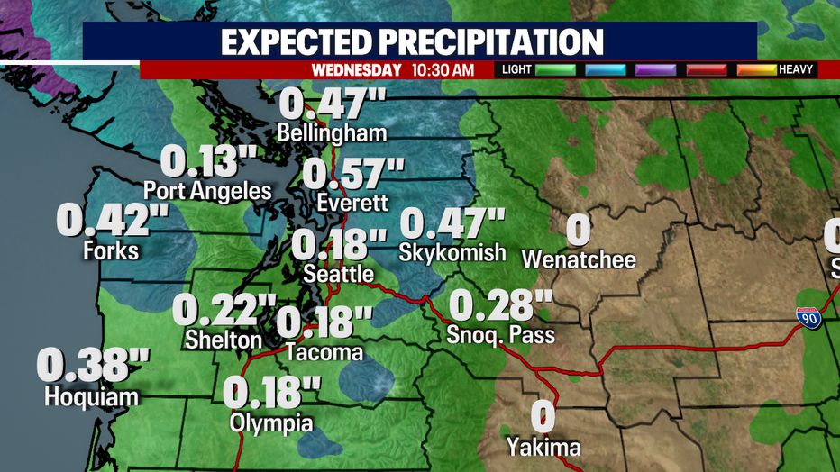
The ridge will start breaking down and pushing east Tuesday. This will open the door for an upper level low pressure system to drop into the area, bringing a much cooler air mass and some rain to Western Washington. Showers will arrive after sunset Tuesday and continue through most of Wednesday. The heaviest rain will fall overnight late Tuesday/early Wednesday.
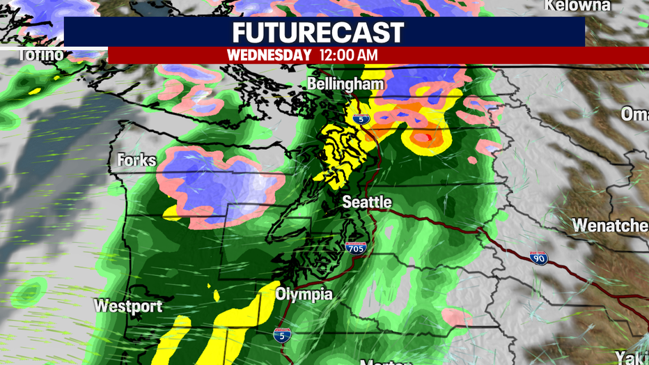
The heaviest rain will fall on the Washington Coast and north of Seattle.
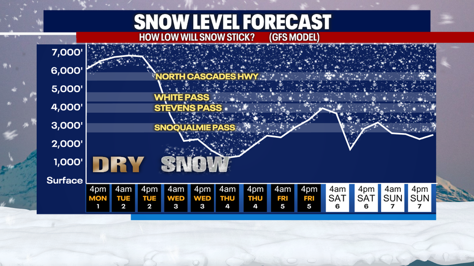
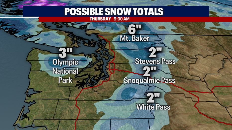
With the introduction of colder air Tuesday night, snow levels will drop fast. Snow levels could drop to around 1,500 feet by early Thursday in the mountains, though only a couple of inches is expected over the mountain passes on Wednesday.
Weak weather systems will continue to pass through Western Washington through the weekend, though Friday and Saturday could be all or mostly dry.