

Seattle weather: Wind and rain ahead Thursday with thunder for some

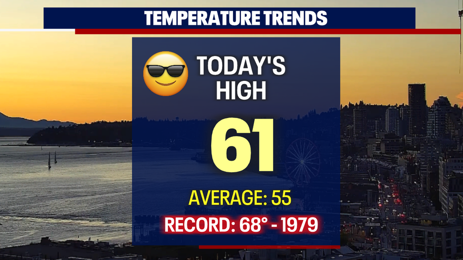
SEATTLE - Another beautiful, sunny spring day for folks around the region with above-average temperatures. Sea-Tac Airport hit 61 degrees!
Don't get used to this weather though-we're flipping the switch and falling back into unsettling conditions to close out the week.
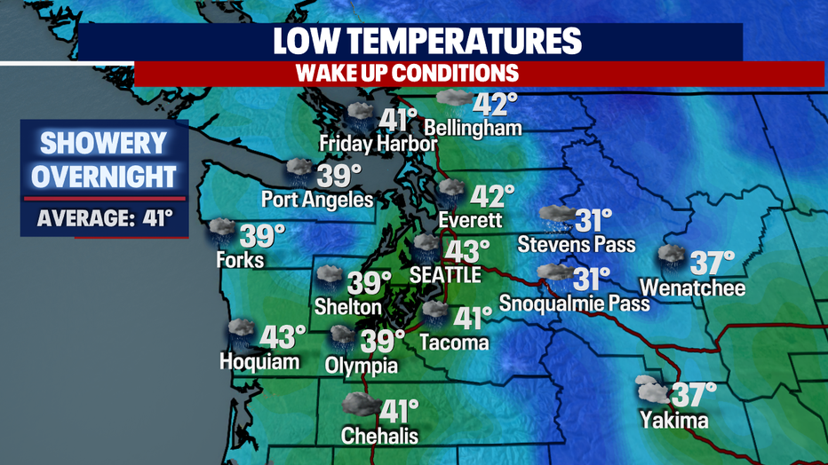
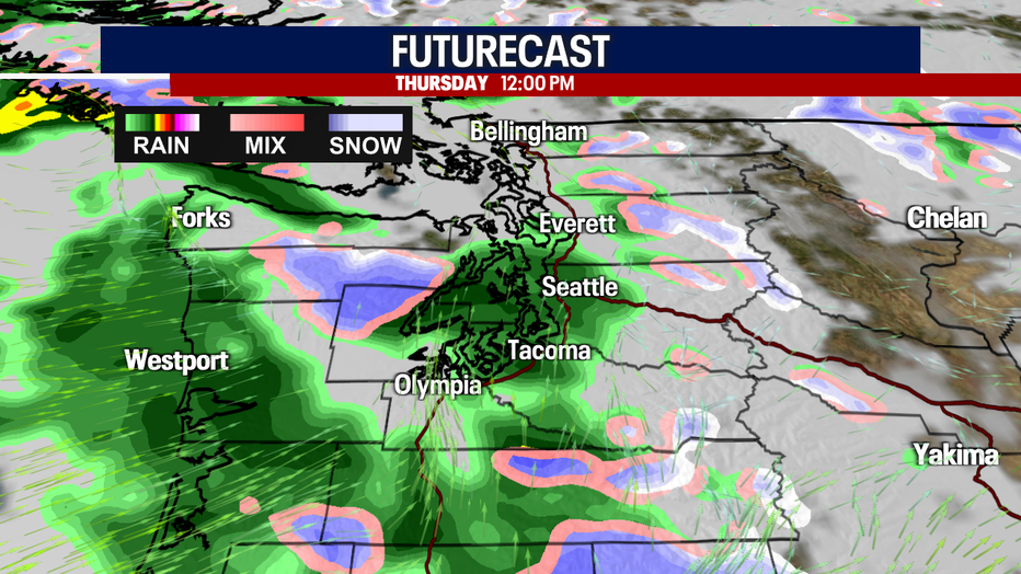
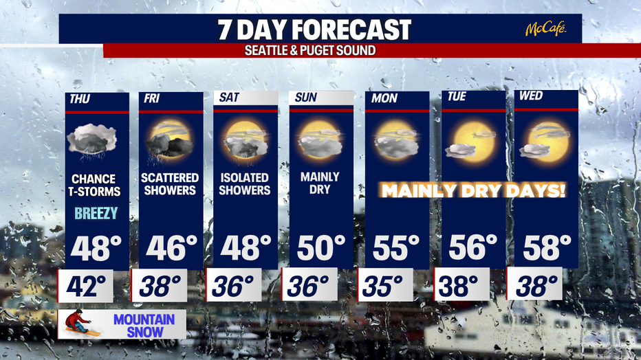
Overnight, low pressure will start to push showers inland. The morning commute won't be a washout, just some light scattered showers ahead of heavier rain.
The good news is temperatures only cool into the upper 30s to low 40s right where we should sit for this time of year.
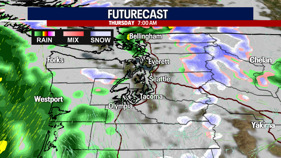
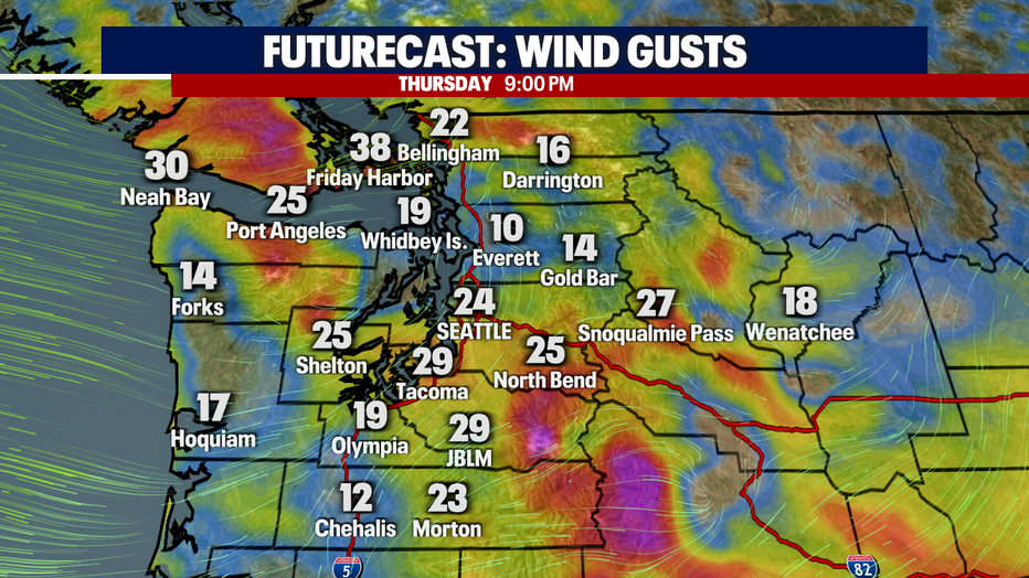
This system not only will bring rain and mountain snow, but gusty winds at times for many communities. Thursday morning looks breezy with gusts 15-20 mph out of the SW.

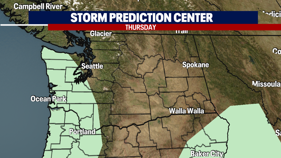
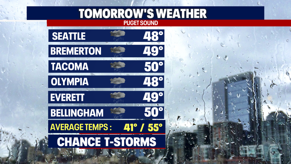
As this active pattern drops into the Northwest, the upper atmosphere will remain unstable at times opening the door for thunderstorms to fire up.
Many areas south and west of Seattle may experience heavy downpours, thunder, lightning, hail and gusty winds.
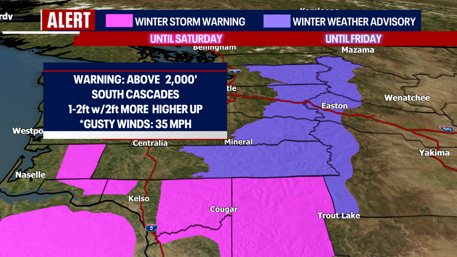
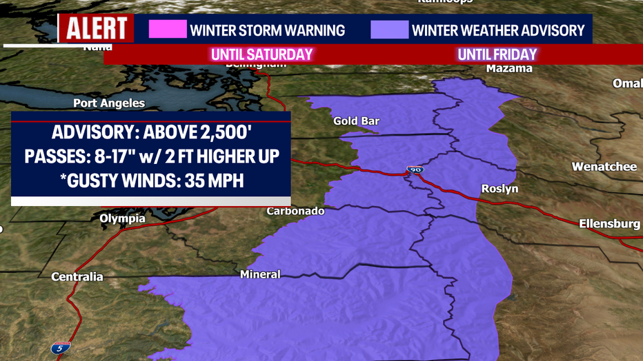
This strong system will drop another round of snow across the Cascades. We have a couple of alerts up for the mountains.
First, a "Winter Storm Warning" is in effect through Saturday above 2,000 ft for the Southern Cascades for 1–2 feet of snow with more accumulation in the higher elevations.
We also have a "Winter Weather Advisory" up through Friday for the Central and Southern Cascades above 2,500 ft. We expect anywhere from 8-17" with more snow higher up.
Plus, winds could gust up to 35 mph at times making for difficult driving conditions. Know the roads before you go!
Highs Thursday cool dramatically, dropping off from Wednesday's low 60s to the upper 40s! Bring back that winter jacket!
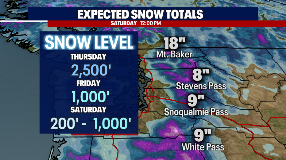
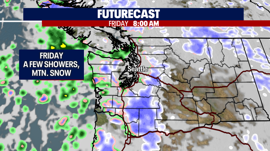
Winds will start to relax as we push into Friday. We'll wake up to cooler lows giving us the chance for a wintry mix early on in the morning. Otherwise, rain lets up to just scattered showers at times with snow heavy over the mountains, especially for the Southern Cascades.
Highs on Friday land in the mid to upper 40s around Puget Sound.
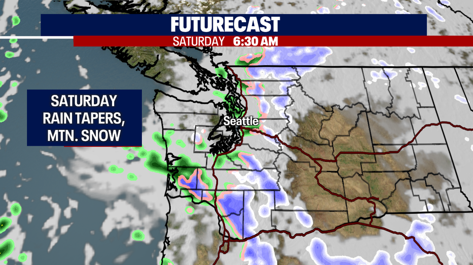
Saturday looks much quieter inland with highs near 48s. The mountains will also start to see snow showers diminish.
By Sunday models are pushing towards a ridge building to help keep us drier and warmer.
As we dry out, temperatures will warm back up into the upper 50s throughout the week under mostly to partly cloudy skies.
Have a great rest of the week all! ~Erin Mayovsky, FOX 13 Forecaster
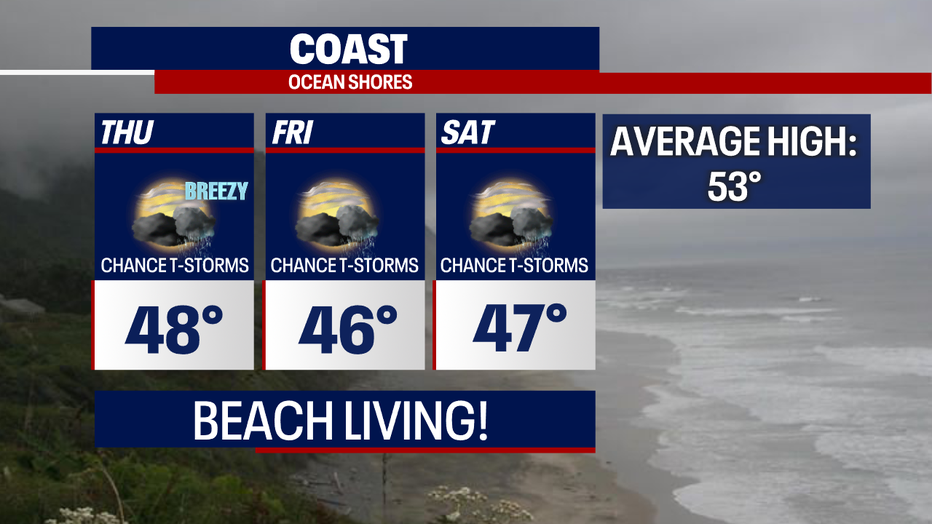
*Coast Forecast
*Mountain Forecast
