

Chilly May afternoons ahead with showers & sun

Showers for the next few days
Scattered showers and possible afternoon thunderstorms expected Tuesday
SEATTLE - So much for July in May -- we've rolled back the clock on our temps to what would be normal for mid-April, not mid-May.
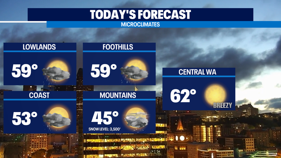
Expect showers and some sun around the region for today with high temps that will be in the upper 50s for the lowlands and foothills. We're seeing a bit more steady rain where the winds forced around the Olympic Mountains are converging back over Snohomish County. In the mountains, it'll be cold enough for snow showers down to our passes, but the ground will be too warm to see anything stick.
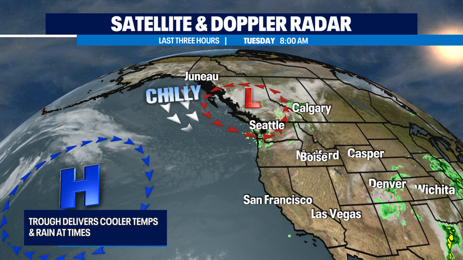
We've got a dip in the jet stream called a trough over the region and that will send in some chillier than normal weather and some atmospheric conditions that will be unstable enough to cause a few isolated thunderstorms to develop later this afternoon and again a slight chance tomorrow afternoon too.
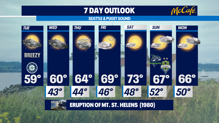
We'll warm up over the next few days and it looks like we'll dry out by Friday with just a slight chance of showers for the coastal areas and mountains. The nicer weather seems to hold for about two and a half days. So, temps look to peak nicely in the low 70s on Saturday.
The best news is that while we didn't really get enough rain to satisfy our thirsty yards and gardens, allergy sufferers can breathe a little easier. We did get enough to knock pollen counts for grass and trees to Low and for weeds knock the pollen counts down to absent in our most recent air sample. Enjoy! -Tim Joyce
Q13 WEATHER RESOURCES:
DOWNLOAD: Q13 Weather and News Apps
WATCH: Forecast and Radar
READ: Closures and Delays
CHECK: Latest Weather Alerts and Live Traffic Map
INTERACT: Submit your Weather Photo
FOLLOW: Lisa Villegas, MJ McDermott, Tim Joyce, Erin Mayovsky, Grace Lim and Scott Sistek