

Seattle weather: Chilly Monday with the 60s returning for Easter
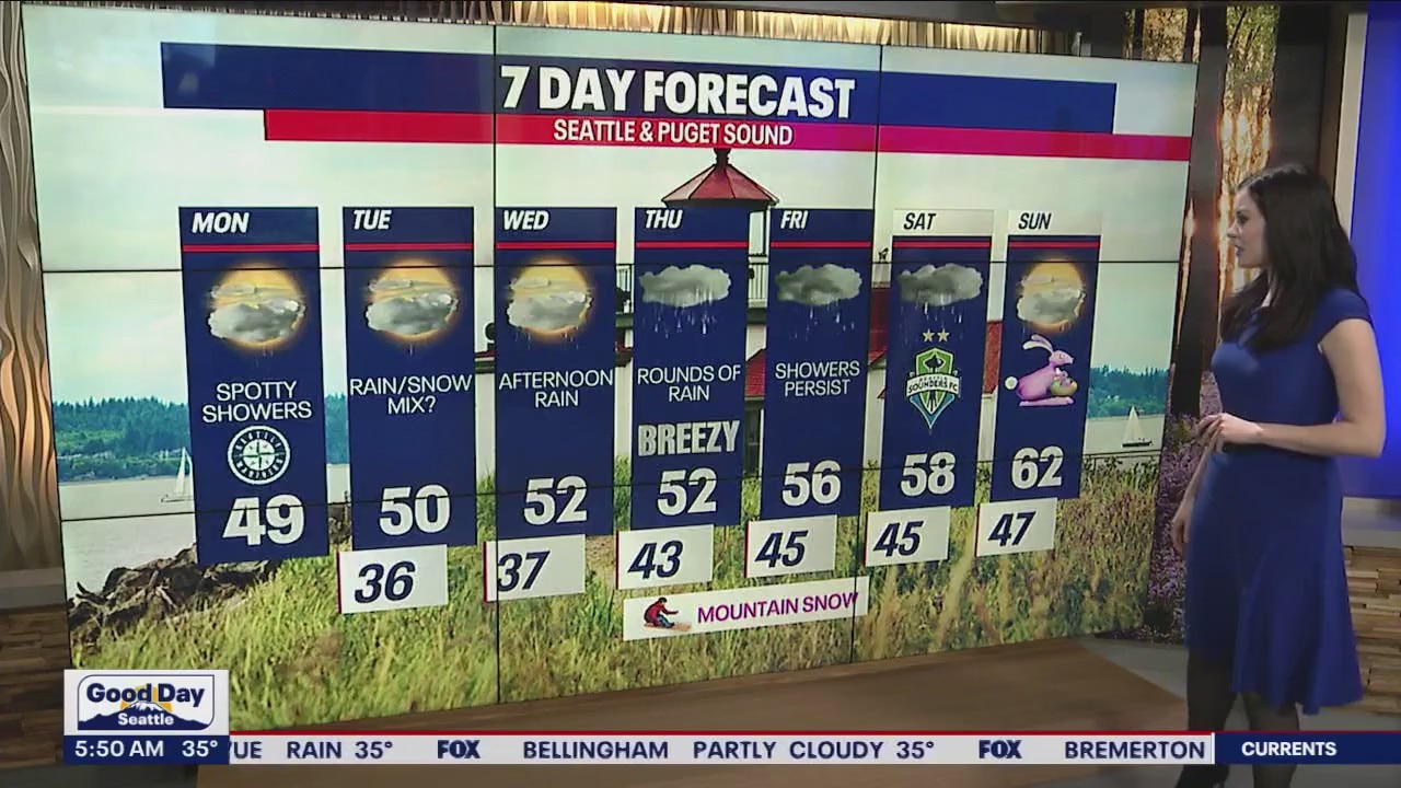
Highs Monday only into the upper 40s to near 50
Temperatures running really cool, landing in the upper 20s to mid 30s. There may be a few areas waking up to a wintry mix as snow levels drop between 500'-1,000'.
Grab a warm coat today! Highs (once again) will only reach the upper 40s and low 50s. If you're hoping for warmer weather, you'll enjoy the forecast for Easter Sunday :)


Earlier this morning, we had reports of wet snowflakes in places like Sequim, Blyn Bay, Chimacum and Port Townsend. Isolated to scattered showers are still in the forecast for the rest of today. At times, small hail or graupel could mix with the rain. Late tonight into early Tuesday, we can't rule out a brief, minor and spotty rain/snow mix in the lowlands. The chance for this is already quite small. Accumulations would be unlikely.


Wednesday morning starts dry. Rain surges back into Western Washington by Wednesday afternoon and evening.

Thursday will be damp and breezy for some. Snow could fall over the mountains Thursday into Friday.
Saturday and Sunday don't look like a washout; however, scattered rain may interrupt Easter plans. Stay tuned for updates! At least temperatures will be warming into the low 60s for Easter Sunday!

Take good care,
Meteorologist Abby Acone
Follow me on Twitter @abbyacone, Instagram @abbyacone, Instagram @abbyaconewx, TikTok @abbyaconetv