

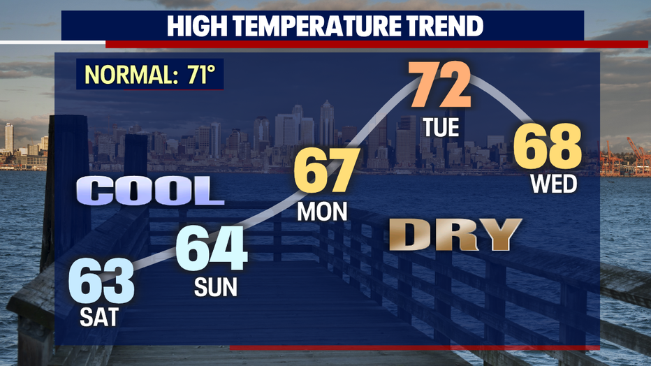
Chilly weekend ahead with the 70s back by Tuesday

Wet and rainy in Seattle this weekend, but things finally start to get drier next week
Wet and rainy in Seattle this weekend, but things finally start to get drier next week
While the "June gloom" hangs on this weekend, the 70s are finally returning to Seattle by Tuesday. Next week, we'll enjoy partly sunny skies and dry weather that could last for several days!
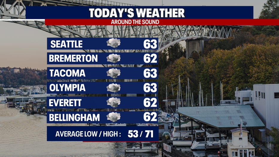
For today, you can plan on highs in the low 60s. Mainly gray skies will hover over Western Washington. A few showers may pop up. A convergence zone could develop in parts of Central Puget Sound this afternoon and tonight (this is most likely over the Kitsap Peninsula and in Snohomish, King and Pierce Counties). Where this zone happens, there could be heavy rain in spots. There could even be a strike of lightning or pockets of small hail!
The Mariners, OL Reign and Sounders are all playing at home today. If you're going to a game, make sure to bring a rain jacket with you.
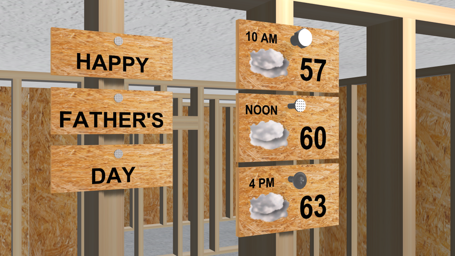
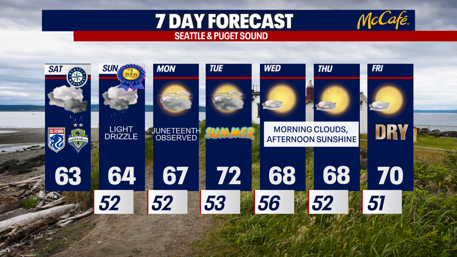
For Father's Day and Juneteenth, you can expect a light shower or drizzle along with overcast skies. Most backyards stay dry.
Dry weather takes hold on Monday. The forecast models today suggest the dry weather sticks around through next weekend! Of course, the forecast is highly to change, so stay tuned.
The 70s are with us Tuesday – just in time for the summer solstice. The 70s are possible once again Friday. In fact, those 70s could linger into next Saturday and Sunday! Even though the cool, cloudy weather has been refreshing, not to mention delaying the start to fire season, I know many people will enjoy a stretch of warmer, sunnier weather. :)
Thanks so much for choosing FOX 13! I hope you have a wonderful weekend.
Warmly,
Meteorologist Abby Acone
Follow me on Twitter @abbyacone, Instagram @abbyaconewx, TikTok @abbyaconetv and Facebook (Meteorologist Abby Acone)