

Cloudy and cooler Friday and Saturday, heatwave looms next week
Cooler temperatures Friday, Saturday
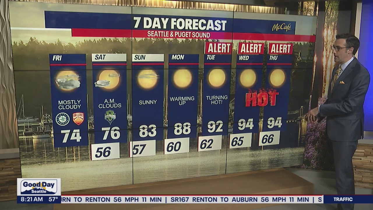
A low pressure system is bringing widespread cloud cover west of the Cascades this morning. Temps will be cooler than average today in the low to mid 70s around the Puget Sound area with sunshine in the mix by the evening commute.
Seattle - It will be cloudier and cooler across Western Washington Friday and Saturday, but next week will likely be the hottest of the year so far.
A low pressure system is bringing widespread cloud cover west of the Cascades this morning. Temps will be cooler than average today in the low to mid 70s around the Puget Sound area with sunshine in the mix by the evening commute.
Saturday will be very similar, although I expect the clouds to evaporate a little faster.

If you're heading out to one of our area lakes or rivers this weekend, water temps are continuing to warm. No matter the temp of the water, it's always a good idea to wear a lifejacket.

Sunday will be the start of warmer weather, which will turn downright hot starting Monday as a ridge of high pressure moves over the Pacific Northwest.

Temps will soar to the 90s Tuesday through Friday, with Wednesday and Thursday looking like our hottest days. Overnight temperatures will be in the 60s, which won't give those without air conditioning much relief. Prepare now for how you are going to cool off during this heat wave.

