

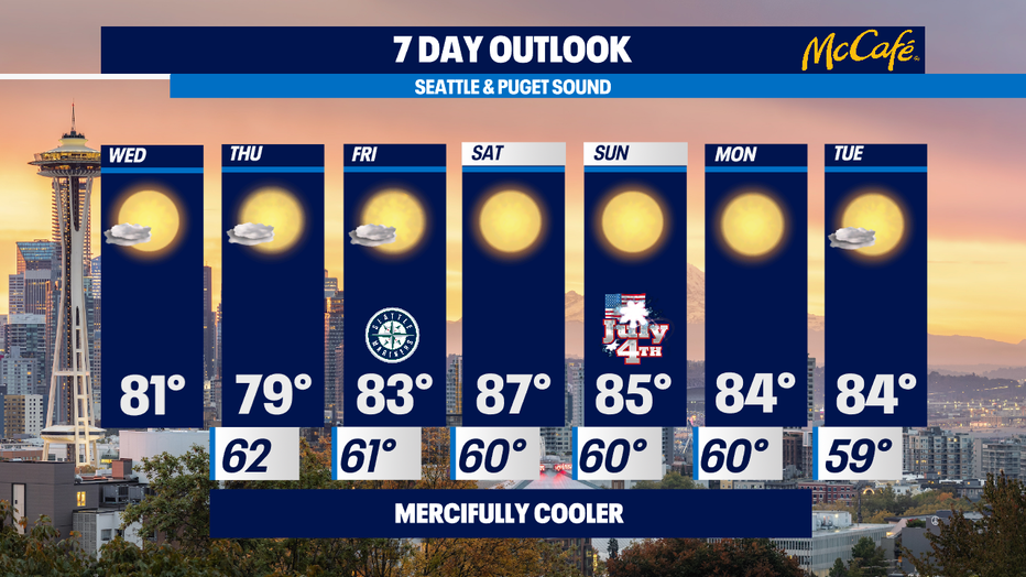
Cool & cloudy morning, mostly sunny and warm Wednesday afternoon

Back to normal summer temps
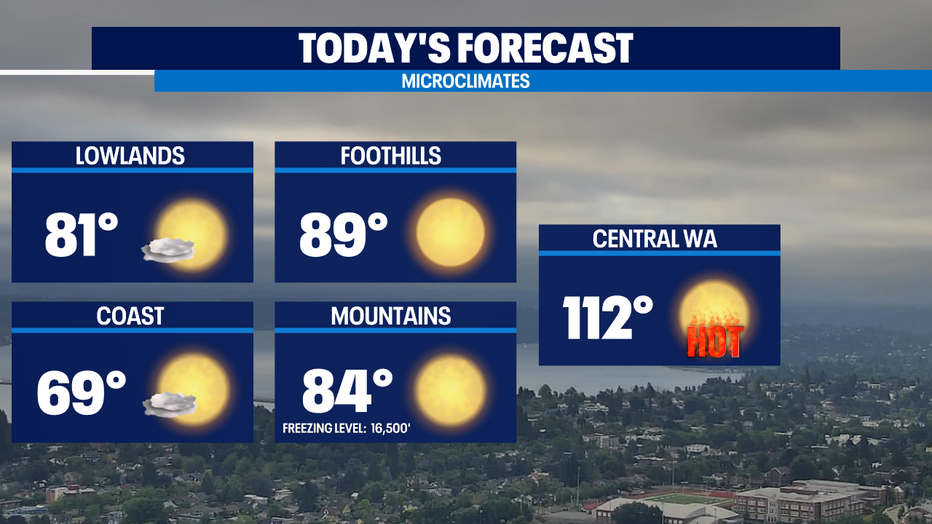
Dry weather continues but we're down to the seasonal low 80s in Western Washington instead of the triple digits. Eastern Washington is not so lucky.
SEATTLE - A cool marine push is bringing in morning clouds and some areas of patchy fog. Expect skies to become gradually sunny except for the coast which will remain mostly cloudy and cool in the upper 60s. Everywhere else will see highs in the 80s, which is still above normal, but a lot more comfortable compared to our unprecedented heat wave.
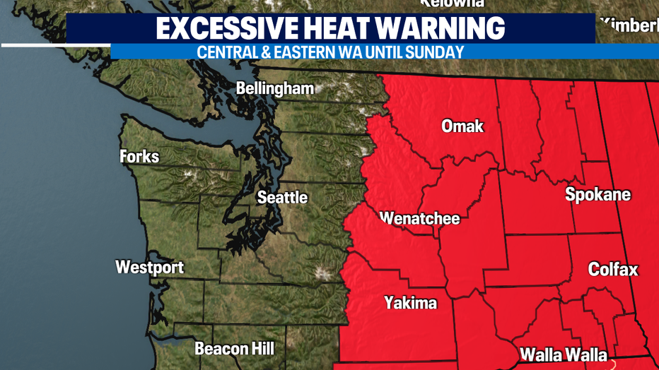
Excessive Heat Warning continues for Central and Eastern WA where triple digits are expected through the 4th of July weekend. It will also be gusty with wind gusts as high as 25-30mph, increasing the threat for wildfires.
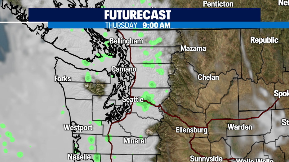
A stronger marine push tonight and Thursday morning will bring widespread morning clouds. There is even a chance for drizzle, especially on the coast. Clouds should gradually clear and Thursday will be the coolest of the 7 day stretch in the upper 70s.
Highs will be back into the lower 80s on Friday. The 4th of July holiday weekend will be warm in the mid to upper 80s. With the stretch of dry and warm conditions, the fire threat will be elevated.
Have a great day!
-Q13 Meteorologist Grace Lim
Q13 FOX WEATHER RESOURCES:
DOWNLOAD: Q13 Weather and News Apps
WATCH: Forecast and Radar
READ: Closures and Delays
CHECK: Latest Weather Alerts and Live Traffic Map
INTERACT: Submit your Weather Photo
FOLLOW: Lisa Villegas, MJ McDermott, Erin Mayovsky, Grace Lim and Scott Sistek