

Seattle weather: Cool, wet week ahead with mountain snow
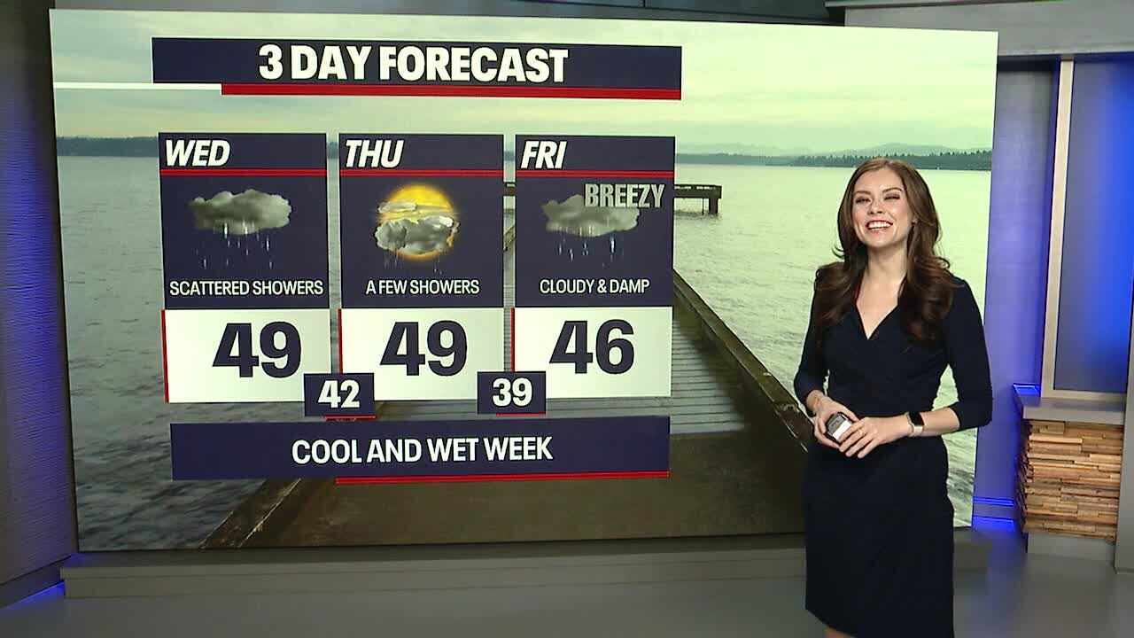
Scattered showers into Wednesday morning
Showers continue this week, but a stronger system comes in by Friday for more rain and mountain snow.
After a dismal December with little mountain snow, things are about to change with an incoming cool and wet weather pattern. Skiers and snowboarders rejoice!
For today, you can plan on cloudy skies, slightly breezy weather and hit-or-miss showers. There will be light mountain snow, but not much to write home about. As you're stepping outside for errands or walking the dog, just wear a warm waterproof jacket and rain-resistant shoes. Highs today will reach either side of 50 degrees.

Tomorrow's forecast is very similar to what we're expecting today: it'll be rather quiet, but some showers could make for damp and slick roads.


Beginning Friday night and lingering into Saturday, a strong storm system will impact Western Washington. This will bring about heavy mountain snow – in the order of six to ten plus inches Friday to Saturday over the passes! It'll be locally windy in the typical spots (e.g. the coast and inland waters).
Sunday will be a fantastic day for heading up to the ski resorts: folks will enjoy the freshly accumulated snow from Saturday, and road conditions won't be terrible. Only light additional snow is in the forecast for the mountains on Sunday.
Thereafter, yet another cool and wet system will trigger more significant mountain snow.
Here's a look at our latest seven day forecast for Snoqualmie Pass. Overall in the next week, we're expecting one to two feet of snow (or more) for the passes by next Tuesday.

This upcoming winter weather pattern will do wonders for our snowpack. Below is a look at where our snowpack stands (percentage of normal). We desperately need more snow!

Thanks so much for choosing FOX 13. We're thankful for you!

Warmly,
Meteorologist Abby Acone
Follow me on Facebook (Meteorologist Abby Acone), Instagram @abbyaconewx, TikTok @abbyaconetv and X @abbyacone