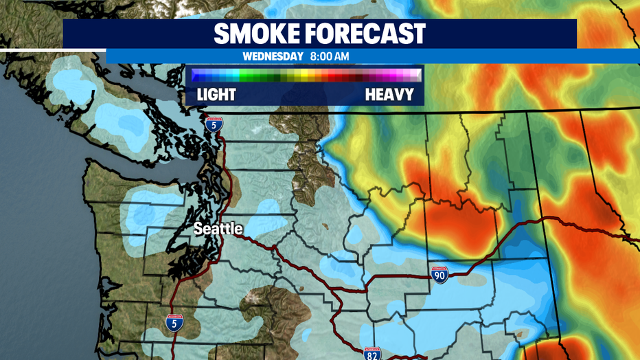
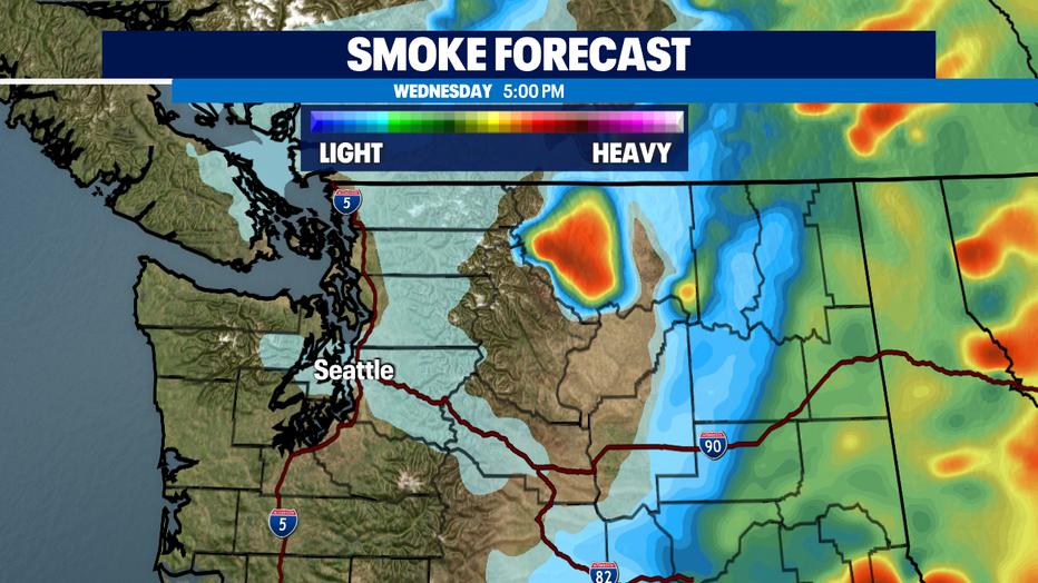
Fire danger is elevated for the state. Expect a light haze around Puget Sound with smoky skies to the east.
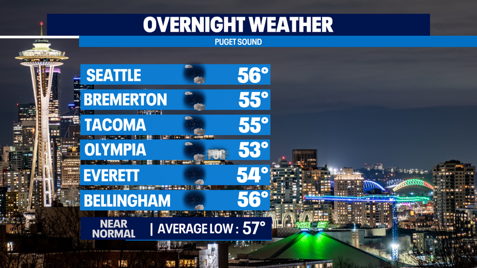
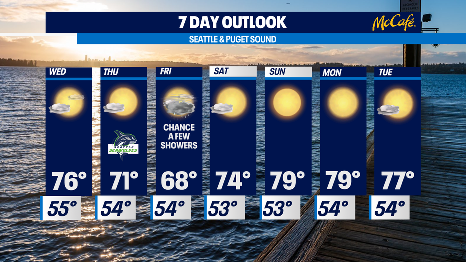
Seattle - Our marine layer will gradually push back for a cloudy to foggy start for some. Overnight lows will land in the mid 50s with cooler spots to the south.
As we move through the week we'll start to cool some into the low to mid 70s.
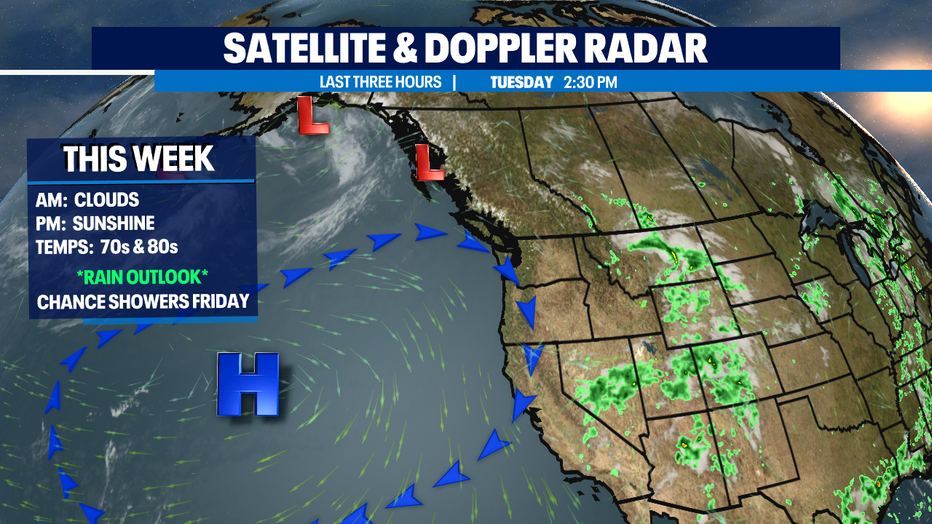
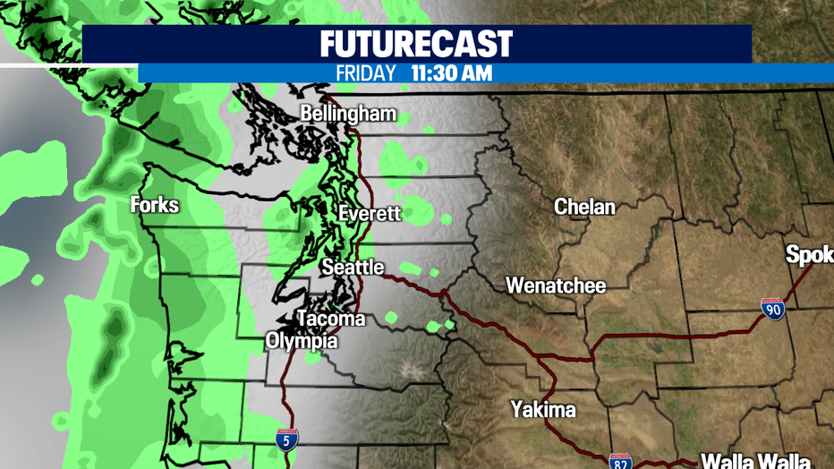
A front on Friday will give us much needed rain, but it will be very light and isolated at best. Showers look to hang near the coast and north Puget Sound, but we'll take it!
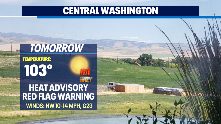
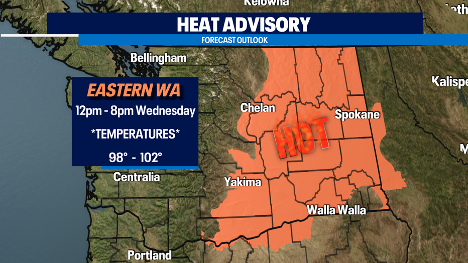
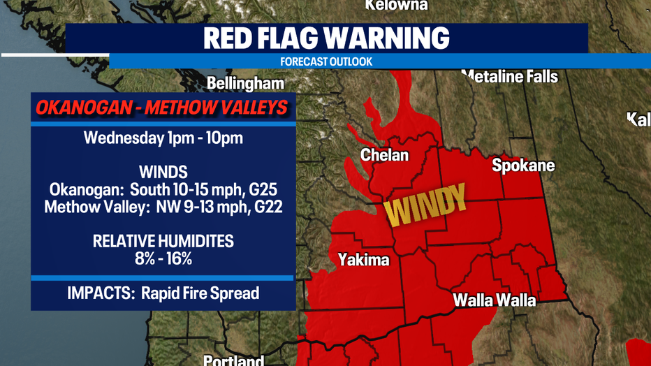
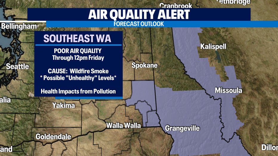
Fire danger is high across the state, but extremely high for Eastern WA. We have several alerts going into effect:
And because of all the fires burning in Eastern WA, Idaho, Montana and Canada there will be reduced Air Quality for many. Even expecting a little haze for Puget Sound. Air Quality levels for Eastern WA will be Moderate to Unhealthy at times and this especially impacts those who suffer from respiratory issues.
We will see another warmup get going starting Sunday and will continue into the work week ahead bring more summer sunshine and dry conditions.
Have a great night! ~Erin Mayovsky, Q13 Forecaster
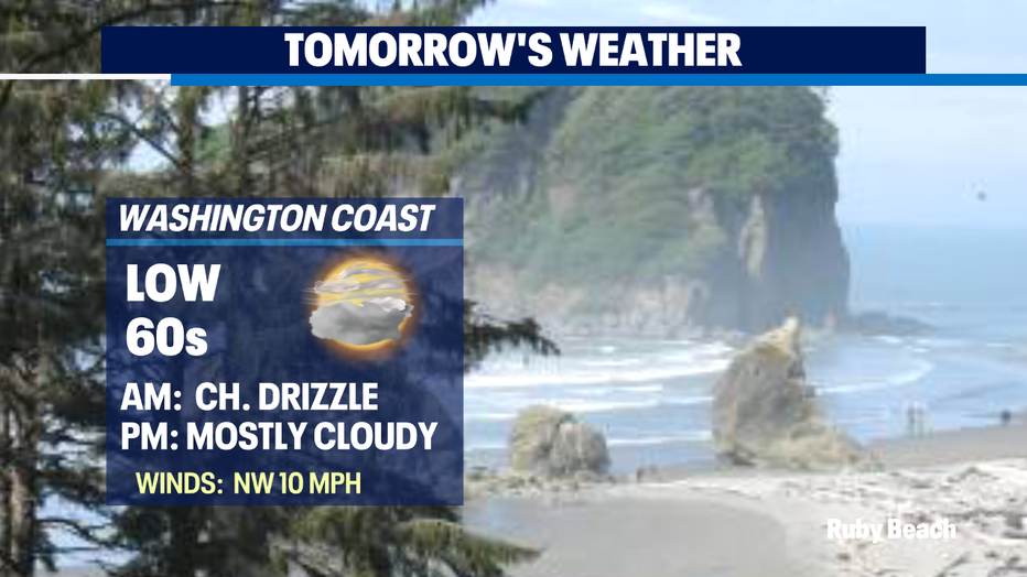
*Beach Forecast
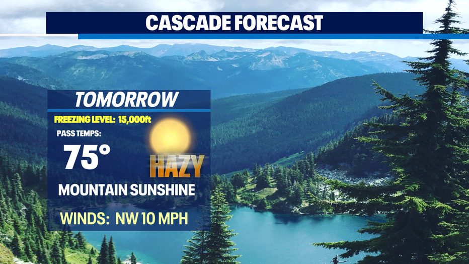
*Mountain Forecast
*Central WA Forecast