

Dry December returns - for now

SEATTLE - Another spell of some nice dry weather for at least the first two days of this week.
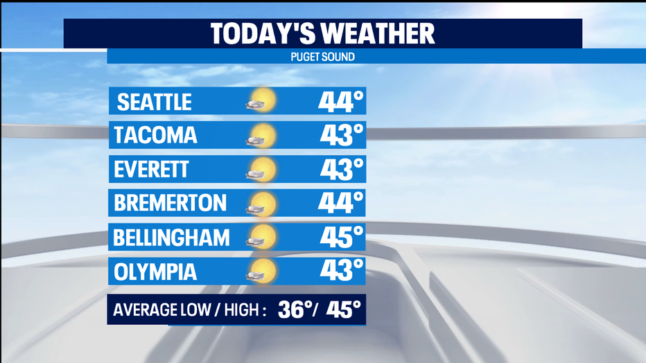
Sun is coming out nicely around Western Washington and the icy conditions earlier are thawing as well. Great day today for a walk, run, or hike. High temps on the chilly side this afternoon, but mid 40s is normal for this part of winter.
Tonight we're going to get foggy and frosty again. Increasing clouds during the day on Tuesday with rain arriving as we get into Tuesday night. Very impactful weather arrives for the lowlands on Wednesday with 1-3" of rain likely for the lowlands and breezy-to-windy weather coming in with the front.
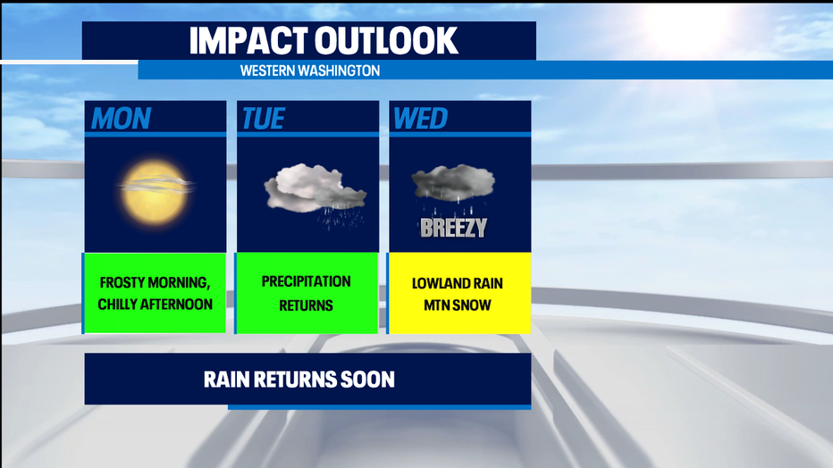
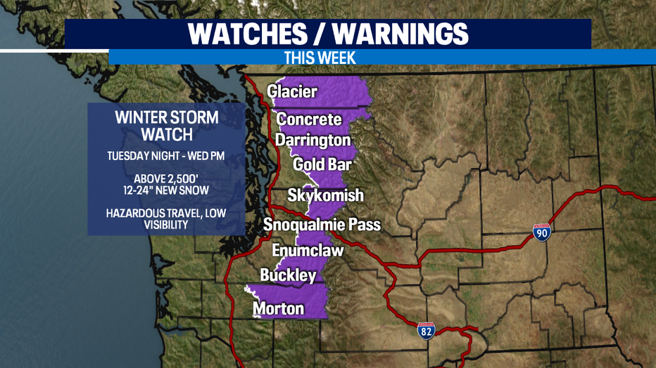
The biggest impact with the mid-week storm will be all the snow accumulating for ALL of our mountain passes and resorts. We'll be counting the snow in feet rather than in inches -- and low visibility and travel difficulties look likely for Tuesday night into Wednesday. That's why the National Weather Service has issued a Winter Storm Watch that will transform into a Winter Storm Warning as the wintery weather gets closer.
The wintery weather will continue into Wednesday night. But we might actually get a bit of break during the day on Thursday. That dry period could end up lasting for the final hours of 2020 on New Year's Eve. But New Year's Day looks wet for the lowlands and snowy for the passes and resorts.
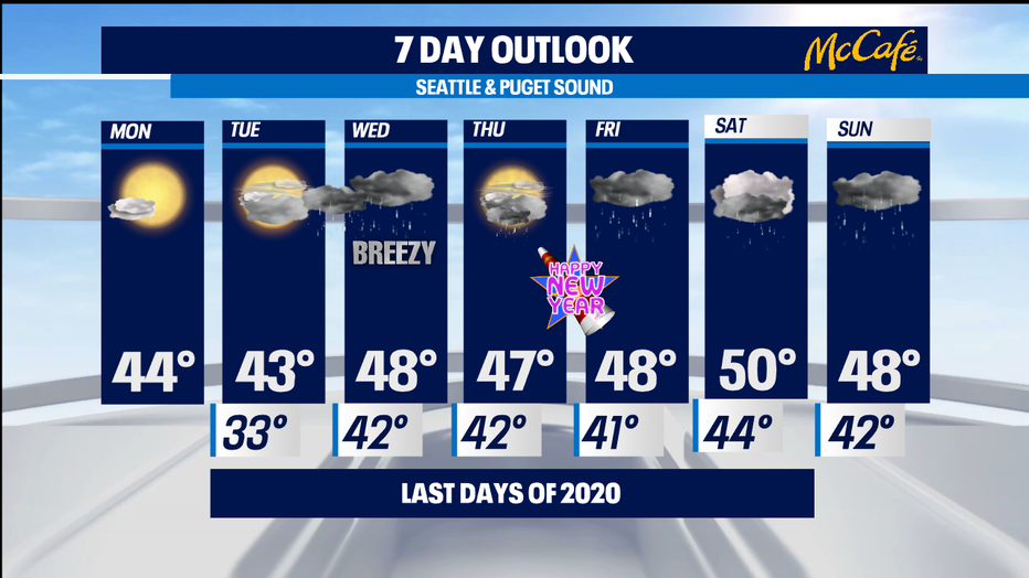
This active weather pattern looks to continue into the first weekend of 2021. Great news for boarders and skiers, not so great for easy pass travel. -Tim Joyce