

Seattle weather: Dry weekend ahead with sunbreaks

Seattle weather: Widespread rain Thursday morning before several dry days
FOX 13 Meteorologist Abby Acone is tracking dry weather for your weekend.
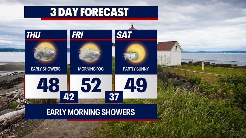
After a rather dark and gloomy start to December, we're forecasting a quiet stretch of weather Friday into the weekend. On Thursday, we're monitoring isolated to scattered showers.
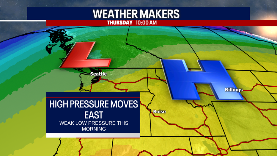
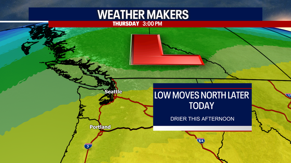
The dry weather we enjoyed yesterday was due to a ridge of high pressure. As that system slides to the east, a weak low pressure system is taking its place: this low pressure triggered widespread rain earlier this morning. As this weather maker moves to the northeast this afternoon, showers turn more hit-or-miss later.
While there are some minor snow showers over the North Cascades today, we're not forecasting snow for most of the ski resorts in Washington. Unfortunately, our snowpack is running below average, and there aren't any big snowstorms in the forecast this week for the mountains. We'll keep tracking that carefully for you.
As you're stepping outside today, I'd keep a rain jacket with you just in case you get caught in a shower. Cloudy skies are expected today with highs in the upper 40s for most. A few lucky neighborhoods could reach the low 50s.

Here's a look at Futurecast:


Tomorrow will be dry and mostly cloudy. Pockets of fog are possible Friday.
This weekend, our familiar pattern of morning clouds and afternoon sunshine will continue. The mornings will be chilly and foggy: bundle up as you're stepping outside!
Showers return to the region Monday and persist into at least Wednesday. Snow levels will mostly stay above the elevation of Stevens, Snoqualmie and White Passes.

Thanks so much for choosing FOX 13! We appreciate you greatly.
Warmly,
Meteorologist Abby Acone
Follow me on X @abbyacone, Instagram @abbyaconewx, TikTok @abbyaconetv and Facebook (Meteorologist Abby Acone)