Seattle weather: Potential for mixed showers & icing again Thursday

Seattle weather: More rain, snow headed for Western Washington
FOX 13 Meteorologist Ilona McCauley has your Western Washington forecast.
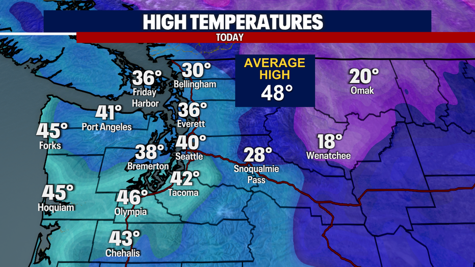
Highs today reached the 40s for some, while only up to 30F in Bellingham. We saw a mix of rain/snow showers and even more snow up north.
For tonight, we are still looking at a convergence zone, mainly around I-90, which has produced snowflakes mixed in with rain. Still seeing snow in the Cascades and gusty easterly gap winds.
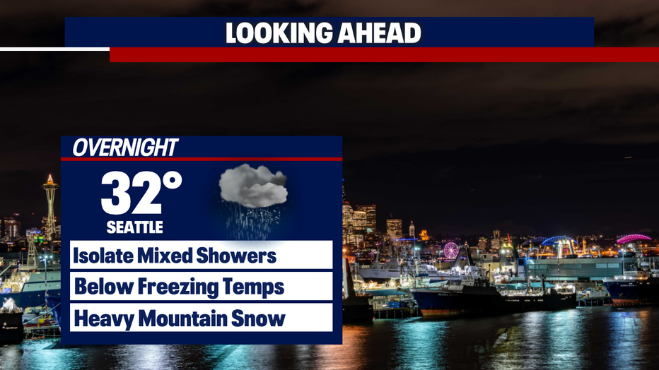
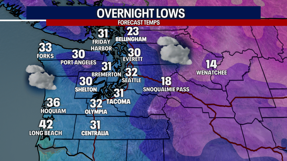
Overnight lows will drop again to freezing and below, so watch for slick spots tonight into Thursday morning.
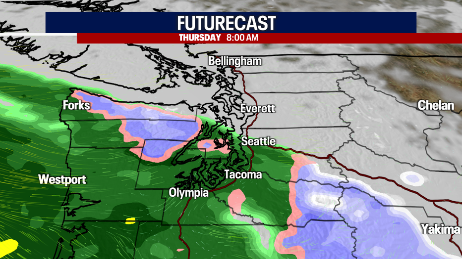
A chance of mixed rain/snow showers, and even freezing rain is possible, as we see more moisture move in early Thursday. Most of the showers will be rain, but you can't rule out the wintry mix, especially near the Cascade foothills.
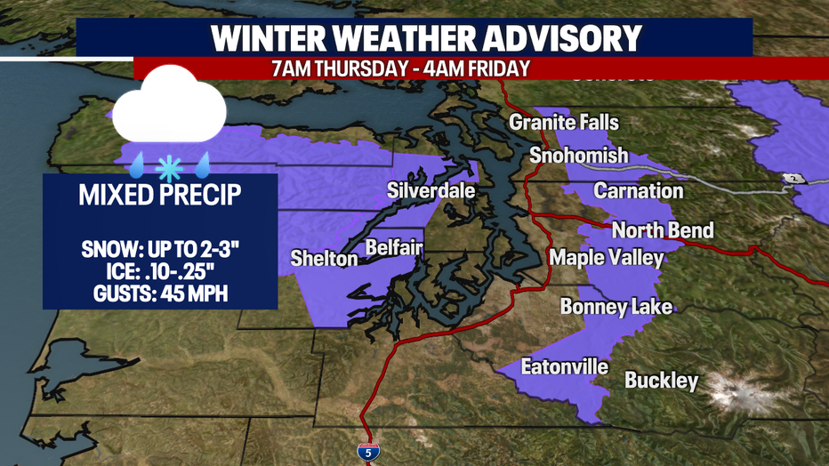
A Winter Weather Advisory is in effect from Thursday morning through early Friday morning for the east Puget Sound lowlands and the Hood Canal area. Snow totals could reach 2-3" and ice accumulation up to .25" along with gusty east winds.
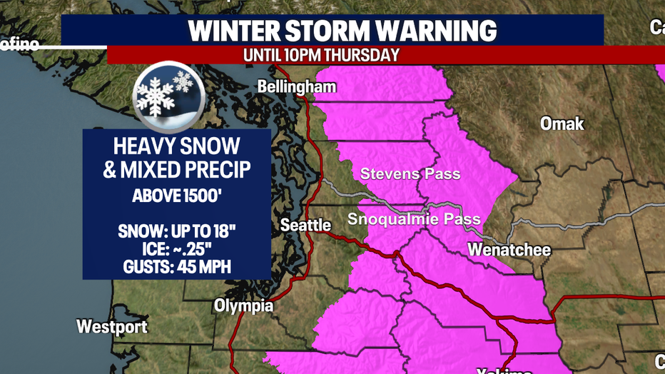
A Winter Storm Warning remains in effect for the Cascade Mountain passes through 10pm Thursday for an additional 18" of snow.
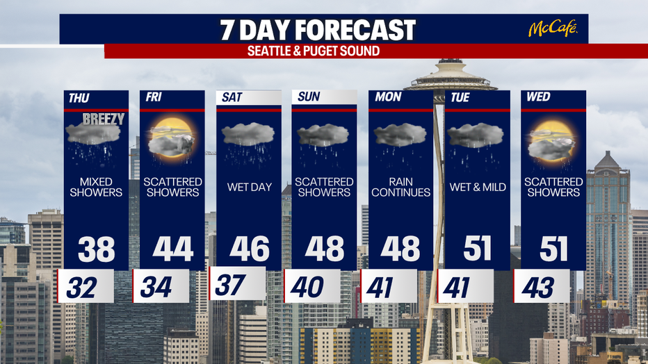
More standard lowland rain and mountain snow are in the forecast Friday with warmer temperatures into the weekend.