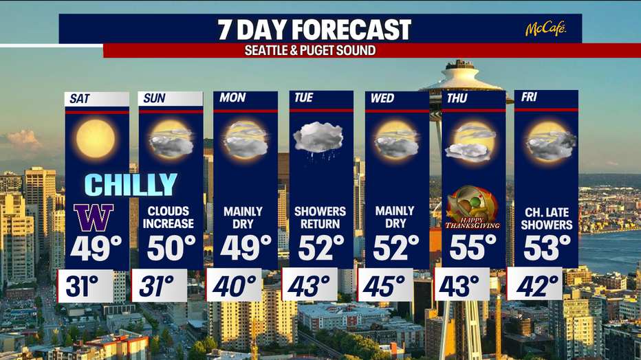
Frosty, sunny conditions continue ahead of rain next week.
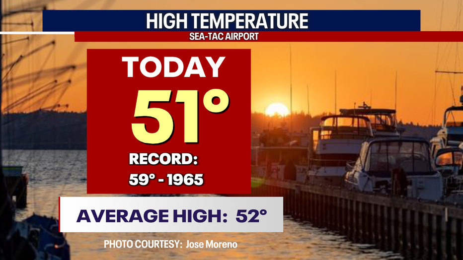
Seattle - After a chilly start Friday high temps warmed close to average. SeaTac hit 51 today!
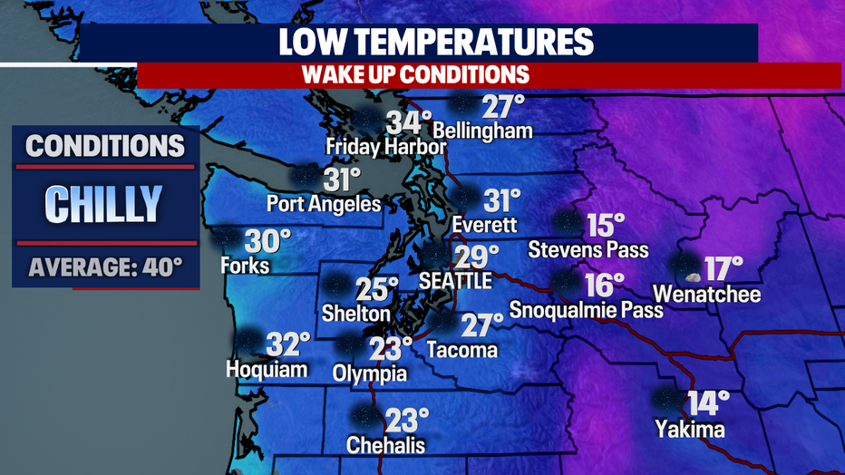
Get ready for another chilly overnight as temperatures plummet under clear skies.
Western WA lows drop into the 20s and 30s with even cooler temps for Eastern WA into the teens.
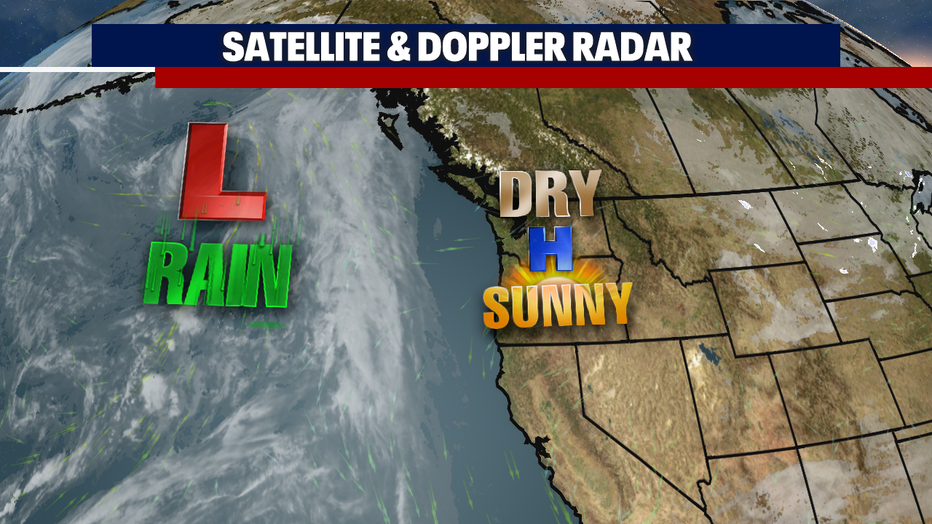
We're dialing up another round of Fall sunshine for Saturday as high pressure controls the west…but change is on the way as we roll into next week.
Our ridge will finally start to move on, opening the door for systems to approach the region.
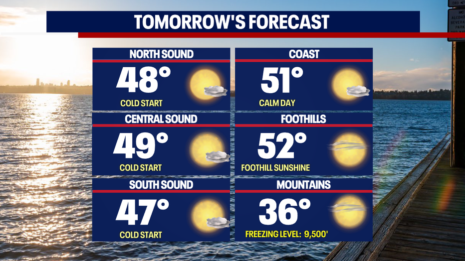
Our Saturday skies are beautiful with highs climbing into the upper 40s to low 50s.
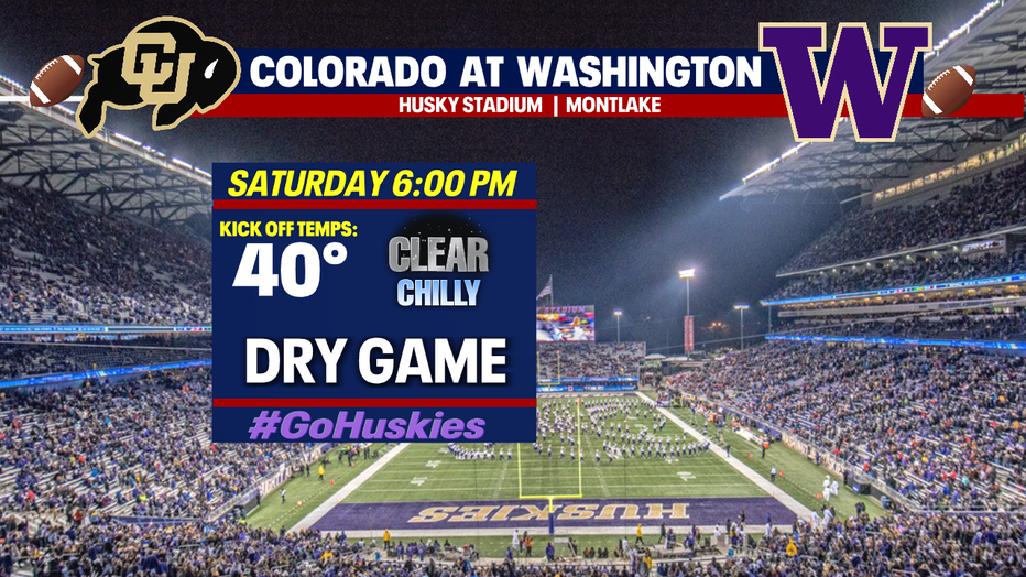
Bundle up if you're heading out to Husky Stadium as your 6pm kick off temperature for the Dawgs and Buffs is near 40! And don't forget to bring an extra jacket as temps continue to drop into the 30s throughout the game. #GoHuskies
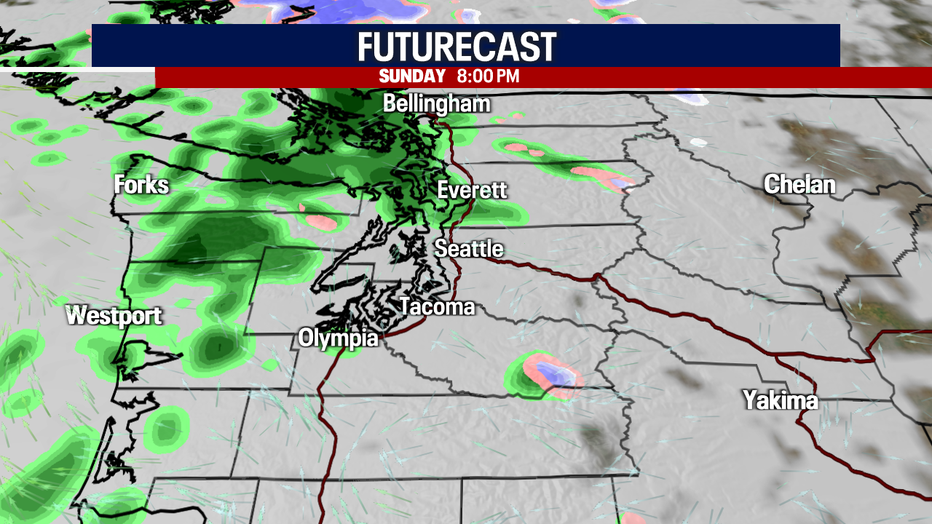
As our ridge breaks down and moves along out of the Northwest clouds will increase and the potential for showers returns. Sunday evening we might see a few showers streaming across the coast and the North Sound.
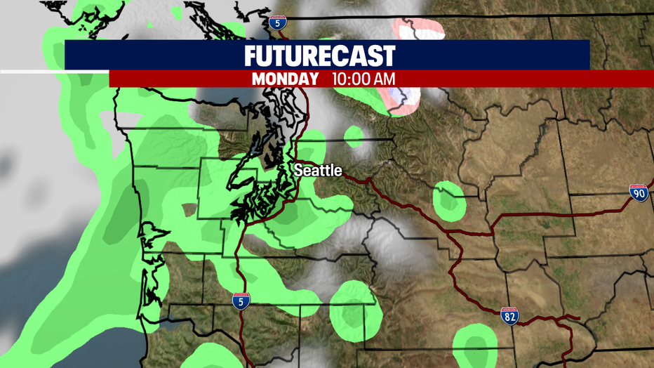
Models are not quite agreeing yet on Monday's rain chances. At this point we're forecasting mostly cloudy skies with a slight chance of a few light showers.
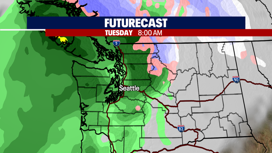
The real rain looks to move in very early Tuesday. We expect widespread showers with some mountain snow in the higher elevations above 5,000ft.
By Wednesday showers decrease with mostly cloudy conditions. Highs land in the low 50s.
We'll warm a few degrees into the mid 50s for the Thanksgiving holiday. And since models have backed off pushing any deep moisture into the region, we may end up mainly dry with filtered sunshine. We can't rule out the chance of a few showers passing through… stay tuned!
Have a great weekend all! ~Erin Mayovsky, FOX 13 Forecaster