

Heating things up to start off June

SEATTLE - We closed out the month of May with our second day of 80° temps at SeaTac in 2021– and only about half of average rainfall for the month.
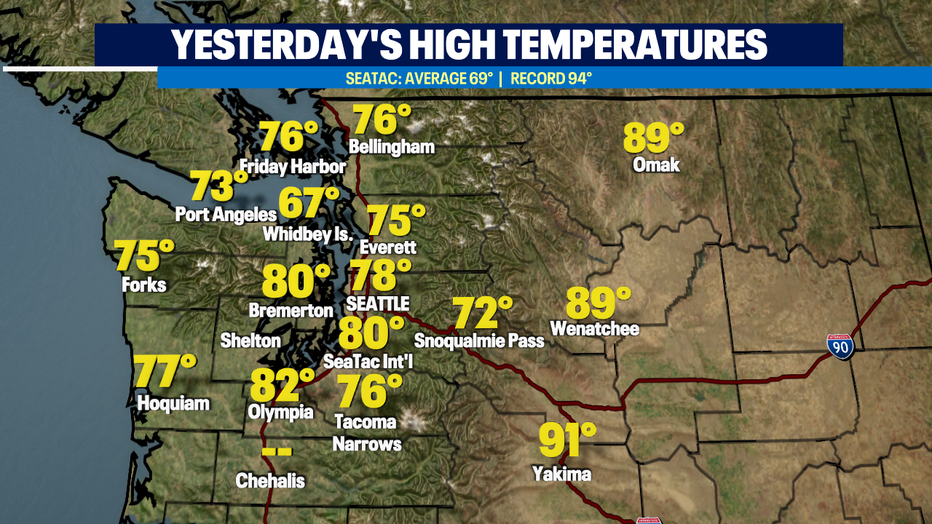
High pressure and control for the next few days and will help drive our temperatures to between 80 and 85° for most of us around Puget sound.
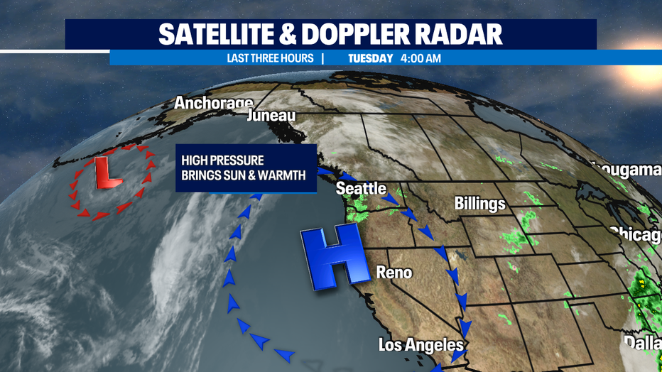
We wont likely break any records today, the number to beat for SeaTac is in the mid 90s… so we're warm, but not nearly that hot.
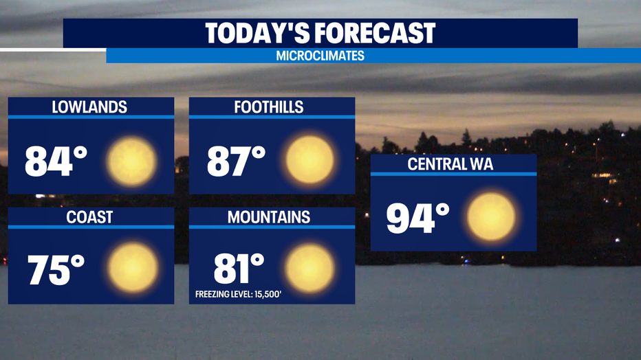
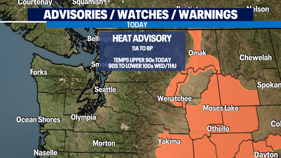
It will be that hot further inland. Today we'll have a Heat Advisory for areas in Central and Eastern WA with temps getting even hotter for this area into Wed/Thu. Some spots like the Tri-Cities could end up having temps near 107 on Thursday.
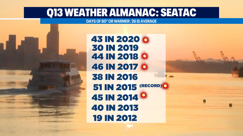
A typical summer season in Seattle has about 24 days of 80 or warmer each year. Though in recent years, we’ve had 40+ of 80 or warmer. The graphic below shows the last decade of # of days of 80+ temps. The highlighted years indicate when we've had bad wildfires or wildfire smoke in our region.
Marine push off ocean air still looks to arrive on Thursday, which could have some morning drizzle but not actual much precipitation. Thick morning clouds and some afternoon sun both Thursday and Friday look likely will mean temps closer to 70 than 80.
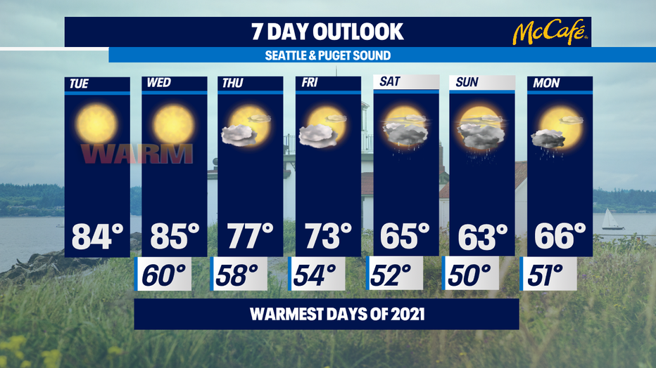
A chance for some rain showers for this coming weekend and cooler temperatures back into the mid 60s. -Tim Joyce
Q13 WEATHER RESOURCES:
DOWNLOAD: Q13 Weather and News Apps
WATCH: Forecast and Radar
READ: Closures and Delays
CHECK: Latest Weather Alerts and Live Traffic Map
INTERACT: Submit your Weather Photo
FOLLOW: Lisa Villegas, MJ McDermott, Tim Joyce, Erin Mayovsky, Grace Lim and Scott Sistek