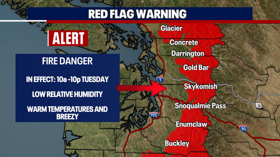
Seattle weather: High fire danger Tuesday in the Cascade Foothills

Seattle weather: Hot temperatures, elevated fire risk this week
Hot temperatures, elevated fire risk this week
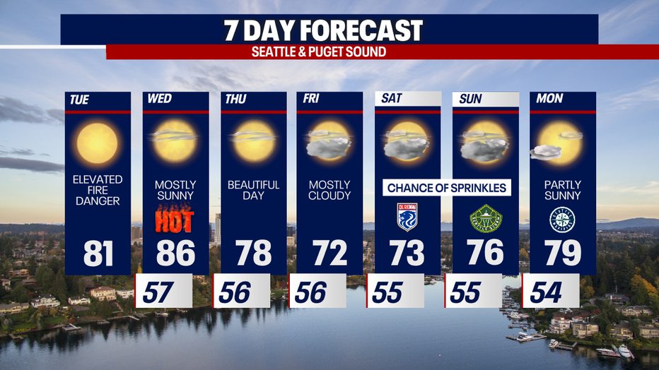
SEATTLE - A ridge of high pressure will bring dry and toasty weather to Western Washington Tuesday, with elevated fire danger as breezy winds continue.
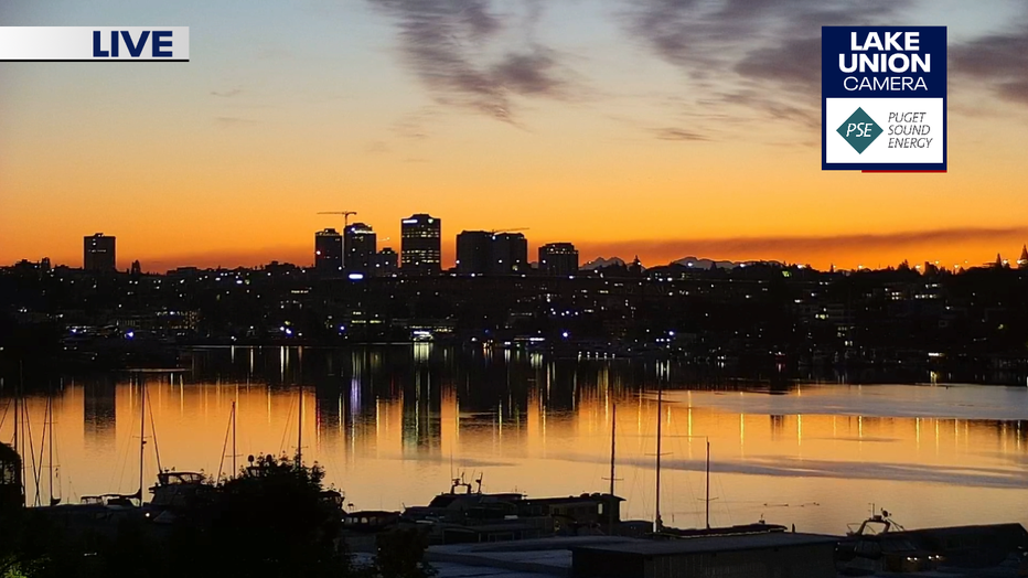
Tuesday morning brought a beautiful sunrise to Western Washington. This was the look from our Lake Union camera this morning.
High temperatures will be much warmer this afternoon with highs in the low to mid 80s for most of the central and south Puget Sound areas. Temps will be in the mid to upper 70s on the north end of the sound.

It has been very dry since early May and an early season Red Flag Warning is in effect for the west slopes of the Cascades. That means high wildfire danger as temps climb, humidity levels drop, and breezy winds push through.
The next chance for rain arrives later this week as a very weak system pushes through on Friday and Saturday. This will bring very light showers or sprinkles, if anything at all.
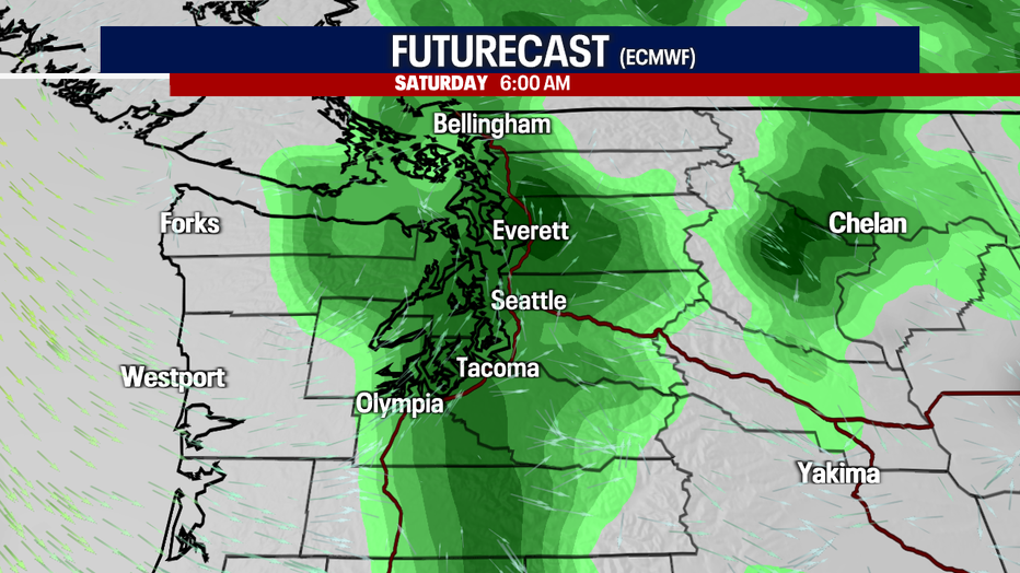
Overall, no widespread soaking rain is expected for at least the next ten days. We sure could use a good soaker as wildfire season kicks into gear.