

Independence Day Forecast: Hot, dry, and hazy
Seattle - Get ready for a hazy, dry and toasty 4th of July forecast! A *Red Flag Warning* will be in effect for those highlighted below due to fire danger. This is also an area where a *Weather Alert Day* will be in place throughout the day. Relative humidity will drop to 15-20%, aiding in the potential for a fire to spark up easily. The current drought monitor is showing abnormal and moderate levels across Western Washington, and it looks like it will continue to get worse. July is typical the driest month (.60"), and we are already in a deficient!
Here is a look at the Red Flag Warning:

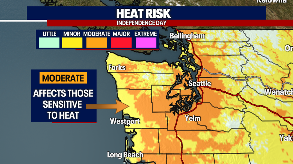
On top of an elevated fire threat, we'll be dealing with the heat! Below is a look at the heat risk across our area. Those in the orange are under a level 2 for the 4th of July. This means if you are sensitive to the heat - you'll want to be indoors at peak hours.
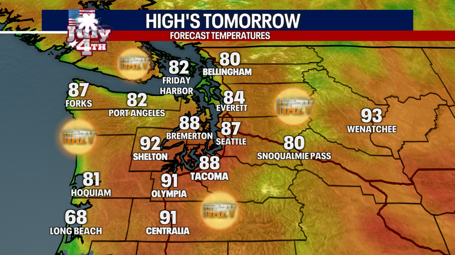
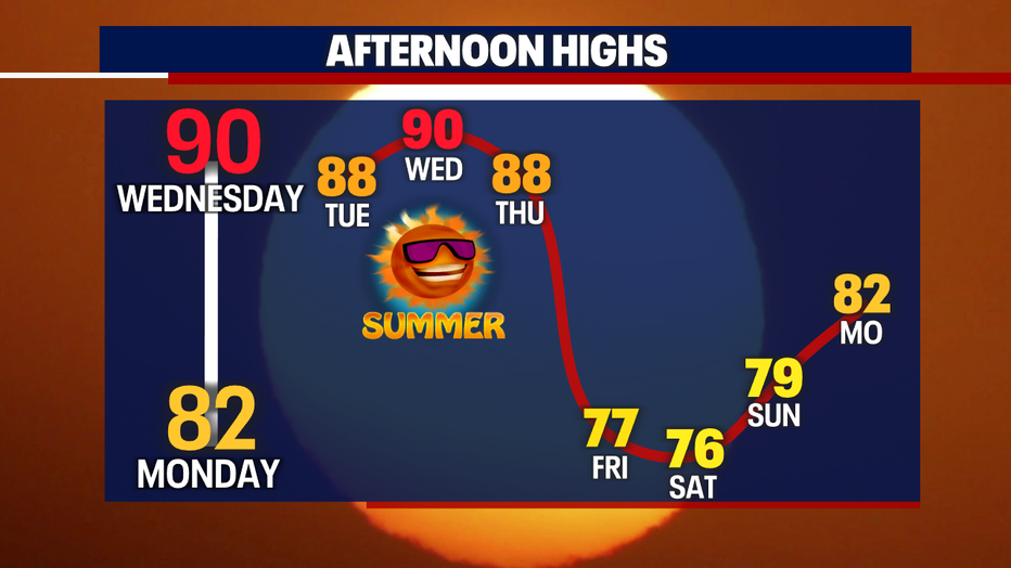
Temperatures will range in the 80s and 90s for most locations on Tuesday. Seasonal temperatures are in the mid-70s, so we'll be flirting with record highs. Listen to your body and stay hydrated tomorrow during all the fun activities.
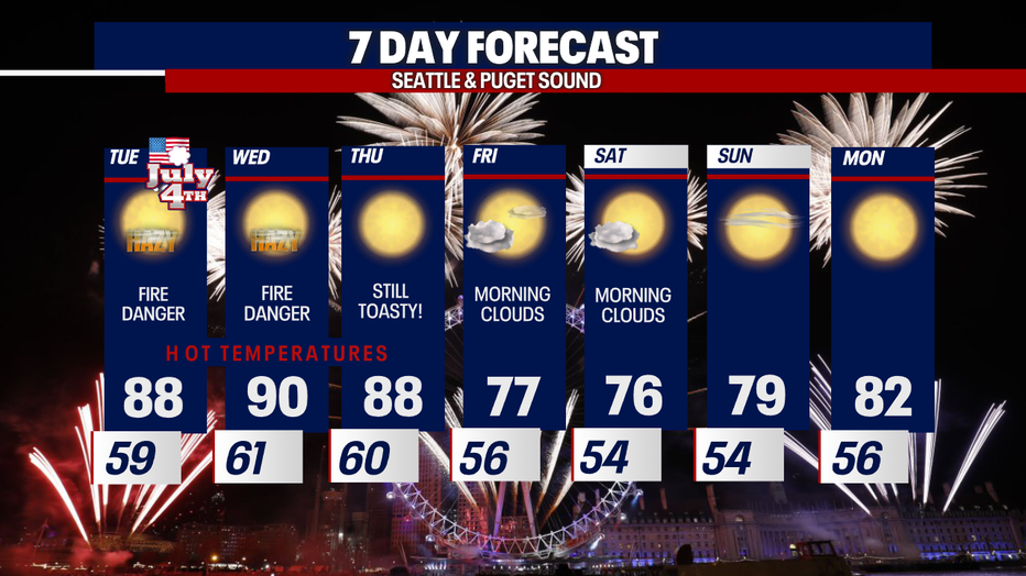
This "hot" weather will stick around for the next few days - so continue to take those precautions. It'll get more comfortable as we head into the weekend. Morning clouds, a few sprinkles, and cooler afternoons will be on tap!
I'll leave you with a look at your 7-day forecast:
Have a safe and fun Independence Day!!