

Low level snow for some, cold showers for most
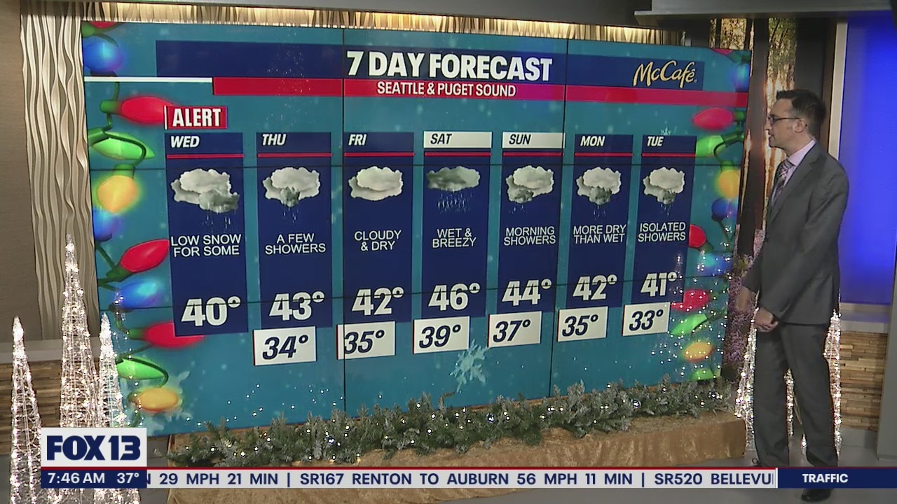
Showers continue Wednesday, low snow for some
The cold temperatures, cloudy skies, and on & off precipitation will continue through the work week.
Seattle - Areas along the western Kitsap Peninsula and near Hood Canal could see some accumulating snow today, with most other locations in the Puget Sound area dealing with cold rain showers.
As another cold weather system works its way onshore this morning, we are keeping an eye on the Hood Canal area for a rain/snow mix or even some snow accumulation. We could see 1-4" in that area today on the southeast side of the Olympics.

The low pressure system bringing showers this morning will head southeast throughout the day. Most areas north of Seattle will be mainly dry, with most of the shower activity staying in the central and south sound. A few showers will roll in from the north on Thursday, but accumulations should be light.

The next seven days look gray and cool. Friday night into Saturday brings our next wet system bringing widespread rain to the lowlands and heavy snow to the Cascades. More on that to come.
MORE FROM FOX 13 WEATHER:
DOWNLOAD: FOX 13 Weather and News Apps
WATCH: Forecast and Radar
READ: Closures and Delays
CHECK: Latest Weather Alerts and Live Traffic Map
INTERACT: Submit your Weather Photo
DAILY BRIEF: Sign Up For Our Newsletter
FOLLOW: Lisa Villegas, Erin Mayovsky, Brian MacMillan, Abby Acone and Scott Sistek