

Magnificent March weather for part of the weekend

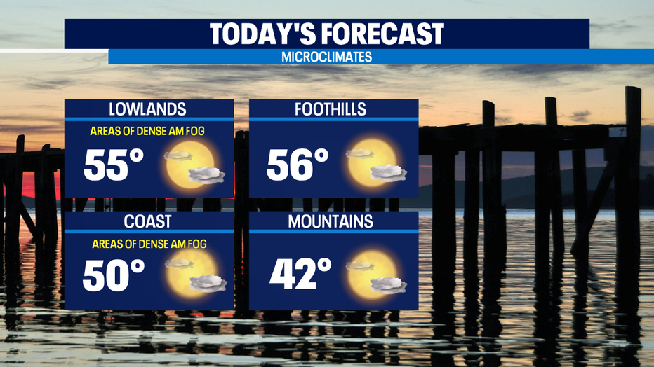
Seattle - Happy Friday! High pressure system in control next 36 to 48 hours. While that means a chilly morning, we'll see clouds and fog part for some nice spring sunshine.
Today will be the sunnier of our two dry days. Highs this afternoon will be a tad warmer than yesterday and back in the seasonal mid 50s.
For tomorrow, the question remains about how quickly the high clouds move in. If they arrive sooner our high temperature in the mid 50s. If they arrive later or end up being thinner than the forecast models are calling for -- we’ll get close to 60.
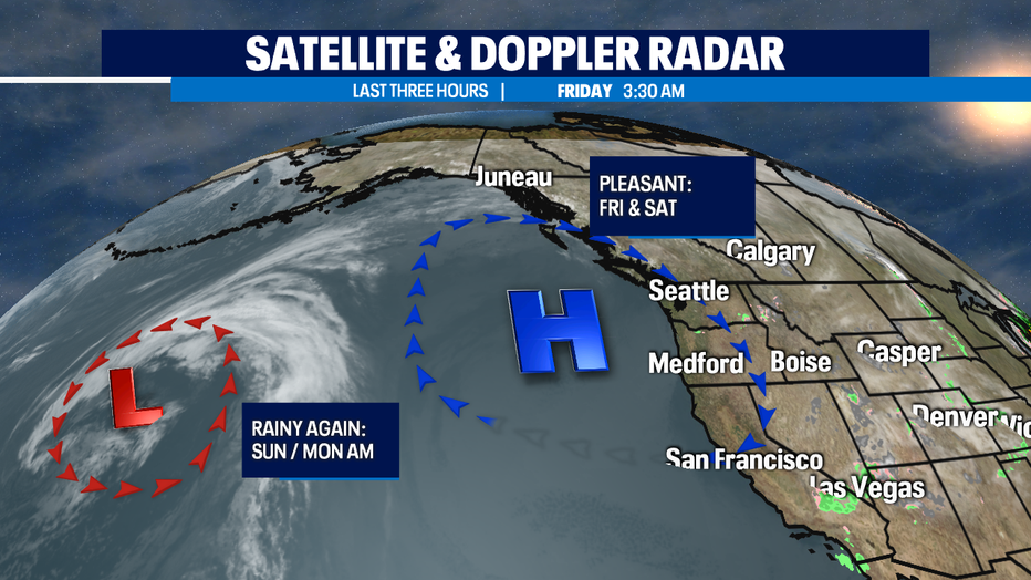
A soggy Sunday, but it appears the rain will hold off until the afternoon for most of us around Puget Sound. Highs back in the lower 50s. It will be more mountain snow for Sunday into Monday.
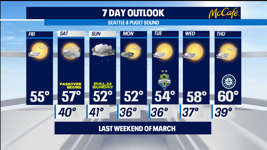
Monday looks quite chilly, but it only looks really soggy in the morning at this point. We’ll be watching how low snow levels go cause the foothill communities could get a rain/snow mix with the current projected temperatures -- though the ground is far too warm for any to stick significantly.
We still look to dry out and see some sunshine despite highs only in the low 50s. Tuesday and Wednesday back towards pleasant again with sun & mild temps — as March 2021 exits like a lamb. -Tim Joyce
Q13 WEATHER RESOURCES:
DOWNLOAD: Q13 Weather and News Apps
WATCH: Forecast and Radar
READ: Closures and Delays
CHECK: Latest Weather Alerts and Live Traffic Map
INTERACT: Submit your Weather Photo
FOLLOW: Lisa Villegas, MJ McDermott, Tim Joyce, Erin Mayovsky and Grace Lim