Wet and breezy Thursday with weekend clearing and cool highs.
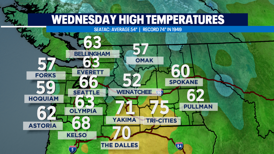
SEATTLE - What warm November day across the Northwest! Unseasonably mild as a warm front pushed inland over the region. The normal high is in mid 50s for this time of year and we pushed well above and beyond that temperature.
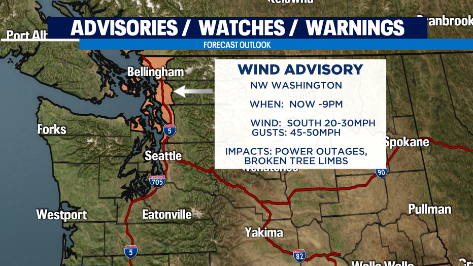
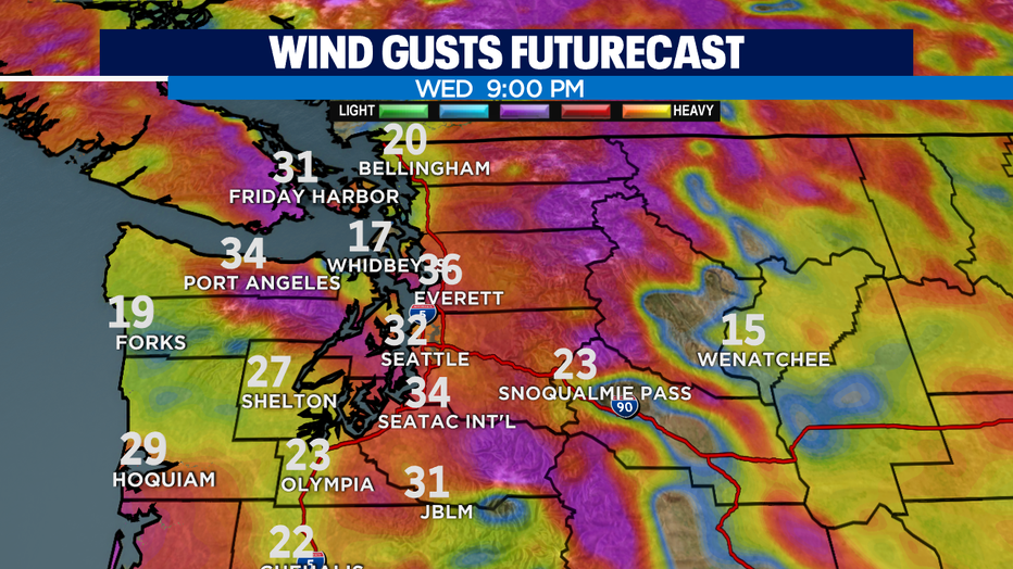
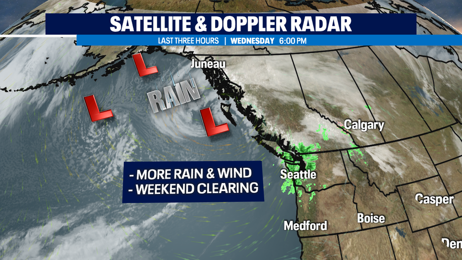
Winds will settle down late tonight but until then a "Wind Advisory" remains in effect for the North Sound. Look for sustained winds out of the south around 20-30 mph with gusts up to 45mph.
A cold front will follow to deliver heavier steadier rain tomorrow and usher in cooler temps as well. We'll drop down to seasonal temps in the low to mid-50s for tomorrow.
As we get into the weekend, we'll actually dry out and cool off. We're going to go from warm and wet to a cold and dry pattern that will hold for about 2-3 days. Overnight lows will hover around freezing and afternoon highs will struggle to get into the mid 40s.
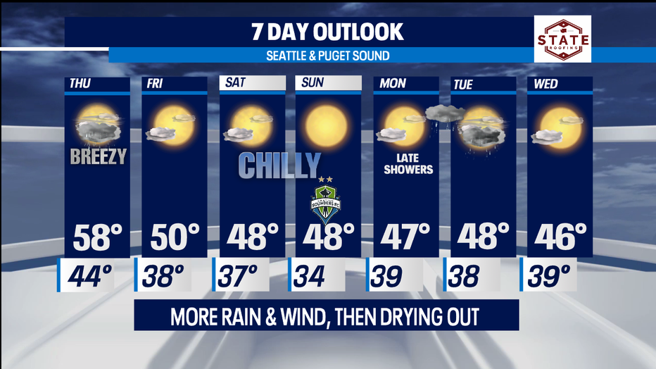
Next rain after the weekend looks like late Monday overnight into Tuesday. Very Novemberish to see this in the Pacific NW.
Have a great night! ~Erin
______________________________________________
- Erin Mayovsky, Q13 Forecaster
Twitter: @ErinMayovsky
FaceBook: /ErinMayovsky
Instagram: @ErinMayovsky
______________________________________________