More cool lowland rain and mountain snow ahead
Seattle - A series of cool and wet weather systems will hit the Pacific Northwest this week bringing more rain to the lowlands and fresh powder to the ski resorts in the Cascades.
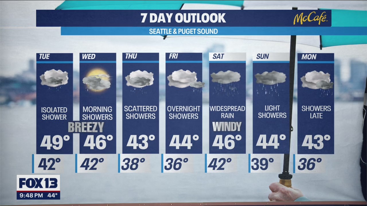
Tuesday brings a break from widespread rain during the daylight hours. Expect mostly cloudy skies and mainly dry conditions for everyone west of the Cascades with high temperatures back close to 50 degrees.

The next round of rain hits late tonight into early Wednesday, brining some snow to the mountains and chilly showers to the lowlands. While the bulk of the rain will move on by sunrise Wednesday, showers will continue in the higher elevations. Snow levels will drop to about 2,000 feet Wednesday bringing a potential for over a foot of snow through Thursday morning at Stevens and Snoqualmie passes.


The next round of rain will hit Friday afternoon/evening and will continue through Saturday. This is a stronger low pressure system that will bring more significant rainfall to the lowlands and the potential for a big snow storm above 3,000 feet. Stay tuned!
Showers and cooler weather will continue into early next week.


