

Seattle weather: Rain returns after a taste of spring-like weather

Brief break from the beautiful spring weather
We hope you enjoyed this weekend's spot of sunshine as much as we did, because we're getting back to clouds and showers this week. FOX 13 Meteorologist Abby Acone has the details.
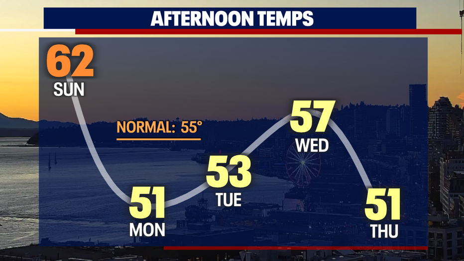
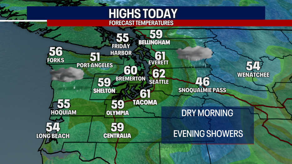
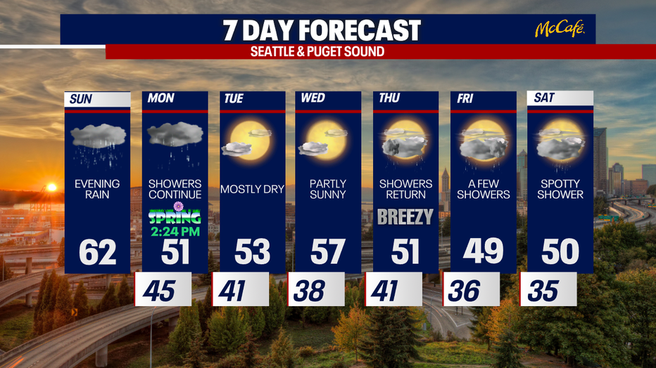
SEATTLE - Hope you enjoyed our glorious sunshine and highs in the mid 60s Saturday! Even though highs today will warm to the 60s again for many backyards, it'll feel cooler as clouds increase and showers return.
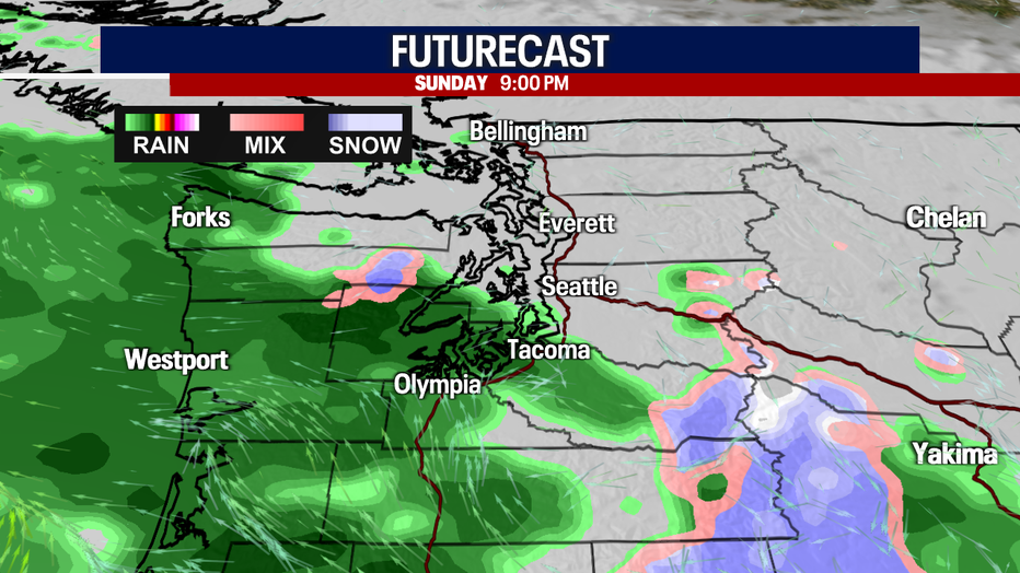
Dry, gray skies will lead to scattered showers returning this afternoon and evening. For the most part, rain will be focused over the South Sound, coast and Olympic Peninsula. However, some showers could track elsewhere into Puget Sound.
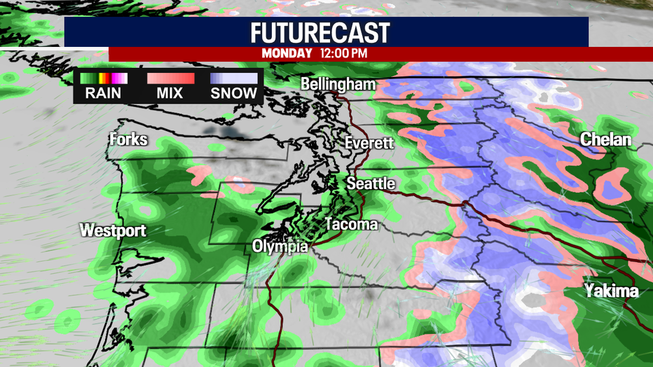
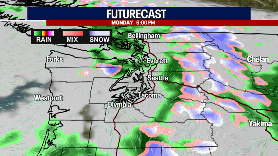
Spring officially arrives at 2:24 tomorrow afternoon! Isolated to scattered showers stay in the forecast on Monday. Keep a rain jacket close by! Temperatures tomorrow tumble to the low 50s.
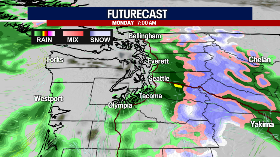
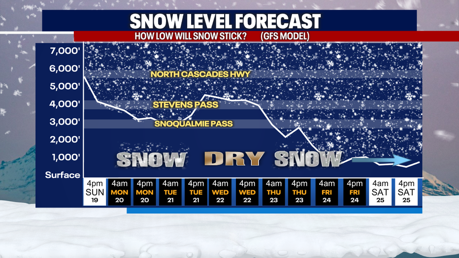
Over the passes, light snow could pile up tomorrow. A little snow could linger over the mountains Tuesday before drying out Wednesday. Minor mountain snow is in the forecast Thursday through Saturday. By Friday and Saturday, the Cascade foothills could even see "chunky" rain or a rain/snow mix. Looks like the chilly weather isn't done with us yet!
Tuesday looks absolutely beautiful with morning clouds and afternoon sunshine. While Wednesday could start foggy, the afternoon will feature sparkling sunshine and highs in the upper 50s.
Thursday, another system arrives. This low pressure system could trigger a little lowland rain, mountain snow and breezy conditions.
Friday and Saturday trend cooler with a few showers sticking around.
Hope you have a wonderful rest of your weekend!
Take care,
Meteorologist Abby Acone
Follow me on Twitter @abbyacone, Instagram @abbyaconewx, TikTok @abbyaconetv and Facebook (Meteorologist Abby Acone)