Record rainfall for Seattle Wednesday and first full day of the fall season

Wednesday forecast has strong winds and heavy rain in Western WA
Q13 Weather Anchor Erin Mayovsky forecast more rain and wind for the next several day.
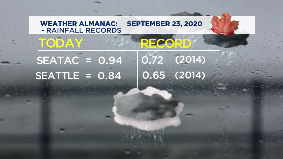
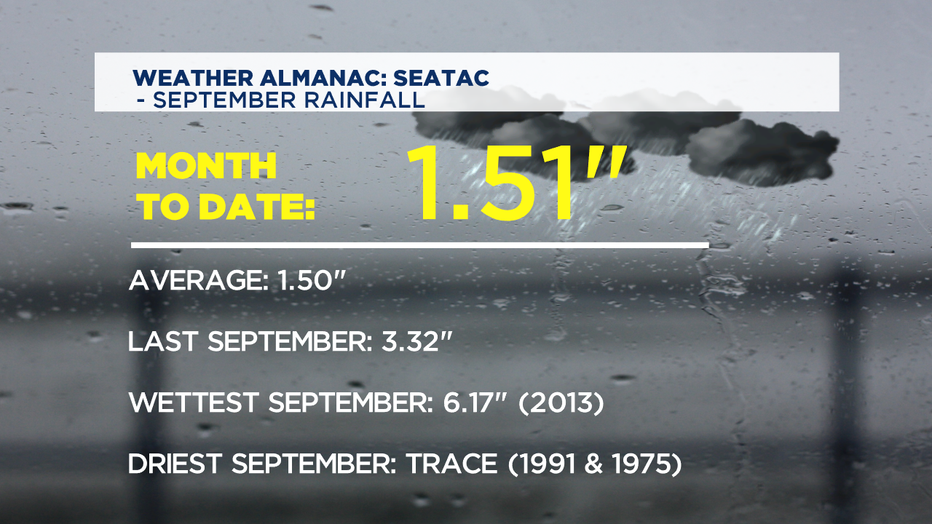
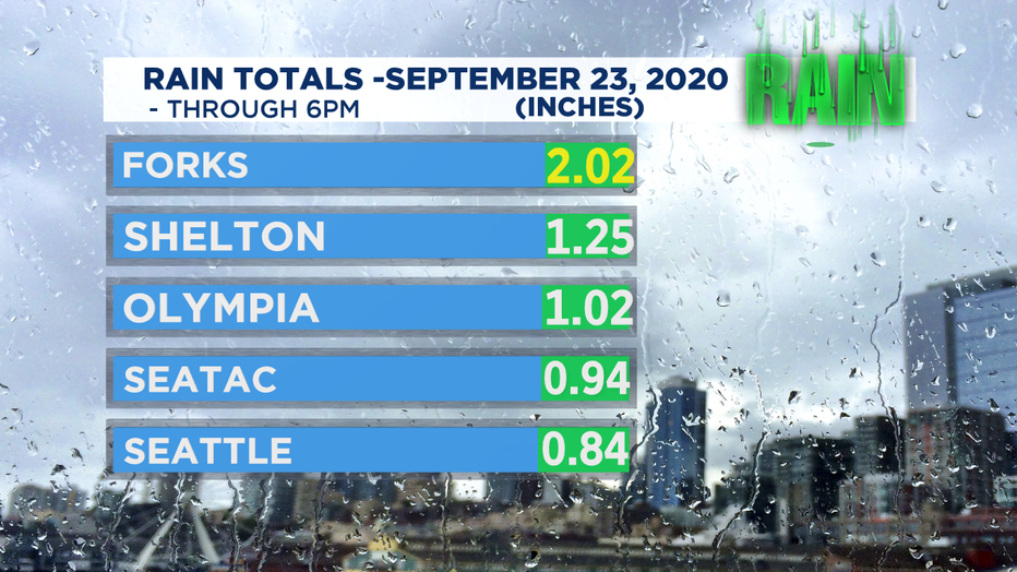
SEATTLE - We made it through the first full day of fall and boy, what a sloppy day! We saw record rainfall at SeaTac and Seattle WFO today. As of 6:30 p.m. here are the numbers:
Not only did we see heavy rain at times, the winds kicked up too, with some spots gusting to near 50+ mph as our first storm of the season blew through. We saw some local power outages but expect winds to relax some overnight. Wet and windy conditions will continue through the rest of the week.... so, make sure to lock down garbage cans and anything that can spring loose. Something else to think about is your storm drains and gutters. Try to keep those clean so water can flow freely without clogging up!
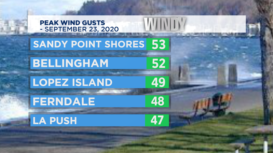
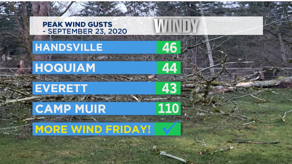
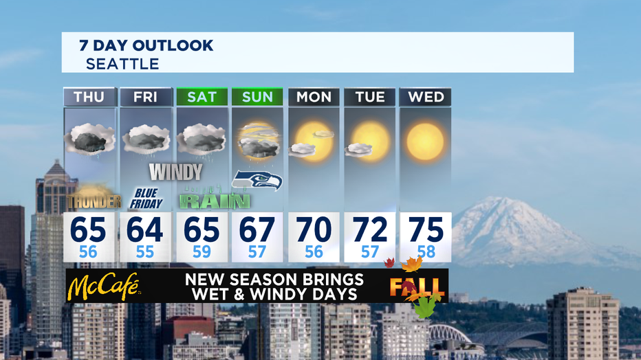
Thursday winds will relax some and rain won't be as widespread as today, but we'll get another good dose with some breaks in between. We're keeping an eye on the threat for some thunderstorms too as there is some instability in the air. Remember when "Thunder Roars... Stay Indoors!"
Our deep plume of moisture will continue to spray at us through the weekend. Friday looks to be another round of fun. Rain and wind will pick up with temps remaining cooler than the norm. We usually sit in the upper 60s for this time of year, but we'll hang in the low to mid-60s. Overall, we can expect 2-4" of rain in the lowlands with 4-6" expected in the mountains as these systems push through.
Saturday we'll start to see a little sun behind the clouds with showers as well. Highs will warm slightly too. Unfortunately, we may not dry out by Sunday for the Seahawks vs Cowboys game at CenturyLink Field. Kick off from CenturyLink Field set for 1:25 p.m. You can catch all the game-day action on #Q13Fox.
Next week we dry out! Look for fall sun with highs pushing into the mid to upper 70s!
Have a great night all! ~Erin
_____________________________________
Erin Mayovsky, Q13 Forecaster
Twitter: @ErinMayovsky
FB: /ErinMayovsky
Instagram: @ErinMayovsky
_____________________________________
