

Seattle Weather: Active week ahead with rain, heavy mountain snow, frigid temps

Seattle weather: Heavy rain, mountain snow and wind alerts for Western Washington
FOX 13 Meteorologist Abby Acone has your weather forecast.
SEATTLE - Get ready for an ACTIVE weather week! We are going to see widespread rain, heavy mountain snow and gusty winds for the first half. By the end of the week, cold air will bring frigid conditions and possible mixed lowland snow/rain showers.
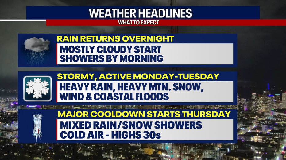
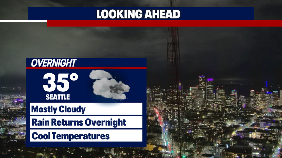
We are seeing calm conditions tonight, but changes ahead by Monday morning. Showers return late Sunday night into Monday.
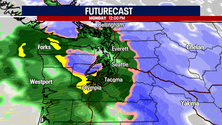
Showers will be widespread Monday with heavy rain at times.
High temperatures will be in the mid to upper 40s Monday, but that will be the last seasonal average day for the extended forecast.
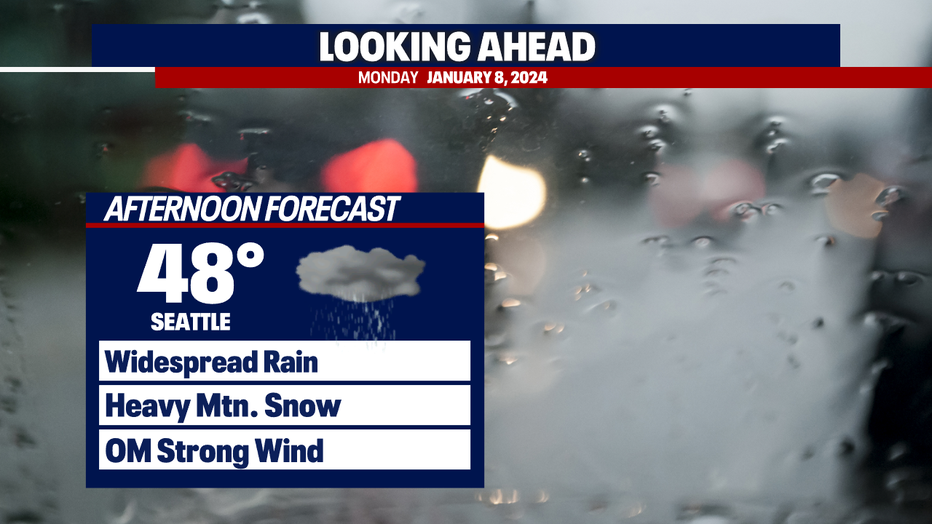
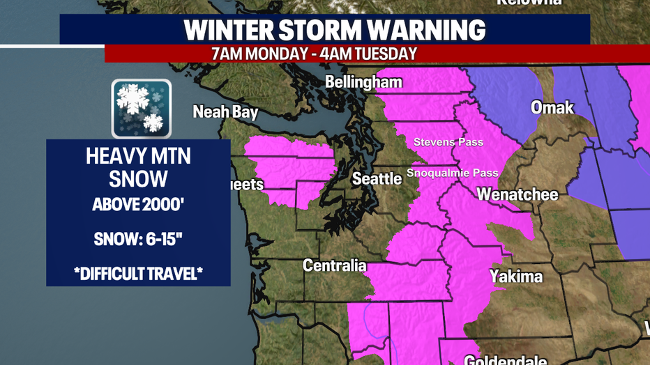
Eyes on the Cascades this week as heavy mountain snow is expected. This is good news for the snowpack and the ski resorts--bad news for drivers! A Winter Storm Warning is in effect for the Cascades above 2000' from 7am Monday - 4am Tuesday for up to a foot of snow.
Winds will pick up Monday night for Western Washington. The strong system bringing more snow and the wind will increase the Winter Storm Warning to a Blizzard Warning.
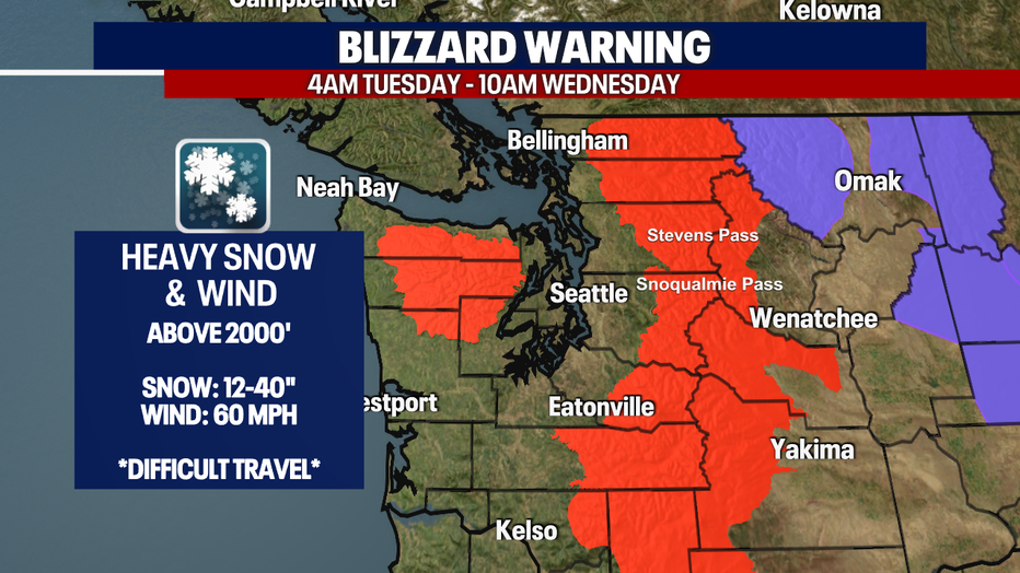
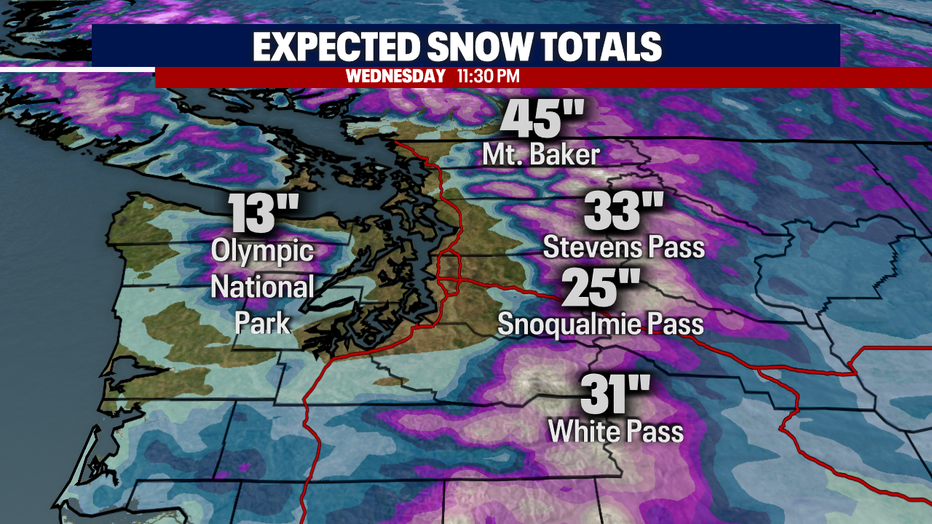
Snow will continue to be heavy at times through Wednesday, with total snow accumulations Monday through Wednesday to 2-4 feet.
After midweek, the focus will then shift to lowland snow chances and cold temperatures. Cold air will move in and with enough precipitation, there is a possibility for mixed rain/snow showers. Stay tuned!
