

Seattle Weather: Cool and Wet Start to June

Seattle weather: Rainy conditions into next week
FOX 13 Seattle Meteorologist Ilona McCauley has your weekend weather forecast for western Washington!
Seattle - After enjoying a beautiful sunny, warm day around Western Washington this afternoon, look for clouds to increase overnight with lows in the low 50s.

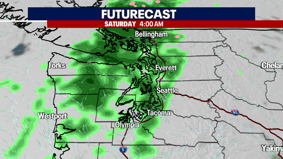
A weak front will swing through early tomorrow morning with some light rain around. Saturday is likely to be more dry than wet, but keep your umbrella handy in case you encounter a brief shower.
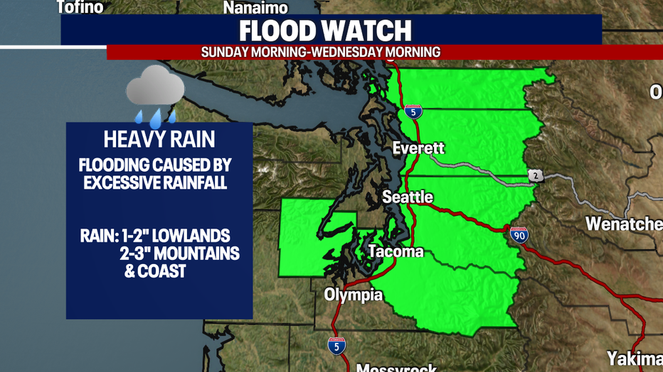
A late-season atmospheric river is forecast to set up beginning Sunday. Rounds of rain will move through Western Washington through Wednesday morning.
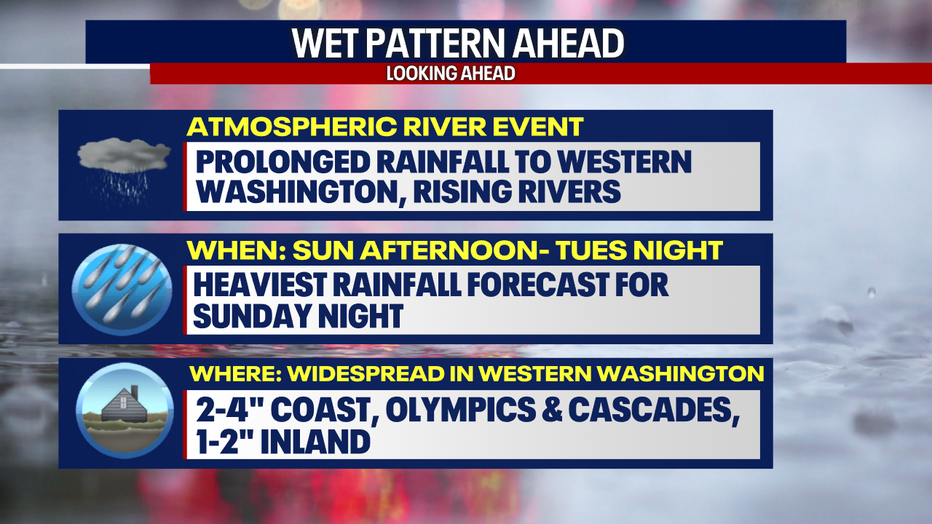
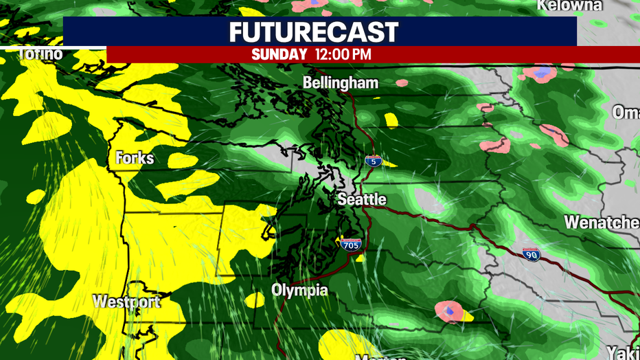
Monday will also bring breezy wind and a chance of thunderstorms ahead of the cold front. Sunday through Tuesday, high temperatures will struggle to get to 60 degrees. There is a chance the Puget Sound Convergence Zone will keep lingering showers for some through Wednesday, but most spots should be much drier by midweek.
The average rainfall in Seattle for the entire month of June is 1.63". We could see well over half of that over the course of 48 hours. Late spring rain is often a welcome sight for firefighters, as it can delay the start of fire season in the mountains and west of the Cascades.
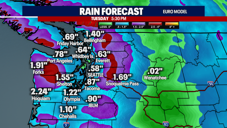
The National Weather Service has issued a Flood Watch for potential flooding due to the excessive rainfall and runoff into area creeks, rivers and streams.
After a few water-logged days, we flip the weather once again and see drier, sunnier skies and warmer temperatures into the mid 70s by next Friday.
