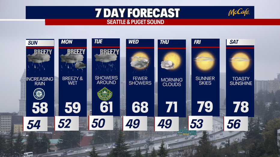
Seattle weather: Increasing rain on Sunday

Seattle weather: Increasing rain Sunday
FOX 13 Seattle Meteorol0gist Ilona McCauley has your latest western Washington weather forecast!
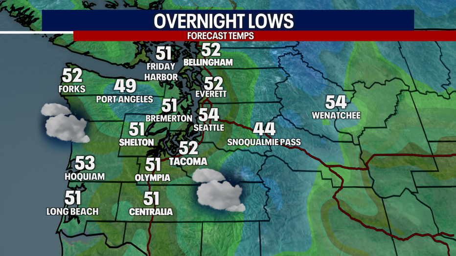
A weak cold front brought some light rain to some spots early this morning. Expect to see a few lingering pockets of light rain around into the evening hours with lows a little milder as compared to last night dipping into the low and mid 50s.
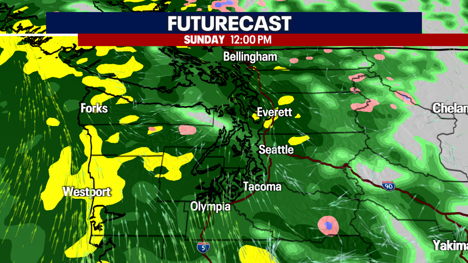
The first in the series of systems pushing through with this atmospheric river event will arrive on Sunday. We will see rain along the coast beginning early tomorrow morning, then spread inland during the late morning and afternoon hours. Pockets of moderate to heavy rain will be possible. During this time, winds will also pick up with gusts nearing 40 mph in spots.
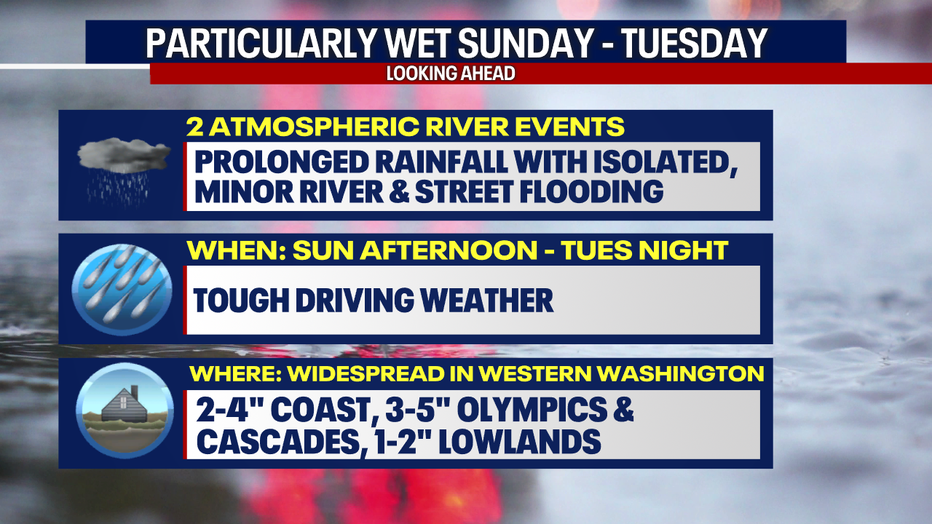
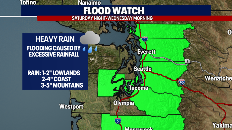
With excessive rain forecast for the next few days, the National Weather Service has posted a Flood Watch for the areas in green below. This goes from Saturday Night to Wednesday morning. Where there's poor drainage, we can't rule out spotty, minor street flooding. At the bare minimum, the wet roads will make driving slippery and a bit treacherous. Drive carefully!
The Snoqualmie River near Carnation has the best chance for minor flooding. At this time, it looks like other rivers will be rising but not meeting the flood stage threshold.
Cloudy, rainy and breezy conditions will keep highs tomorrow in the upper 50s.

The atmospheric river event will wind down on Tuesday night/ early Wednesday morning with improving weather conditions. We will once again flip back to more late spring/ early summer conditions with plenty of sunshine and highs warming to near 80.
